
Difficulty: Class 2 & 3
Exposure: Significant at summit cap.
Summit:
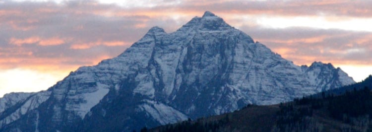
Mt. Harvard 14,420 feet
Mt. Columbia 14,073 feet
Elevation Gain:
8,100 feet total from TH
6,500 feet from Camp
Roundtrip:
17.6 miles total from TH
8.8 miles from camp
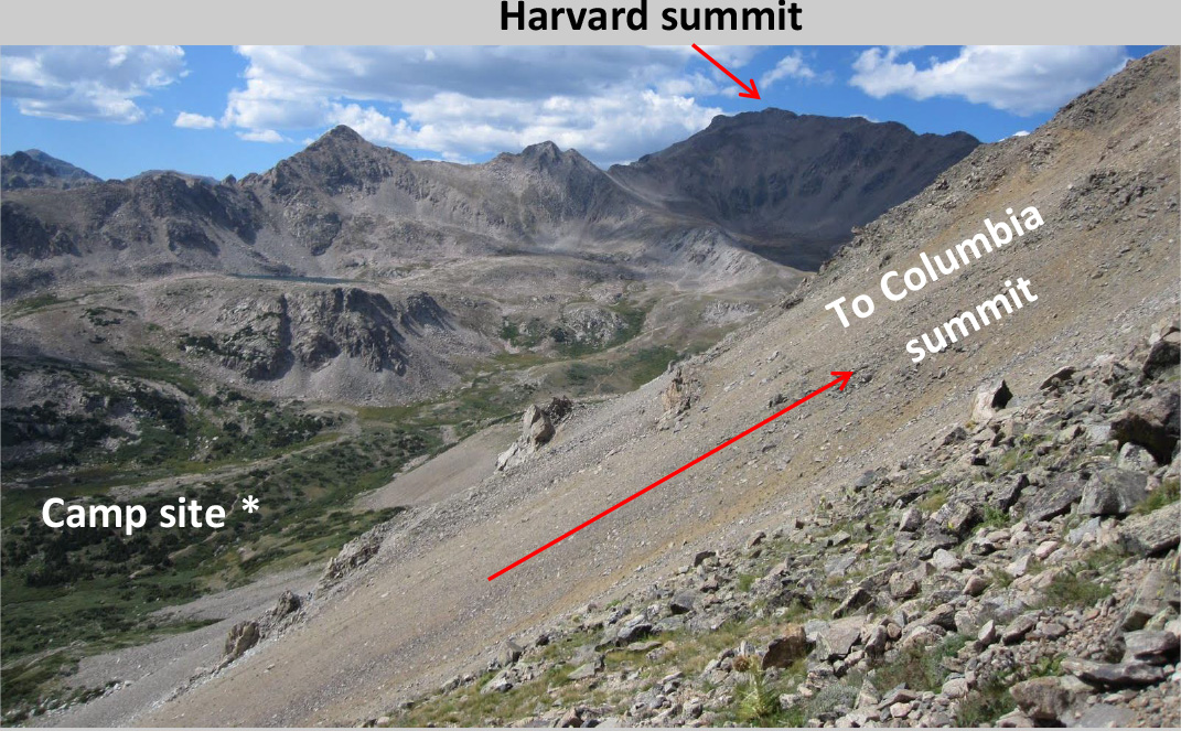
Camp: 11,300' up 4.4 miles & 1,600' from TH
Trialhead N. Cottonwood Creek at 9,900'
Climbers: Rick Crandall, Rick Peckham July 7-9, 2013
N. Cottonwood Creek Trailhead to Campsite
Camp Elev.: 11,300'
Trailhead Elev.: 9,900'
Elevation Gain: 1,600'
Roundtrip: 7.5 miles
Total Elevation Gain: 8,110'
Total Roundtrip: 17.6 miles
Climbers: Rick Crandall, Rick Peckham
July 7 -9, 2013
This summer, our friend Rick Peckham is visiting us in Aspen for two months. He will be my climbing companion as I head towards the 40th fourteener mark. Rick is from Alaska and has summited Mt. McKinley twice when he was doing military search and rescue, is EMT trained and has been a great companion for me in the mountains.
To get the summer started, I decided we should dispense with Mt. Columbia, probably the most disliked of all the 54 Colorado fourteeners. If you don't intend doing them all, don't do Columbia. Here are some quotes from other climbing reports - and then you'll see our experience:
- "Columbia is an evil mountain. It's west side sucks beyond belief."
- "If you don’t like steep scree slopes, loose talus, shifty boulders or unstable rock piles, this climb would be your worst nightmare."
- "Whoever said that Columbia is “easy” or “quick” is a lying dog. It goes straight up, I mean straight up. I would not recommend this mountain to a newbie, nor to someone who is out of shape or has knee issues and such - not a good idea at all."
- "I climbed Mt. Columbia. It sucked. I hated it. It was steep, loose, crappy rock.
I fell no fewer than 7 times on the loose scree descent. It took me 3 hours to get down
I hated this mountain, it is crappy." - "One of the sloggiest slogs any slogger could ever slog. It sucked."
- Mt. Columbia has no redeeming qualities whatsoever, and someone should simply scrape off the summit and render it a 13er
See what I mean? Also accessible from the same trailhead and campsites is Mt. Harvard, reportedly a much nicer experience, so we decided to make this a camping trip and get them both. Mt. Harvard is the taller mountain so I figured we should climb it first - turns out Columbia took a lot more energy.
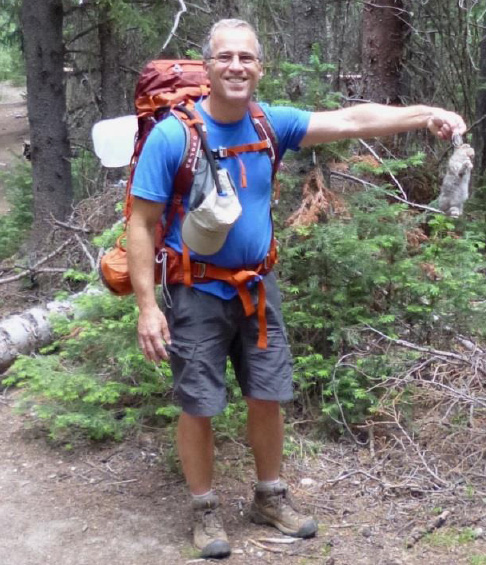
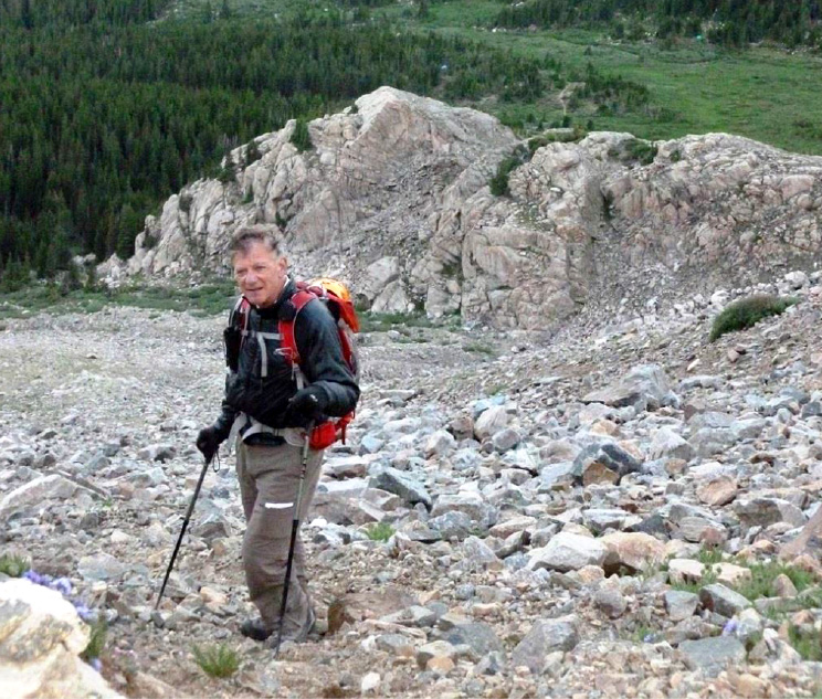
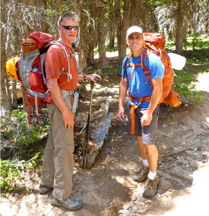
So, let's begin. First this was going to be a two-night campout. We backpacked in to camp hiking 4 miles with a 1600' elevation gain. We were so equipped with food, tents, clothing layers and supplies for all contingencies yet keeping our weight under control was critical. When all loaded I had a 30 lb. pack and Rick P. had about 35 lbs.
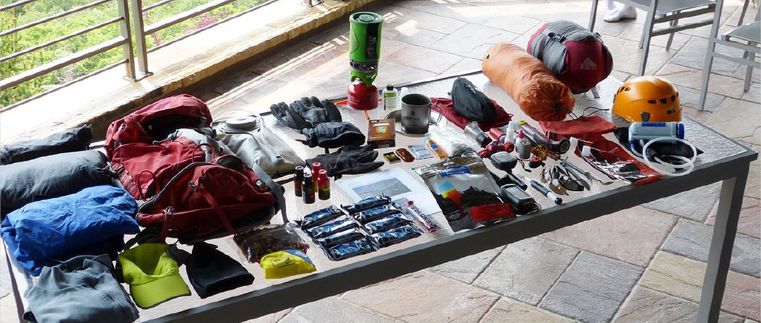
One backpack load - you can see equipment checklist click here.
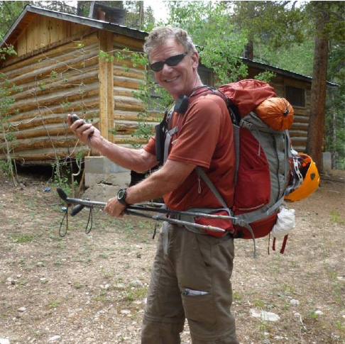
Rick C. at the start of the adventure – with backpack loaded and trying out his Garmin 450 GPS for the first time - there are plenty of stories about people getting lost on the Columbia climb, so I downloaded the GPS coordinates and brought printed instructions as well.
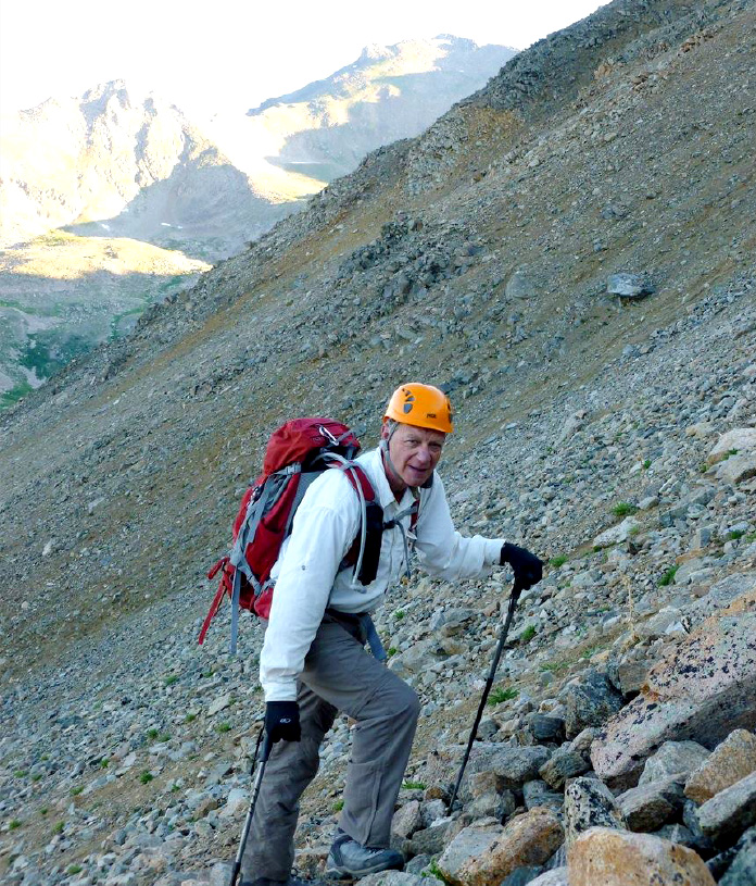
The helmet was to protect against falling rocks - a must on Columbia.
Another climbing friend, Laura Welch was to join us but discovered she couldn't - she's our gourmet chef on campouts - so instead ....
Rick P. being the resourceful guy he is - found a dead rabbit for our dinner 🙂 Well in truth, we settled for dehydrated dinners - Beef Stroganoff and Chicken Alfredo for dinners and P, B and J's plus VPX Bang protein bars for the climbs.
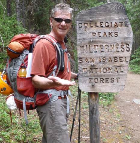
We hiked from the 9900' trailhead to tree line at about 11,600' and then backed down a few hundred feet to find a campsite in the protection of the trees - not from animals, but rather from thunderstorms. Signage is non-existent except for this one, not very helpful.
It announces that we're among the Collegiate Peaks - a subset of fourteeners in the Sawatch Range only about two hours from Aspen.
In the late 1800's first ascenders in this range starting naming mountains after the colleges they'd attended - and so the grouping of five became known as the Collegiates. They are Harvard, Columbia, Princeton, Yale and Oxford.
In particular as pertains to Mt. Harvard, in 1869 Professor Josiah D. Whitney (for whom the highest California 14er is named) and all six students in the first graduating class of the Harvard School of Mines, of which Whitney was the head, were the first to survey the mountain. Whitney named it Mt. Harvard in honor of the university to which most of the team members belonged as teachers or students.
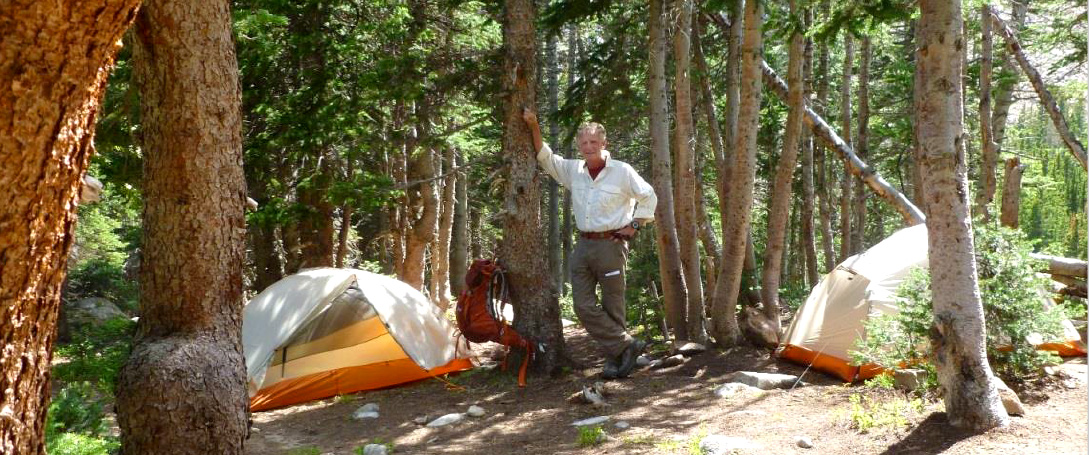
We found a great campsite at 6:30pm just below tree line at 11,300'.
Weather threatened us so we set up tents quickly. Literally minutes later a thunderstorm hit. We dove into our tents and rode it out for about an hour until that cell passed. However, that was a precursor for later in the evening.
From about midnight to 3:30am driving rain, rapid-fire thunder, lightning and ground-covering hail pummeled our tents. We stayed dry, but awake - you couldn't sleep through that. Then we were up at 4:30 for a 5:30am start to Mt. Harvard.
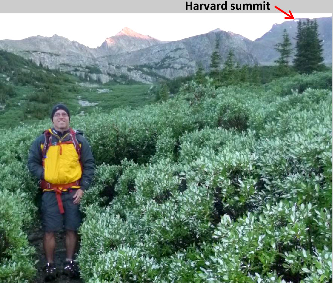
Harvard start at 5:30am. Rick P. getting soaked walking through the tight willows.
Mt. Harvard is a great 3 mile hike across a beautiful basin to get to the steeper approach to summit. The weather had totally cleared and we had Colorado blue skies. Harvard is a difficult mountain to spot since it doesn't have a typical pyramid shape - but as the approach steepens and your breath shortens, you know you're climbing a fourteener.

The mountain wildflowers were everywhere.


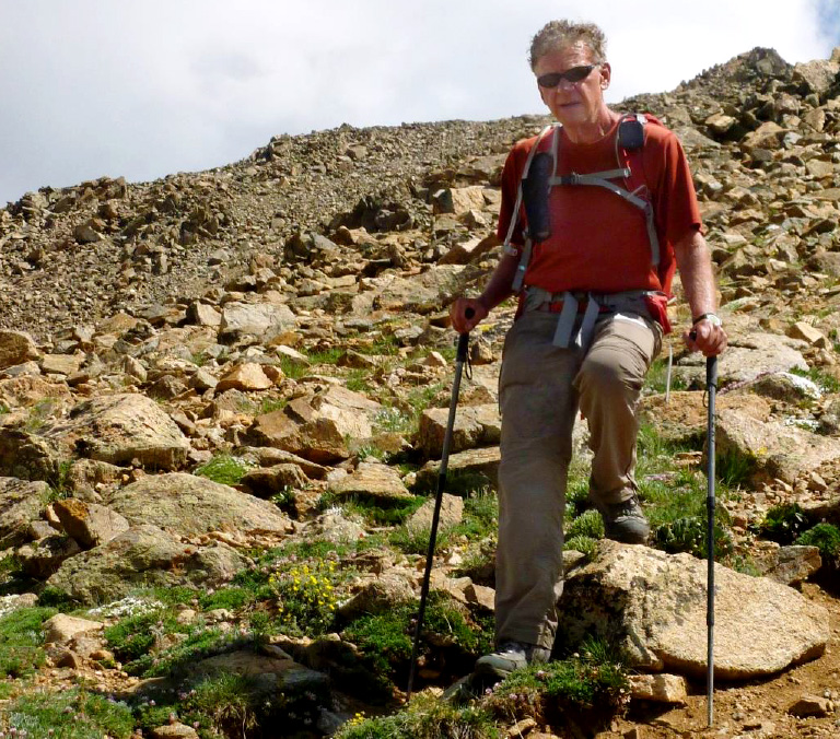
The final summit push - Class 3 climbing any of several ways. See climber for scale.
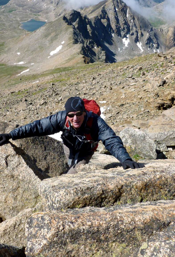
Rick C. on Harvard final summit cap push
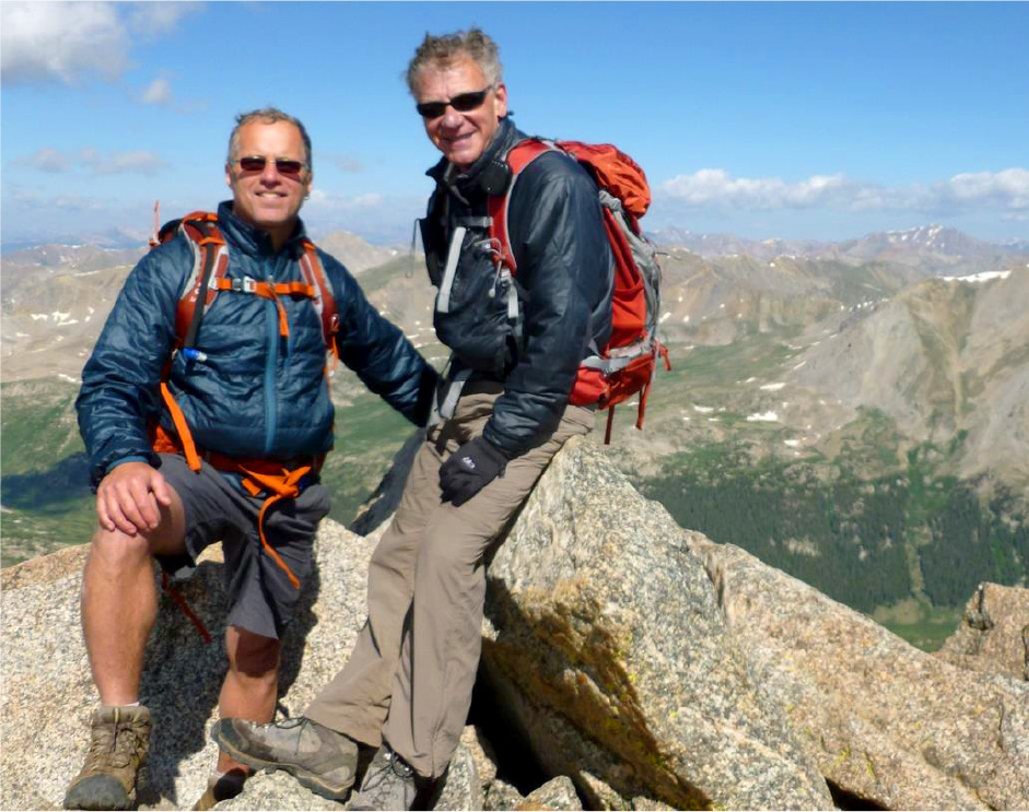
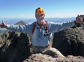
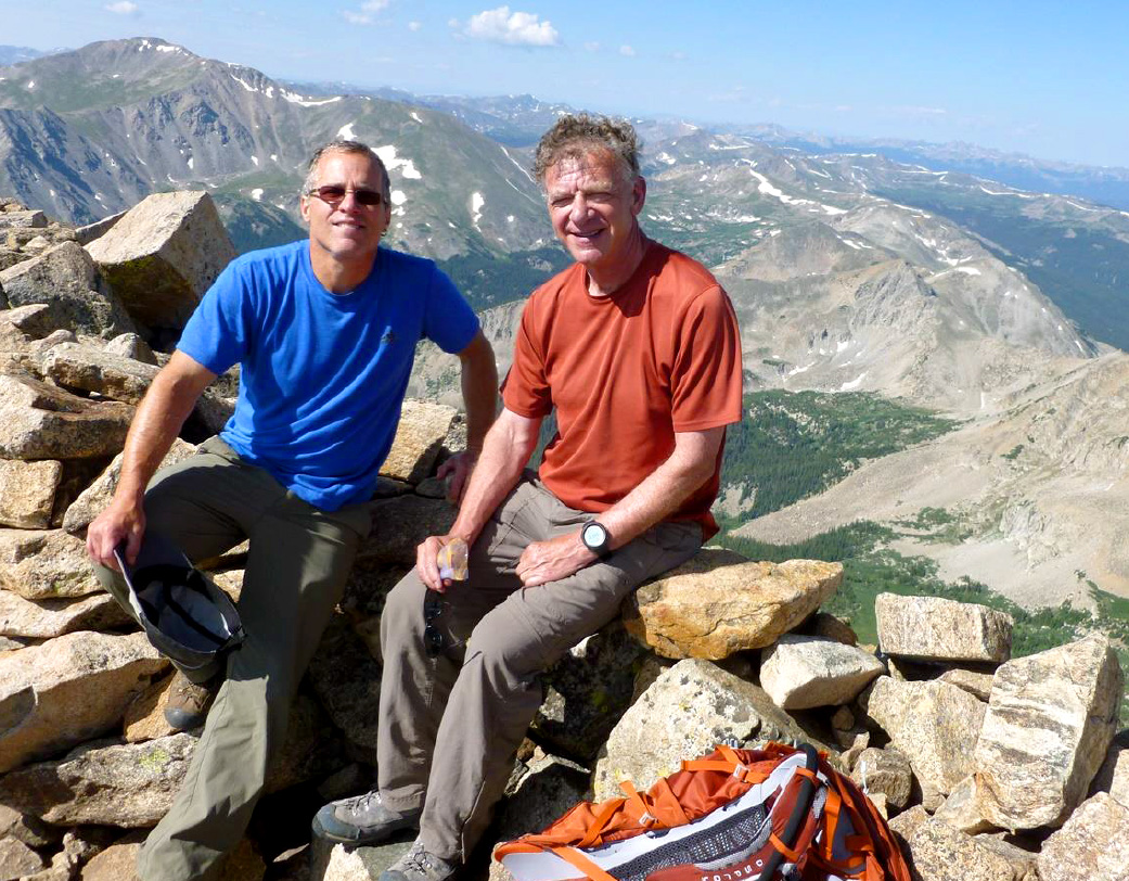
Summit Mt. Harvard, 14,440', 9:45 am, July 8, 2013.
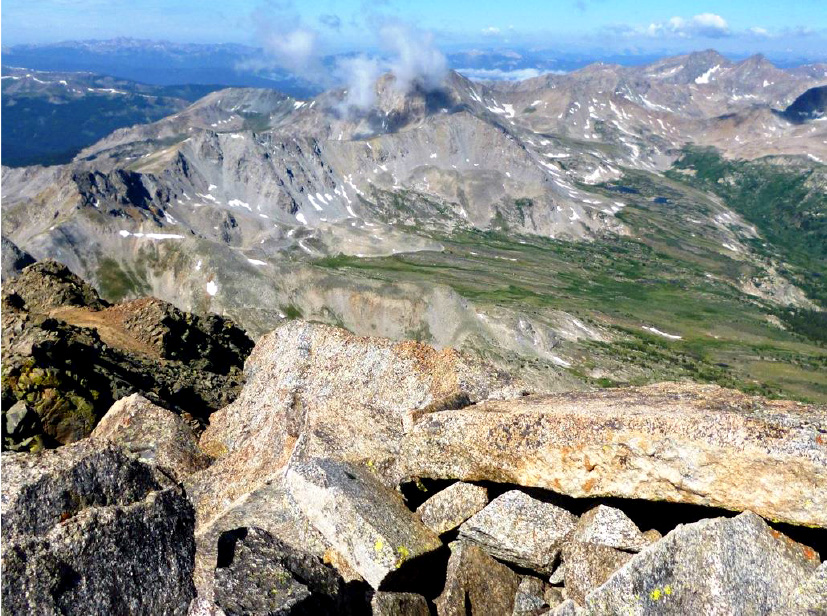
Views from the top of Harvard - above the clouds on the 3rd highest peak in Colorado
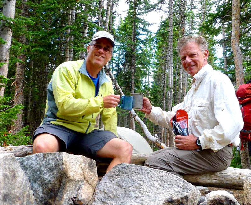
Back at campsite enjoying a terrific Australian Shiraz and toasting the great day, with fortunate weather and a beautiful climb.
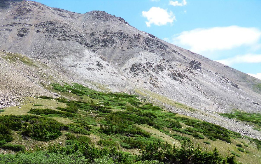
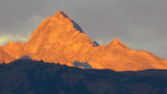
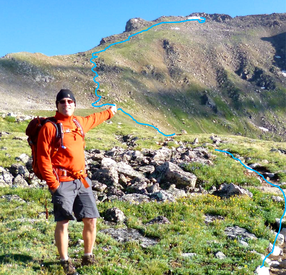
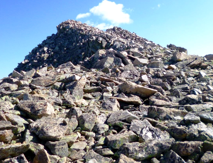
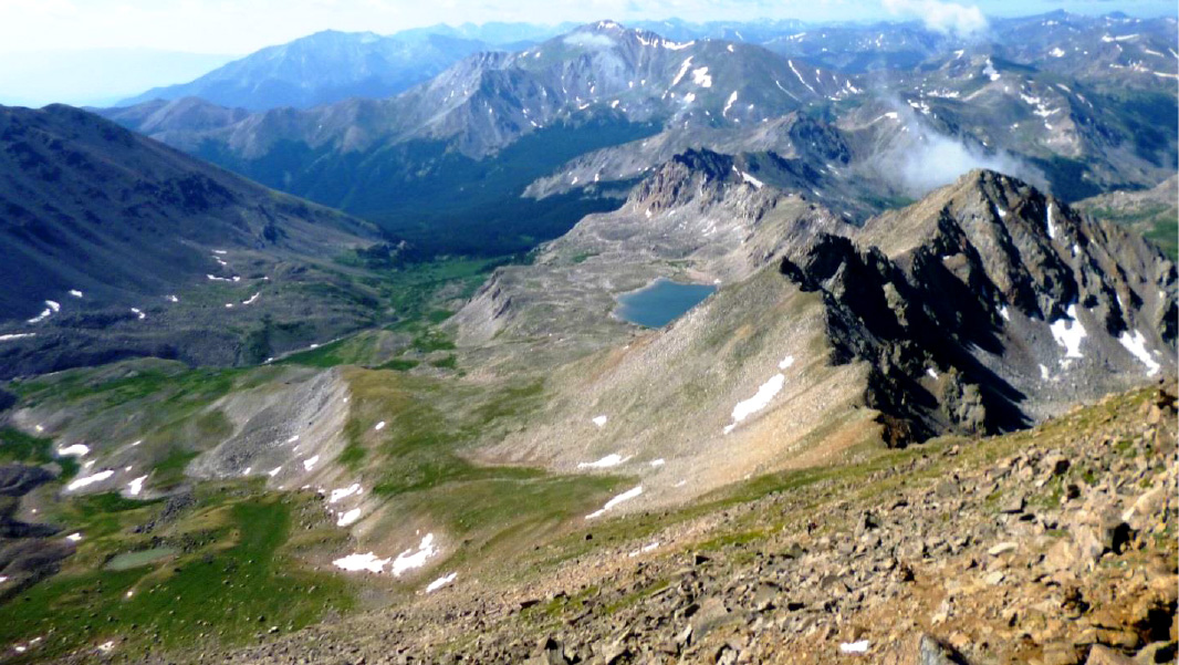
In the afternoon we canvassed Mt. Columbia - it looked steep and crappy indeed, but little did we know we were only seeing about 1/4th of the climb. The rest of the mountain is out of sight over the top - that tricked us into a route our research advised against.
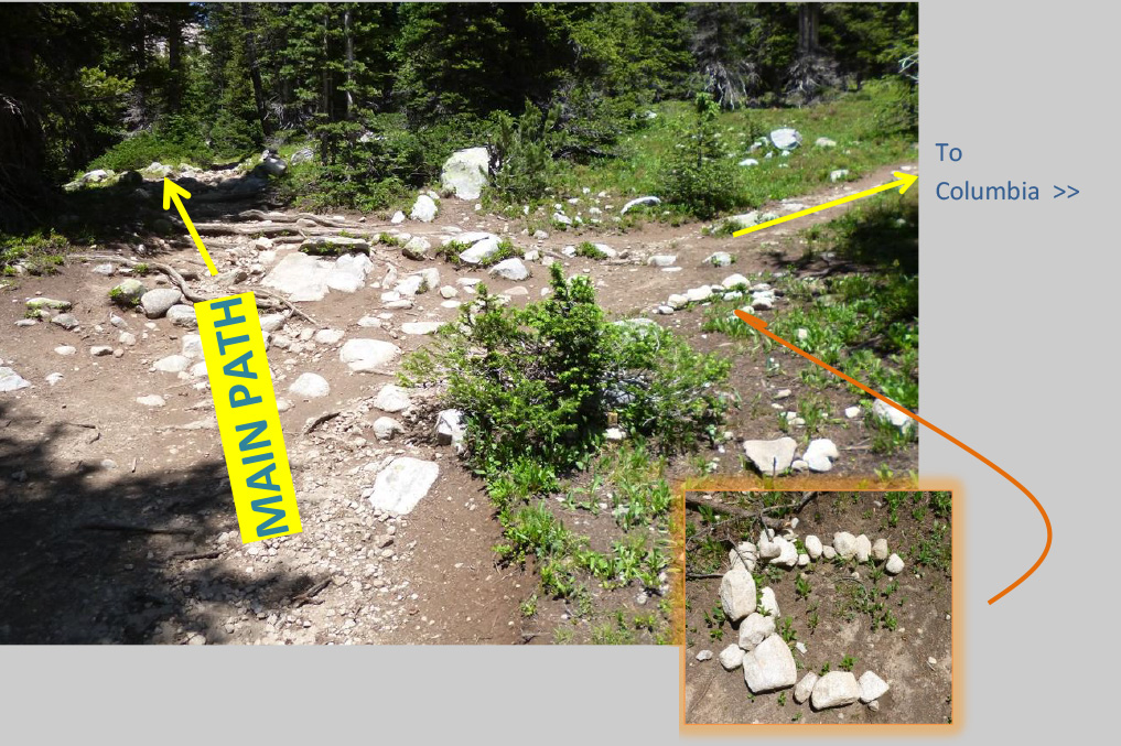
The side path to Columbia appeared totally unmarked. We found the "C" made of stones later. Our GPS helped us find it.
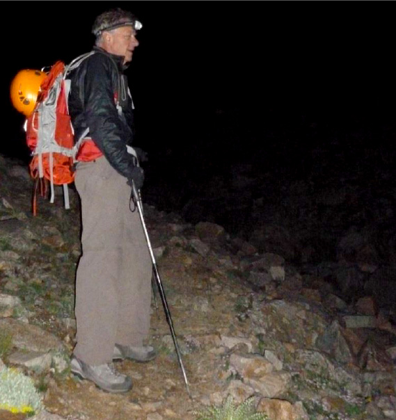
We got an early start towards Columbia with headlights after and no new thunderstorms. We were up at 4 am and on the trail by 5:00 am. We wanted to leave plenty of time for the climb and later the collapsing of the camp site and finally backpacking back to the car.
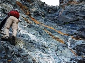
As dawn approached we were already on the talus - which we initially found not so bad. That got us optimistic that the negative accounts of this mountain were a bit overdone. Climbers use the French word "talus" (meaning slope or embankment) interchangeably with the old Norse term for landslide which is "scree."
Either way, it's a collection of broken rock fragments accumulating from rock fall off adjacent cliff faces and presents loose, unstable and, if steep, potentially dangerous conditions.
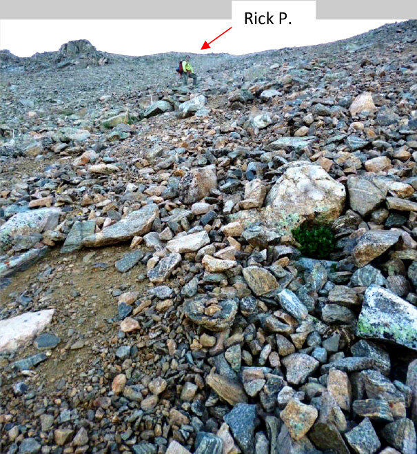
By 6:00 am we thought we were well up the slope and it appeared we'd reach the shoulder pretty soon. See where Rick P. is?
We knew the pitch lessened on the approach shoulder and the rocks under-foot got more solid. So instead of taking a sharp right to attain the shoulder at a much lower, but further point from the summit, we went straight up, which was a bad idea!
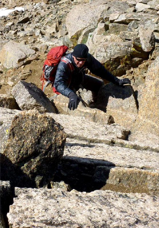
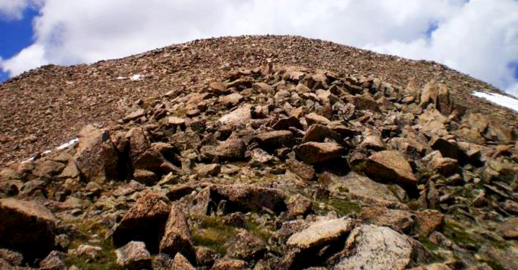
Soon we were experiencing what the other climbers had talked about - steeper, loose and ugly scree. Progress was two steps up and one step back ...
... until it got so bad that even with hiking sticks, upward progress was impossible. At every step I was causing rock slides, occasionally with me going with it.
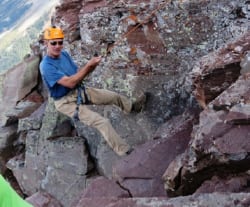
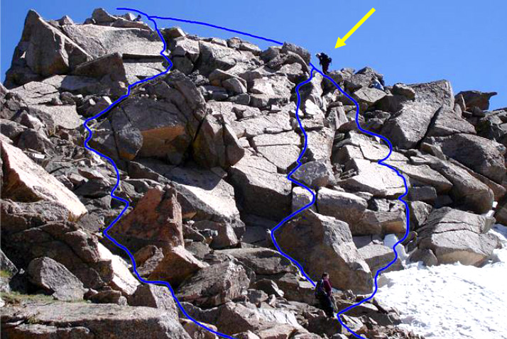
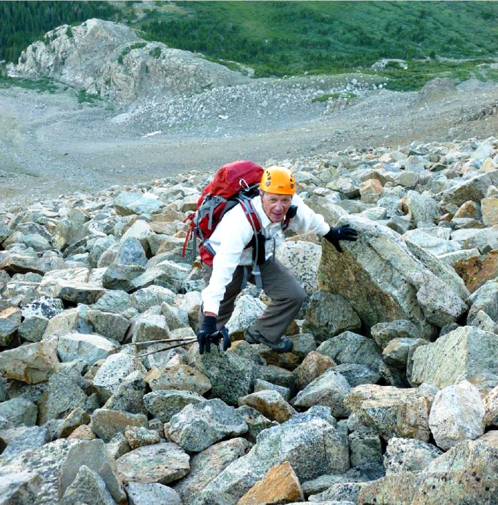
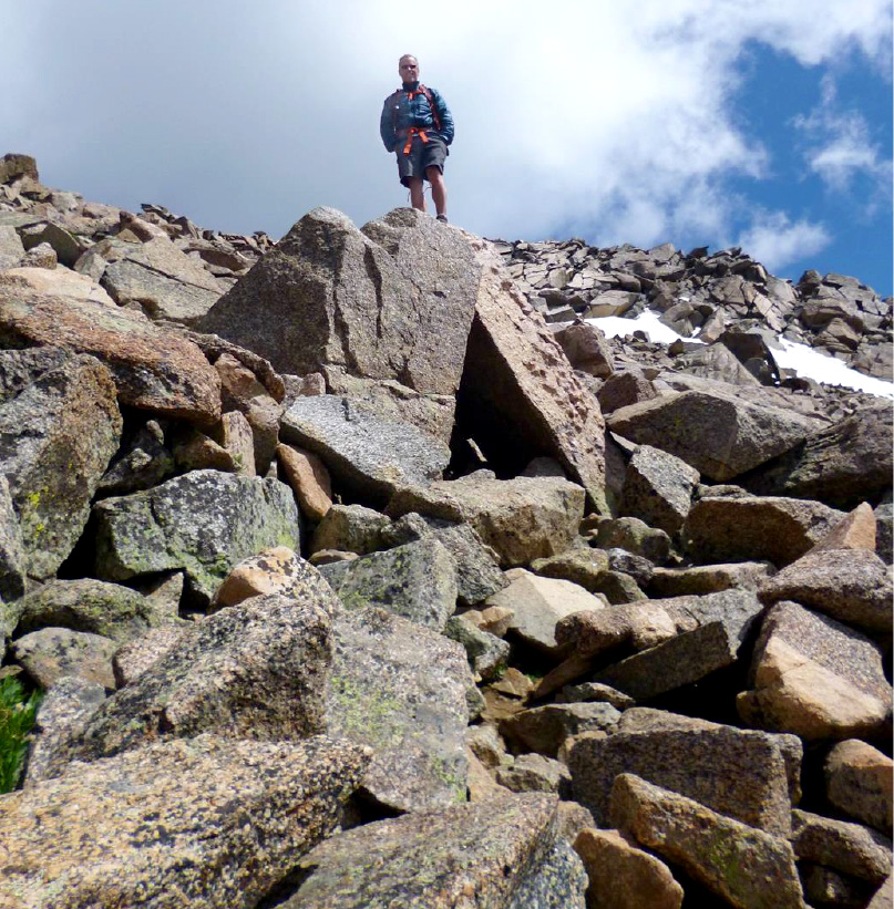
So I saw sections with bigger rocks which got into rockier climbing but more stable. Rick P. came over and we slogged up over 1200'. The ridge line kept receding as we went up, until finally at 13,500' we got to the shoulder. We'd nearly climbed to the summit - or what we thought was the summit.
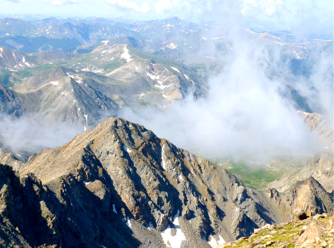
It turns out there's four false summits up there - see the picture - looks like a false summit and the real summit behind? No, both are false, with two more to follow.
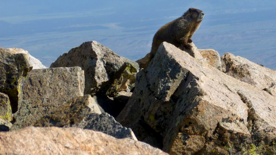
After a while we weren't sure where the real summit was - so Rick P. climbed all the false summits on people-sized rock (fortunately not loose). I was circling around to find another approach. Rick P. put his pack down near the real summit and shouted down to me. As I climbed up, I could see a marmot heading towards his pack. Marmots are notorious thieves - of anything with food or even sweat on it. I shouted to Rick and he turned to see what was going on - and then he ran up the rocks to get to the pack before the Marmot dragged it to his "thieves den."
Summit Mt. Columbia, 14,073' 9:40 am July 8, 2013 View from Columbia summit.
We both chomped our PB & J sandwiches and decided to head down. We had a long way to go. We were not going to descend the way we came up, so we hiked the shoulder until we found the recommended way up and down. That is a well-marked but really bad, loose, steep ordeal from 13,500' down 1800' before reaching more reasonable territory.. 1800' of loose, steep rock is no fun at all!
Your quads are burning and occasionally you have to "skate' down it because there is no footing. NOW we really saw what others were talking about. Turns out we actually liked our ascent path better - I'll take climbing up stable rock to slogging up loose, steep scree any day.
Somehow the camera never captures the steepness or looseness of a scree slope. Take my word for it - unless you're going to do all 54 fourteeners, leave Columbia alone - it won't miss you.
We got back to campsite at about 12:30 pm, 7 1/2 hours after start - and then broke camp, packed up to start the backpacking to the car.
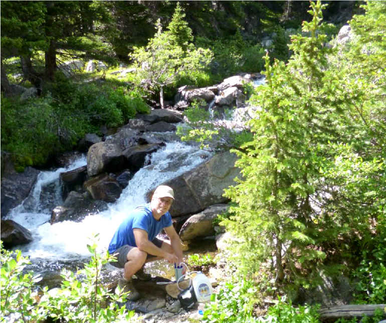
Rick P. pumping and filtering water for our hike out.
Somehow it always seems our packs are as full on the way out as the way in. We got to the car at 3:30 pm and back to Aspen at 5:30.
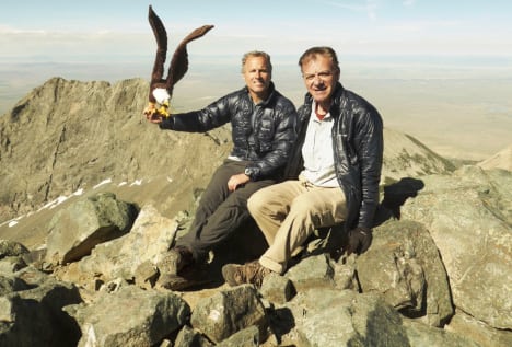
Two more mountains - CHECK! (and for me, Columbia is finally history)
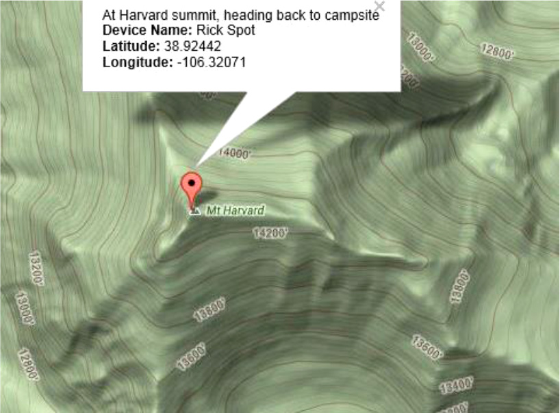
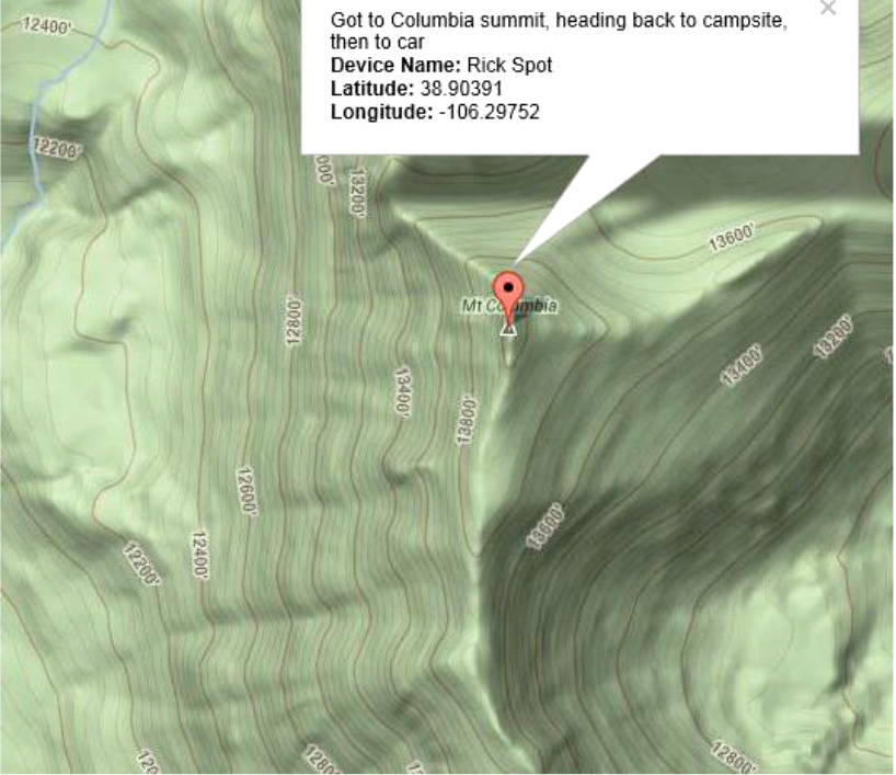
SPOT "evidence" of summiting.