
Difficulty: Class 2 Difficult & Class 3
Exposure: on Castle upper
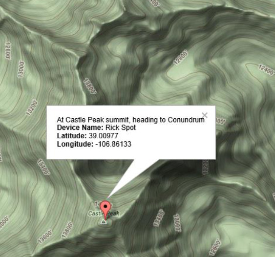
Summit:
Castle Peak 14,279'
Conundrum Peak 14,060'
Elevation Gain: 3,050 feet
Roundtrip: 7.0 miles
Trailhead: Montezuma Basin at 11,500 feet
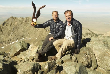
Climbers: Rick Crandall, Rick Peckham July 16, 2013
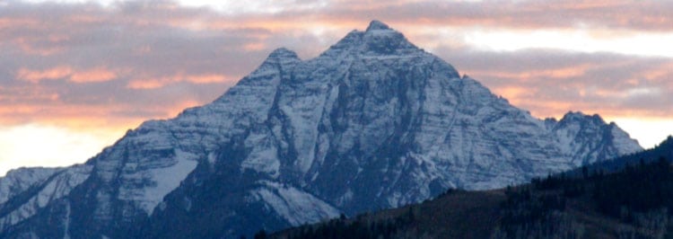
Castle Peak and Conundrum are two fourteeners that I can see from my house, looking Southeast. Their view is overlapped in front by Mt. Hayden, a named thirteener.

View from our home.
In August, 2009 I attempted to solo these two mountains and I immediately got off-route. I was drawn too far to the left of Montezuma Basin onto Castle's East face which was a steep, Class 3 climb with loose rock all the way to what I thought was the summit. I got into a bit of a mess then, climbing on loose rock, with impending bad weather, but I was helped by a Class 5 climber who happened to be nearby. He guided me up and over the top of the approach ridge at 13, 700' and back to the standard route. We reached what we thought was the summit, but the true summit was obscured by intensifying clouds and reduced visibility. This also convinced us not to try for Conundrum that day. We began to descend immediately - on the correct route. We descended quickly, glissading on the snow much of the way back to the car.
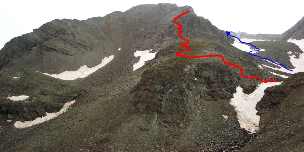
2009 attempt - blue line is the correct way up the basin. The red line is where I wound up - not a good place. Also note now what I didn't know then - we'd "summited" the false summit, not the real Castle summit.
Now in July, 2013 I decided it was time to check off Conundrum Peak - which is done by first summiting Castle. It was on this climb that I realized I'd never gotten to the real summit of Castle on the first climb.
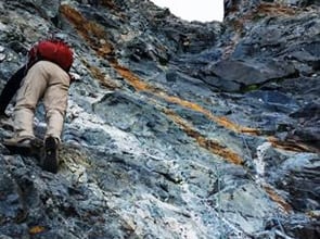
Castle Peak is the highest peak in the Elk Mountain Range famous for its loose, dangerous rock (see warnings in the Pyramid story at: /pyramid-peak-a-dream-climb-2/ ). This looseness will be part of the story in this account below.
Note the orange rock flows leftover from old mines.
Apparent in almost any view in these mountains are the old mines and their orange-colored " tailings". Gold and silver were found here in 1881, and Ashcroft became the second boomtown in the Aspen mining district. Today Ashcroft is a ghost town which can still be viewed about 12 miles out from Aspen on the Castle Creek Road. It is a continuation of that road that leads to CO 102, a really tough, rocky silver mining trail, along which climbers leave their vehicle to start the climb. You can go quite far up this road depending how good your 4WD vehicle is and your nerves for boulder-hopping on skinny trails that switch back up a mountain. Driving or hiking, you'll pass the Pearl Pass "road" which was completed in 1887 providing a route for hauling ore to the mills of Crested Butte. Meanwhile Aspen was booming by then and the mines of Aspen were producing $6 million per year in sliver. The signing of the Sherman Silver Act in 1890 established a silver standard for the U.S. dollar, and silver prices shot up and then went bust three years later when the silver standard was abandoned. Ashcroft (as well as the town of Independence) quickly became ghost towns. The last of the big mines fell silent in 1930.
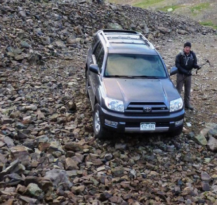
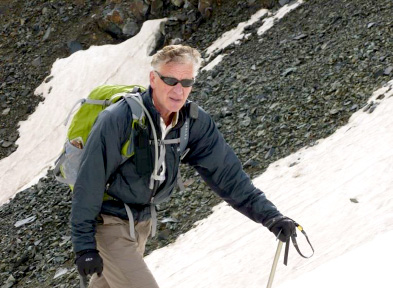
Rick P. (Peckham) and I left our house at about 4:30 am for an early start to the day. The Aspen summer weather pattern was in full swing with daily electrical thunderstorms that threaten anyone near a 14,000' summit. However my analysis of the weather reports was that a morning climb would be OK as long as we were off of the high elevations by 1 or 2pm. We drove up the very bad CO 102 road until we'd had enough off-roading. We left the 4Runner at about 11,500' and started up on foot at 6:00 am.
We were equipped with ice axes and crampons - required for these specific mountains that retain a lot of snow.
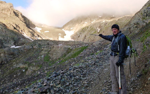
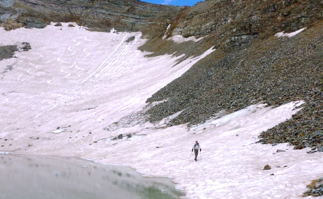
We headed up the old mining trail towards the Montezuma Basin. Clouds were already upon us but they were not the water and lightening-bearing type so we pushed upwards.
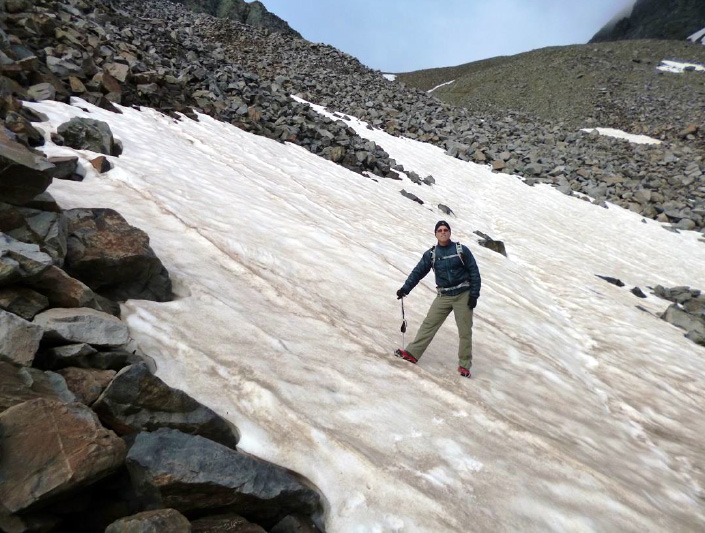
Rick P. headed up the snow-fields which remain in this basin much longer than elsewhere. These are steeper than they look - crampons required.
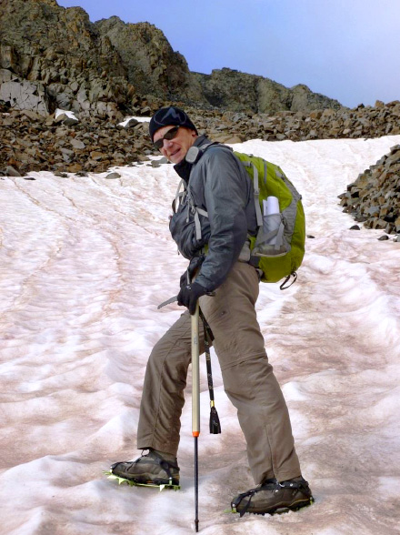
Rick C. heading up the first snow field. In addition to crampons (spikes under boots) I use an ice ax with a pull-out extension so it can be doubled as a hiking pole.
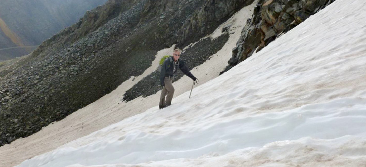
Getting steeper.

... and steeper.

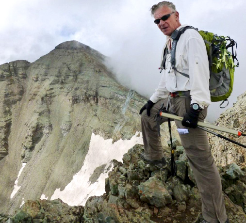
At 13,000 feet we looked up left to the shoulder and then straight ahead where the clouds cleared enough to show the Castle Peak summit in the distance. Note the false summit to the left of it - where we were headed first.
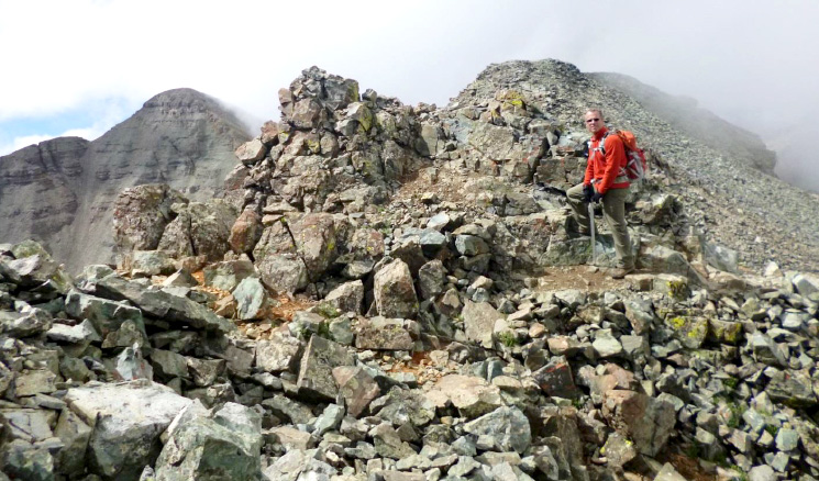
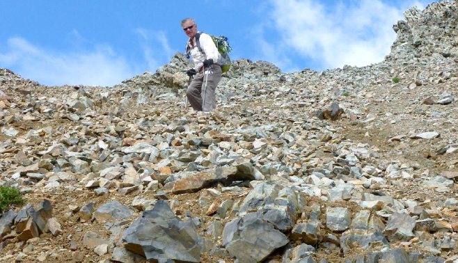
We hiked high above the snowfields into rocky Class 2 and Class 2 difficult terrain on the Northeast shoulder. It was then that Rick P. decided to see if he could give me a heart attack.
Why is it that every good climber I've had the pleasure to accompany me, at some point in a climb, needs to get to the top of the tallest rock or out on the outermost outcropping?
If you look through my other stories you will see Andy Mishmash on Wetterhorn, Brett Crandall on Sunlight and, oops, even me on Mount of the Holy Cross do the same thing.
But these are the Elk Mountains - loose and dangerous.
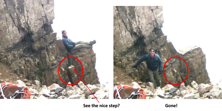
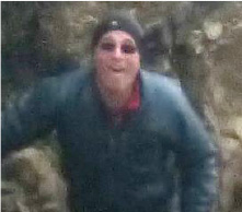
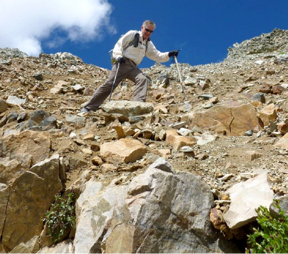
Sorry for the blurriness but these were grab-shots. As I turned around I saw Rick P. climbing out to a cliff edge with 1000' falloff on all three sides. I yelled to him - "NO THIS IS ALL LOOSE, YOU CAN'T TRUST IT!" to no avail. When he decided to return, he flipped around to his right, stepped on the indicated sub-ledge, which promptly broke away with him on it. He was fast. He got two handholds and jammed a foot somewhere and scrambled to safety. We heard that rock crashing down causing a rock fall for many seconds afterwards.
It's a lesson for any reader climbing in the Elks - these mountains are falling apart. They are not granite, they are mud-rock and none of it can be trusted. Always have multiple points of contacts on different rocks and when heading up - press on rocks instead of pulling on them. Sheeesh!
Just for a bit more nervous fun -
here's Rick P.'s face right afterwards.
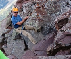
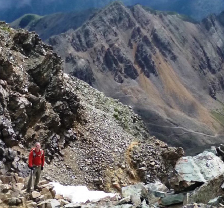
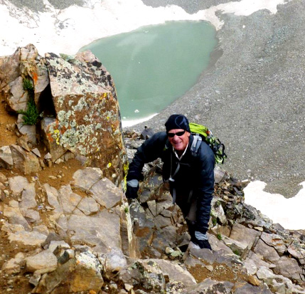
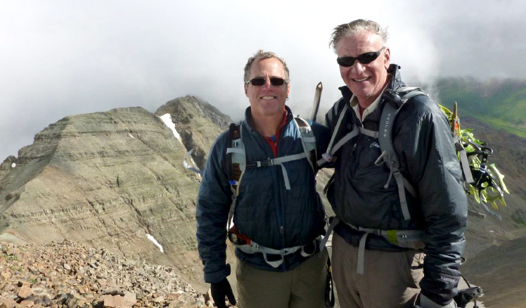
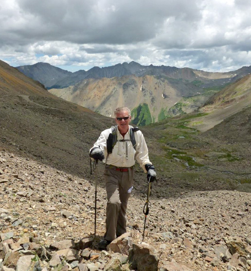
As we approached the summit cap and a bit of Class 3 climbing, we looked back on the Northeast shoulder, the clouds were still friendly and the views were stunning.
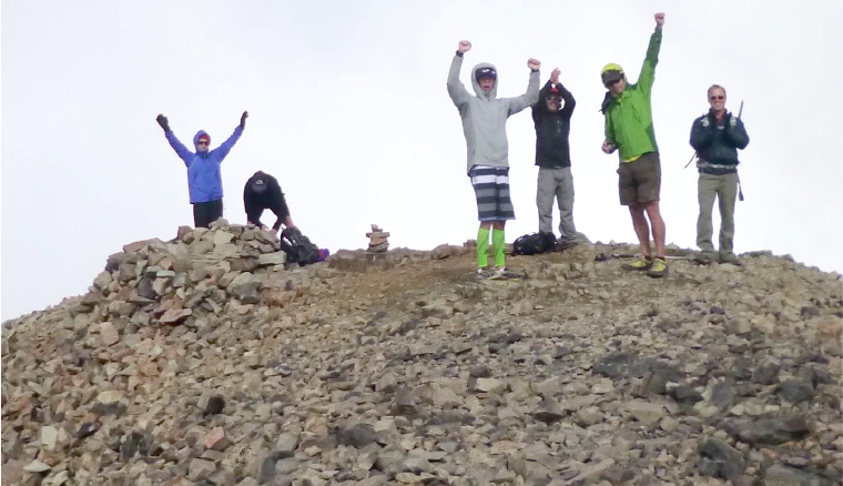
Of course Rick P. (on the right) got to summit before I did - and ran into 5 young guys who were totally high. Rick obviously told them (as he usually does) that I wasn't really just slow, I'm nearly triple their age which always gets the reaction you see above - cheering my arrival - usually followed by everyone saying I'm their role model. Usually they can't believe I am still breathing, especially at 14,279'
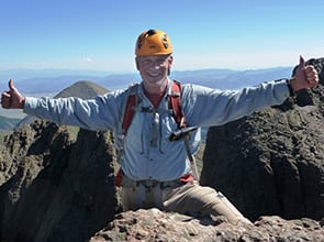
Summit: Castle Peak 14,279' on July 16, 2013 at 9:20 am, 3 hours 20 minutes from the car.
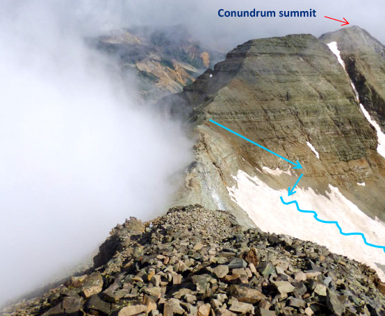
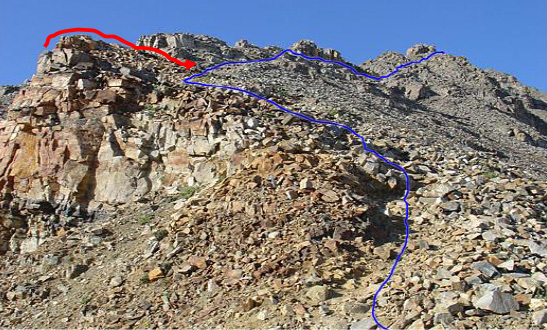
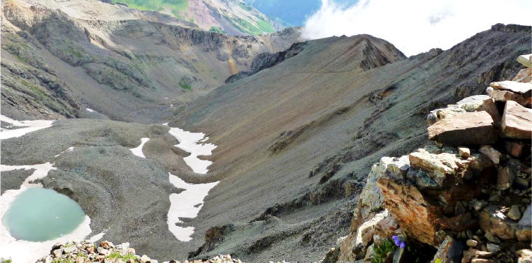
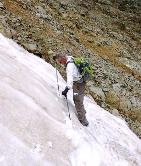
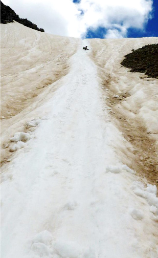
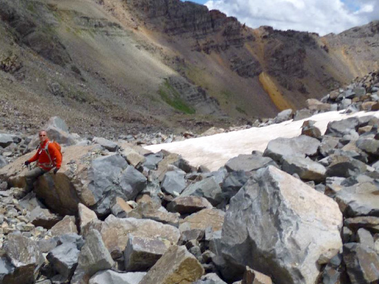
Well, on a climb I'm the one usually concerned about the weather. We had a key decision to make. Clouds were all around, and Conundrum was off in the distance (the second peak after the ridge). Earlier in the summer the descent is a glissade down the steep snowfield (shown in blue). But on this July day, after the hot weather, the snow had receded leaving a very steep, rocky, sandy, loose descent to even get to the snowfield. If that closed the glissade option, we'd have to re-summit Castle and hike down which would add a lot of time leaving no room for escape if the clouds turned unfriendly.

Here's a closer look at the wall above the top snowfield: ugh!
Well, I decided the clouds were still of the friendly type and I'd read that as little as ten days previously climbers will still finding a way down to the snowfield, so we headed for Conundrum Peak.
We climbed down to the connecting ridge, and headed up to the false summit en route to Conundrum
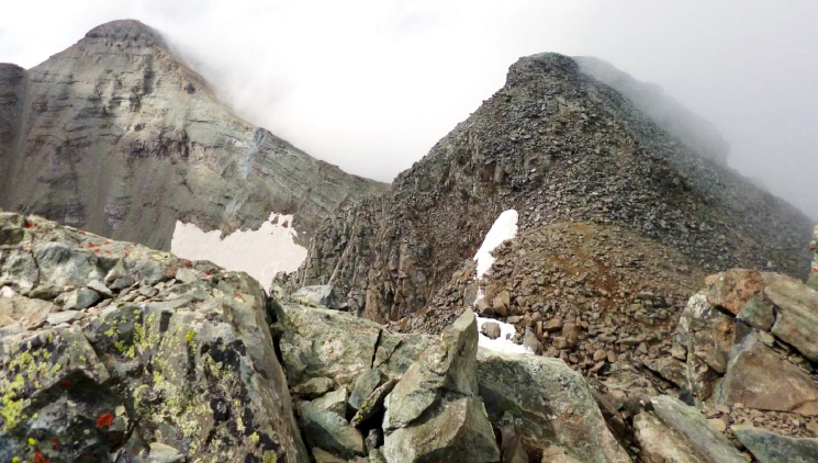
... and then on to the Conundrum summit. Above see Castle Peak on the upper left. Then you can see the snowfield we were going to have to descend on return. Conundrum's false summit is on the right. The photo is taken from near the real Conundrum summit.
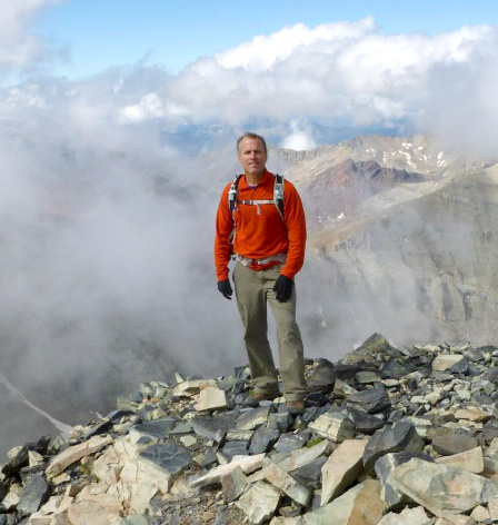
Summit Conundrum Peak 14,060' at 10:35 am, 65 minutes from Castle Peak.
We took some photos and then did not dawdle. While it was still before 11 am, there was some intermittent clouds building. We still didn't know for sure if we could get down to the snowfield to glissade down or if we would have to re-summit Castle adding a lot more time to the descent.
We did find a way down but it was a very steep, loose wall and no picnic. In the few pictures that follow, every single thing you see is loose and started rockslides as I went down.
Once we got to the snowfield - we had to traverse to the middle before we could safely start to glissade. We wanted to be far from the edge rocks because steerage with an ice ax is not perfect.
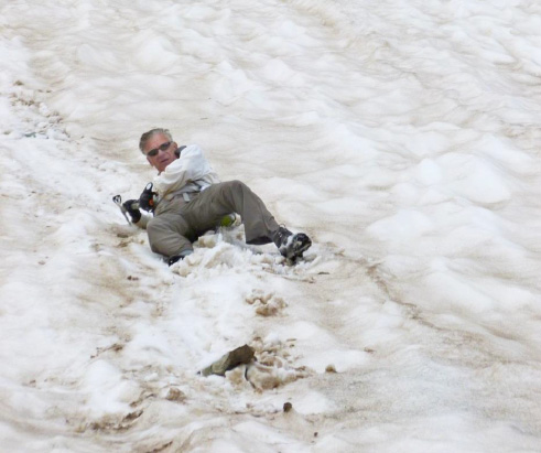
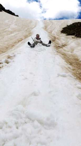
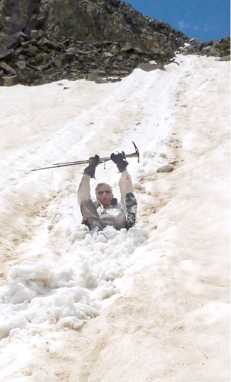
I managed to fall - and once you do on the steep stuff - you don't stop. This is where the ice ax comes in. To arrest the speed, you jam the long (pick) end of the ice ax into the snow beside you, and then roll onto the handle to keep the pressure on sinking the pick deep. It acts as a brake. Make sure the hand strap is on your wrist because if the pick hits a rock under the snow - it stops dead and you don't. The last thing you want is to lose your ice ax.

Once we got control of the descent, the fun began. We glissaded down 1000' and were careful not to glide right into that very cold pond.
Then we had to walk around the pond to get to the two additional lower snowfields that we also glissaded. That is a super fun and a great way to get down a mountain in a hurry!
As the slope eased, so did my glissading form!

At the bottom of the snow fields, we hopped through the rocks at the basin ...
And back to the road down to the car. We got to the car just as the clouds began to gather more seriously. Arrival time at the car: 1:10 pm. We had a 7 hour and 10 minute amazing adventure in the Rockies.