
El Diente - South Slopes
Difficulty: Class 3/4
Exposure: Serious exposure; some along snow ledges
Summit Elevation: 14,159'
Elevation Gain:4300' from TH; 3200' from camp at 11,000'
Round Trip: 12 miles from TH; 4.5 miles from camp
Trailhead: Kilpacker at 10,040'
Climbers: Rick Crandall; Rick Peckham – September 7, 2016
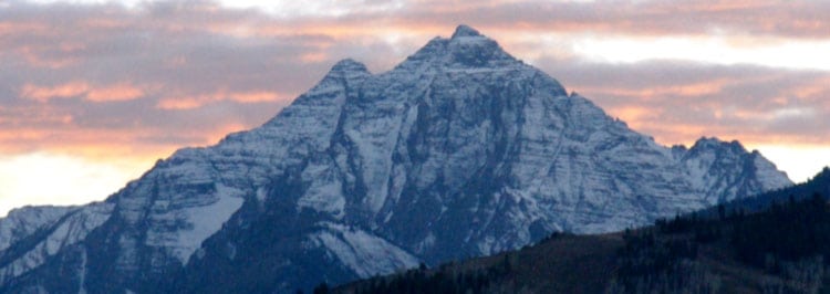
El Diente is one of the more challenging 14ers in Colorado and now that I've had the experience of climbing to summit, I can say that in my book it ranks in the top 6. The mountain is named for its tooth-like summit appearance when viewed from the south. "El diente" means "the tooth" in Spanish. Its earlier names were "The Jag" and "Montezuma Peak." El Diente is one of a trio of fourteeners (the others being Wilson Peak and Mt. Wilson) located in the Lizard Head wilderness part of the San Juan range near Telluride.
The Wilson Group is made up of roots of volcanoes, called "stocks" which are small intrusive igneous rock bodies. Intrusive igneous rocks are magma that never made it to the surface. As the mountains eroded, the stocks became high points in the range creating the sharp ridges, steep walls and picturesque columns that make up the spectacular look of the San Juans which you'll see in the photos. Stocks fracture easily, making the rock loose and creating the nasty scree slopes and gullies on the flanks of the mountains.
Here is what a few others say:
From Wikipedia:
"El Diente is one of the more dramatic peaks in Colorado in terms of local relief and steepness. As a result, it is one of the most challenging climbs among Colorado’s fourteeners. All routes involve at least class 3 scrambling on loose talus. Poor route-finding can expose the climber to more difficult and dangerous terrain."
From Summit Post:
"El Diente is a potentially dangerous climb and reaching its small summit block is without doubt one of the most satisfying climbs on any Colorado Fourteener. El Diente is a challenging mountain that will best most of the Fourteener's and ... it will blur the line between class-3 and class-4."
I had my eye on the weather as rain, snow and thunderstorms were a daily occurrence on the high peaks for weeks, especially in the San Juans. Just as I was seeing a few days of clearing in the forecast, I came upon this recent climb report on the Internet:
September 1, 2016: "Summer conditions with a few wet spots here and there until you drop over to the north side of the ridge. The last 300 feet is steep angled corn snow, just shallow enough to be unsupportive, but deep enough to help you slide off the edge should you slip. Too shallow for crampons, but deep enough to make microspikes marginally useful. Definitely bring microspikes and an ice axe if you intend to summit the last 300 feet. Wherever there is not snow, there is wet and slick rock, so take your time! Remember you have to down climb as well! My 2 cents: wait for warmer temps next week to let it melt out."
Well, we waited a week from then, but I remained concerned about the snow on the narrow ledges approach to summit. We did bring Katoula micro-spikes and ice axes.
I had a pretty good idea that El Diente was going to be a challenge, since it ranks along with the other most difficult peaks in the state as being the least attempted. The mountains listed in the Aspen Times article below are the very ones I'd put on the most difficult list:
![]()
Study: 14,000-foot peaks least climbed in the state August 13, 2016
Hard peaks to climb
The study estimated that fewer than 1,000 trips (recorded at trailhead, not summit; we don't know how many summited) are made per year to Pyramid Peak, Maroon Peak, Capitol Peak and Snowmass Mountain. It came as no surprise that these Elk Mountain fourteeners were the least visited ... difficult peaks to climb....
Among the least visited, in addition to those in the Elks, were Mount Wilson, El Diente Peak, Mount Eolus and Wilson Peak, all in the San Juan Mountains and with less than 1,000 visits annually .... Little Bear Peak in the Sangre de Cristo Range also had fewer than 1,000 visits per year, the study indicated.
The Start: Backpacking to Set Camp
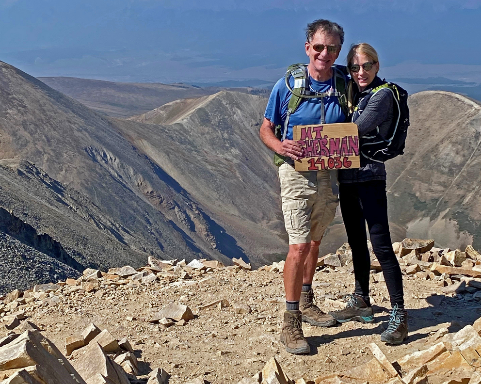
 My climbing friend was Rick Peckham who has appeared in a number of these adventures. He has visited for several weeks each summer from his Anchorage, Alaska home to enjoy the camping, climbing and beauty of the Colorado 14ers with me.
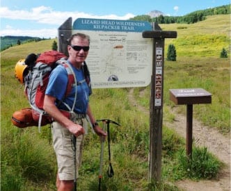
We drove the 5 hours from Aspen to the Kilpacker trailhead about 45 minutes south of Telluride and left the car at 10,040'.
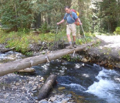 With our usual loaded backpacks, we hiked about 4 miles and 1000' up to find a camp site. There's no lake in the Kilpacker Basin but there is the Kilpacker Creek that needs crossing a few times.
WARNING - at about the halfway mark (2 miles) from trailhead there is a junction marked Kilpacker/Navajo Lake and right off the path is a sign to El Diente Peak - take that right! Don't miss it.
Rick P. with El Diente in the background.
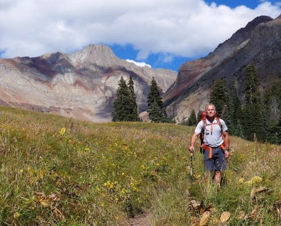
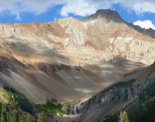
Eventually you break out of the trees into a meadow featuring El Diente majestically showing in the background. It is an impressive mountain that has a major presence on the basin.
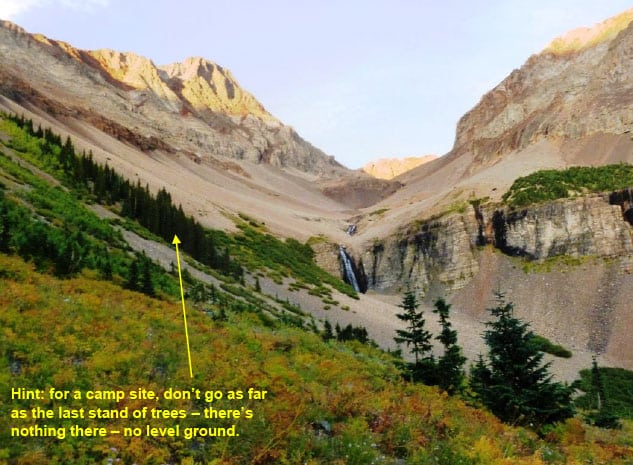
As you approach the basin, you'll see several clusters of pine trees. The best camp site is in the second to last bunch of trees, higher than the campsites at the lower water falls.
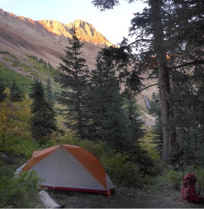
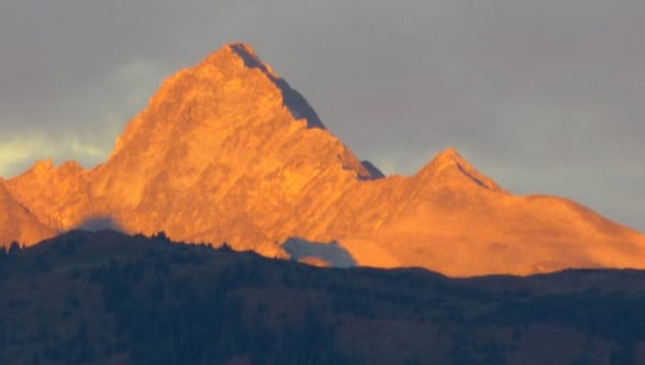
We set camp at about 5 pm at 11,000' in full view of our target for the next day, El Diente.
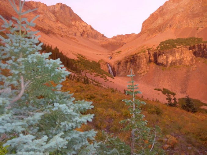
How do you describe beauty like this? As the sun set, we saw alpine glow on El Diente (left of center) and most of the route we'd climb the next morning. The waterfall wove in and out of the high ground.
The Climb
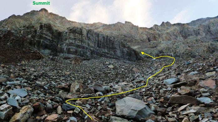
The next morning we arose at 4 am and were on the trail in the dark (really dark, only a thin crescent of moon) by 4:45 am. Our first goal was to get to what we thought was a split in the trail, going left for El Diente and right would be for Mt. Wilson. Well, here’s a tip - it is hard to see in the dark!
For the first 1500' we hiked up on a good path in rocks until reaching a somewhat level place with two cairns on your right. Take the left the trail to El Diente begins whereas the path we had been on heads off almost straight (blue) Mt. Wilson. In the dark it's easy to miss the left, and we did!
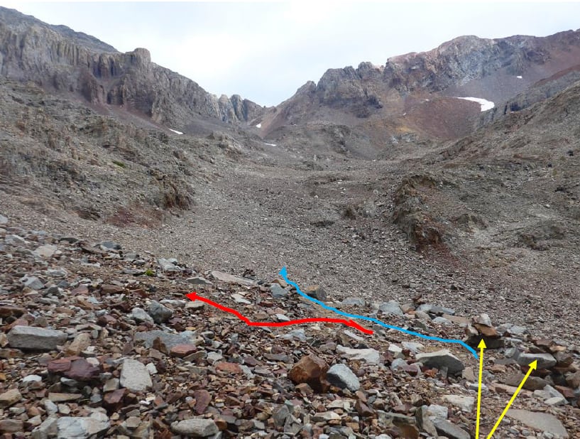
The route to El Diente is left. We didn't see that in the dark.
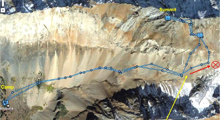
Here is our whole climb, tracked with my DeLorme GPS. Note our wide swing, we mistakenly climbed 300' towards Mt. Wilson in the dark.
Fortunately I had recalled some commentary about a cross-over between Mt. Wilson and El Diente at about 13,000' so instead of retracing downward, we headed left over some small rock ribs and connected with the route to El Diente (marked by cairns). By this time, at about 7:30am, we could see more of what we needed to do.
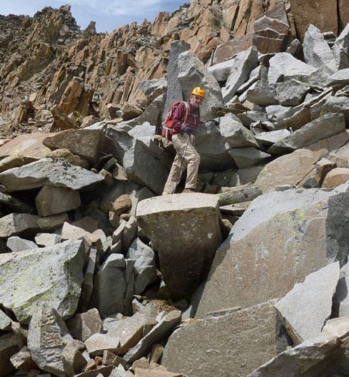
There's not much of a path, rather fairly frequent cairns, seemingly every 50' or so.
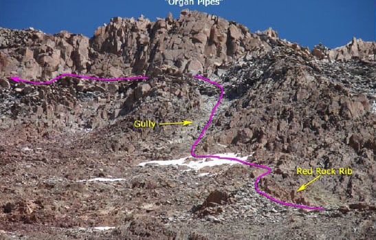
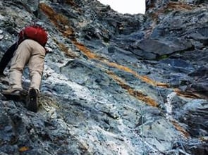
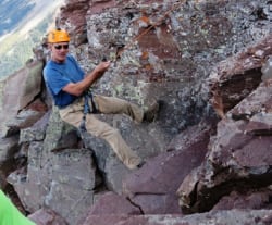
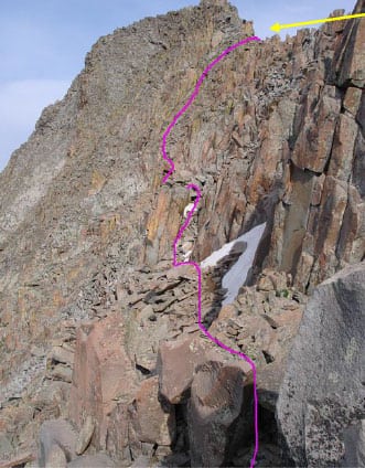
The next several segments of the climb are shown here. Hiking left, a rib of red rock appears (the magma "stocks" mentioned earlier). Bouldering under the rib leads to a grey-rock gully that is big, steep and full of small and large boulders that are all loose. Working up through that gully takes time and gets into Class 3 scrambling
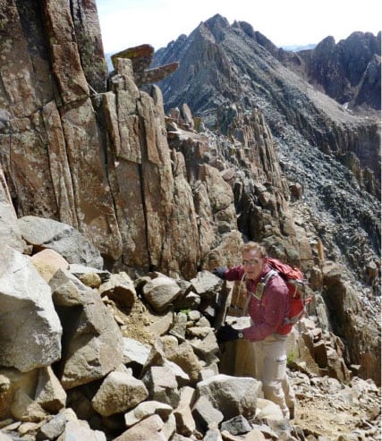
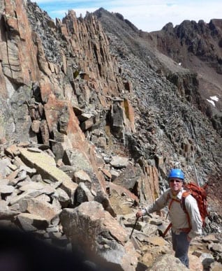
Rick C. just past the rock rib and about to head up the grey gully.
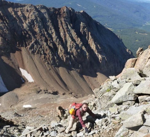
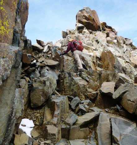
Heading up the gray gully - all loose and some of those boulders are huge.
The boulders get bigger, sharper and they move.
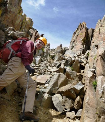
Half way up the gray gully, we cut out left under a continuous wall of natural columns and cliffs - pretty much all Class 3 scrambling along the way.
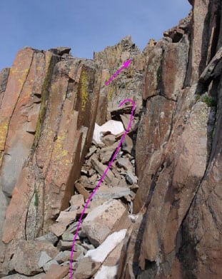
Here's a chute we climbed up and down the other side.
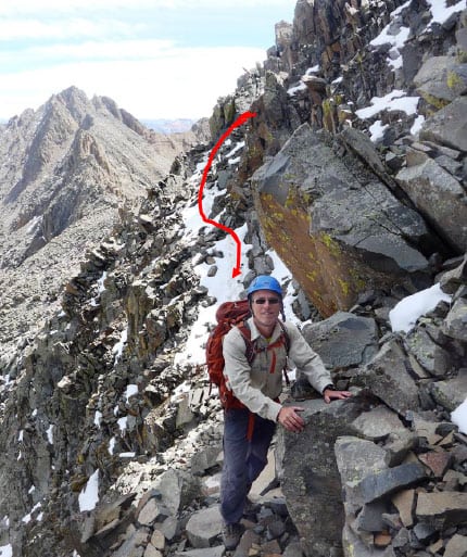
Notch cross-over to North side
The next objective was to climb under a bunch of vertical columns (also magma insertions) that are locally called the "Organ Pipes." Once past them, the climbing gets steep as we headed towards a notch in the ridge that connects Mt. Wilson with El Diente.
Rick P. Is just past the "Organ Pipes" and starting to head up towards the notch.
There were several times on this climb I wondered if I was up to finishing it. This was one of them. Right at this point I saw it was 10 am. We'd been climbing over 5 hours. The ridge we had to cross-over to the north side approach to summit was still far away and it was all climbing steep, loose rock.
In the back of my mind there was also the worry that snow on the north side would be too treacherous even if I got there.
I started mentally talking to myself – "stop thinking about the whole climb, just focus on getting past the "Organ Pipes" and then focus on the climb to the notch on the ridge - that's the total goal right now. At least the weather is not a threat at all."
Rick P. was also a great comfort. When we got confused about route, which we did several times, he'd scramble - up, down and sideways to find a way up.
Usually he was encouraging, but in this case he got to the notch at the top of the ridge and looked over. I asked from below, "how bad is it?" to which he said "you're not going to like it."
Rick P. just having looked over the notch and now coming down to me.
I actually said to him, "well get some photos in the chance I do make it so we'll have a story to tell."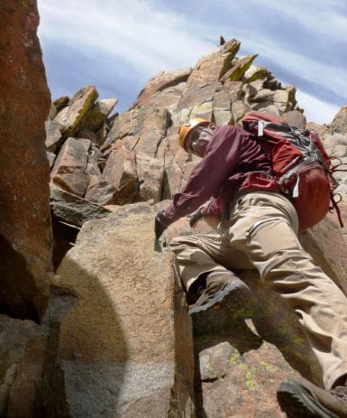
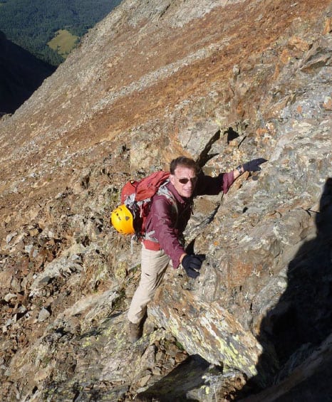
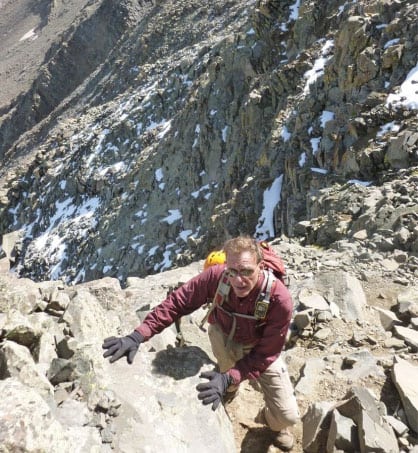
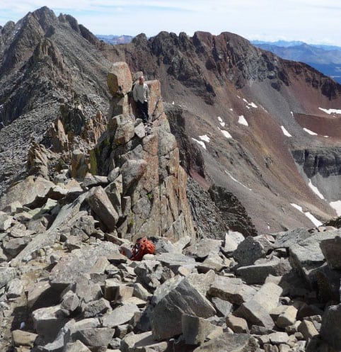
Here I have the notch in sight with good hand and foot placements and on rocks that felt pretty stable.
At 10:45am I got to the notch on the ridge and looked over to the north side.
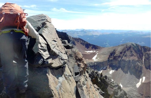
The good news was that the new snow mentioned in recent reports had melted off. The bad news was that the permanent snow was right on the ledges we needed to traverse.
What I had liked about a south approach on this mountain is that this late in the summer, all snow is melted off, but that is not true on the north faces. There some of the snow is permanent. In fact it is left from thousands of years, maybe even much more - from glaciers which have never melted.
Rick P. on one of the ledges on the north side. The snow was very hard - really more like white ice. It was tilted, and as you can see, the deadly-drop off is what is called "exposure."
I put on my micro-spikes which did a great job of traction on the hard snow. Exposure never bothered me and now that my feet felt stable, I was actually energized to go further.
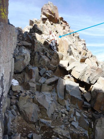
We were aiming for a second notch right at about 14,000', only 150' from summit. The final up climb was snow free.
Here Rick P. is above the second notch on a pinnacle that is not the summit but very close - the summit is even smaller!

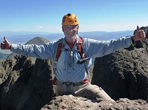
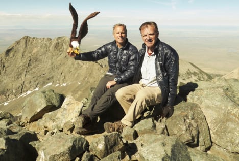
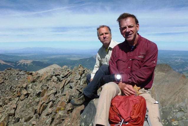
Summit El Diente, 14,159' at 11:30 am, 6 3/4 hours from camp on a glorious day.
The summit block is no bigger than a half a couch - here we're both sitting on it eating a P, B & J sandwich. Only 2 other climbers were nearby and they took our photo.
The drop off was amazing, but so were the views. It felt so good, we stayed on the summit for an hour with no worries about the weather. This is a hard mountain and I refused to rejoice until getting back down all the hard moves. The descent is usually where all the falls happen.
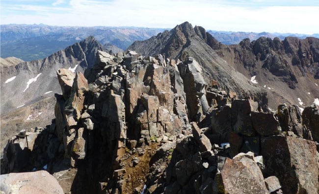
Mount Wilson is in the background across a long Class 5 ridge I had no interest in attempting, today or any day. This was my 55th fourteener summit. I need three more to get them all - and Mt. Wilson is the hard one that is left - reportedly more challenging than El Diente.
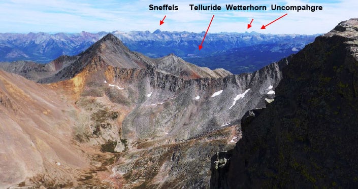
Views were everywhere - in the far distance, the tallest mountain you see in the middle is Mt. Sneffels, the mountain pictured on the new Colorado driver's license.
At 12:30pm we began the descent. The down-climb, while always more difficult, was major fun for me. There were no more unknowns, except we did go off route in that long, gray gully, but the climbing was fun and the weather was amazing.
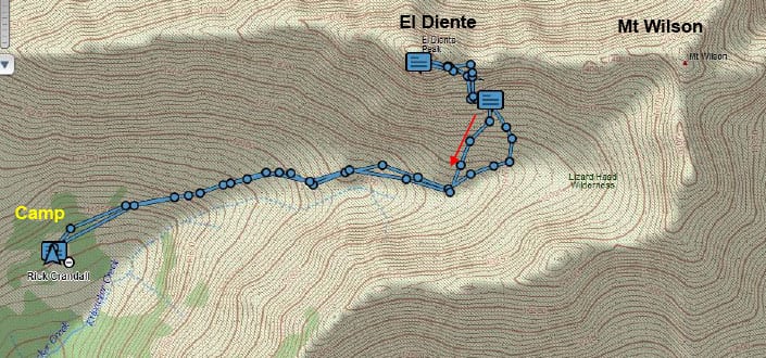
This is the GPS track of our whole day from and back to camp. Note the shorter descent (red) where we avoided the misdirection in the early morning darkness.
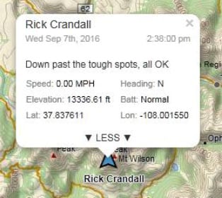
When we got back down to past all the scrambling at 2:30pm I finally relaxed and started rejoicing. I sent a satellite message that said:
We were at 13,300' and still had 2300' to hike down on endless rocks, break camp and then backpack out the remaining 4 miles and 1000' down to the car.
On the way out, we gave one last look back at that very imposing mountain that is El Diente.
We marveled that we'd actually been on that summit only hours earlier that same day.
This was a big one for me - not just being closer to experiencing all 58 Colorado fourteeners - but because El Diente is an experience all by itself -
it is a feast for the body, the eyes and the spirit.