
Difficulty: Class 2 Difficult
Exposure: None
Summit: 13,711'
Elevation Gain: 2,200'
Roundtrip: 2 miles
Trailhead: Independence Pass parking lot at 12,080'
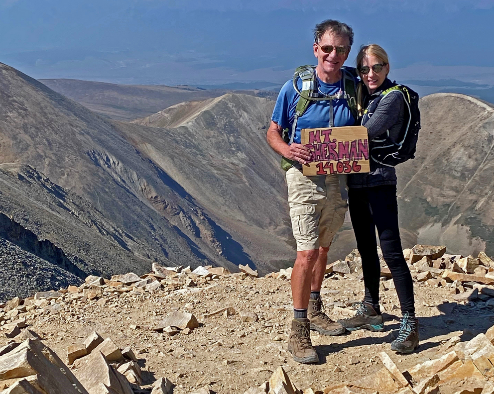
Climbers: Rick Crandall; Rick Peckham; Emme and Alfie Australian Terriers
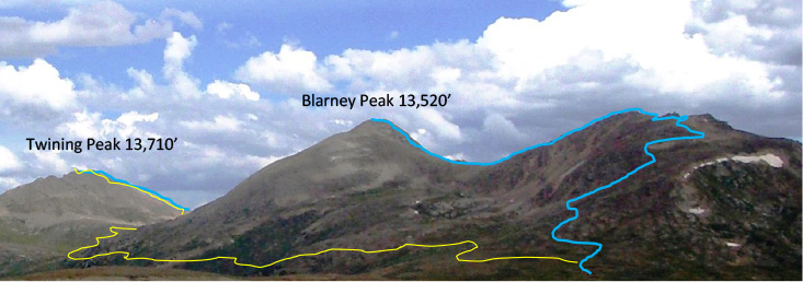
I'm often asked, "What's a mountain excursion near Aspen that's not too difficult?" Most of the high mountains surrounding Aspen are among the most difficult in the state. But from the parking lot on the top of Independence Pass, looking north - there is a high 13er that can be done in less than 5 hours round trip. It's called Twining Peak, although some locals call it "Blue Peak" probably named after Blue Lake which this peak towers over. Twining Peak is a "named" thirteener and a fun hike that should be started early in the day to avoid afternoon thunderstorms. It can be done as a loop as shown: blue being the uphill route and yellow is the descent, although you can also descend on the blue line but you'd need to re-summit Blarney Peak.
The route is not obvious and not well-documented, so I'm documenting it here as an assemblage of photos from two different outings, the earlier one done in a prior year with friend Rick Peckham, and our two Australian Terriers (20 lbs., short legs, love climbing) Alfie and Emme "the fourteener dog" (she's done 17 fourteeners in her climbing career}.
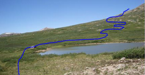
The Start: Drive up Hwy 82 to Independence Pass (elevation: 12,080'), park in the parking lot and cross the road. Start hiking by skirting the pond on its left side and weave uphill around the willows and the wetlands. As you go up, head more steeply to the right.
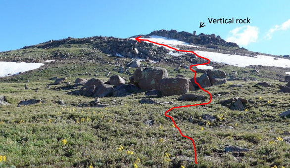
After about 600' of elevation gain, you'll mount a broad approach to a local top. You'll know it by looking east you will see a vertical rectangular rock that almost looks man-made. Aim for it until you are just at the base of the rock pile right under it and then bear left where the strip of snow is shown in the photo. Do not bear left below that point or you'll cliff out.
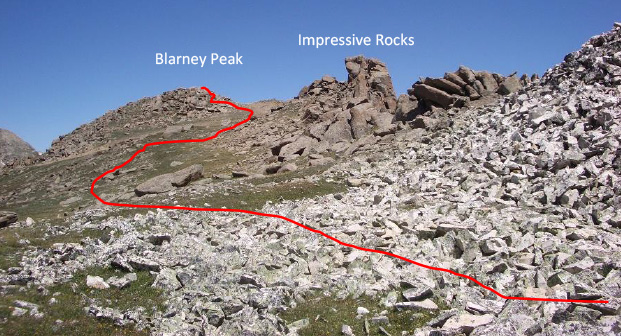
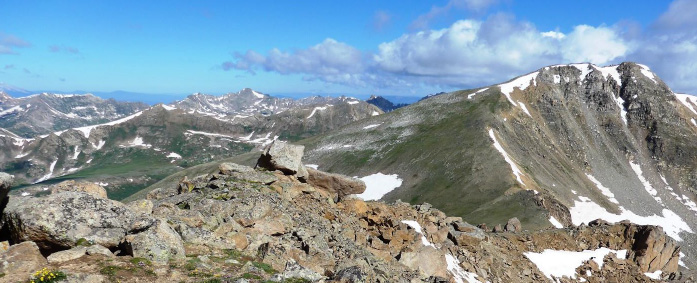
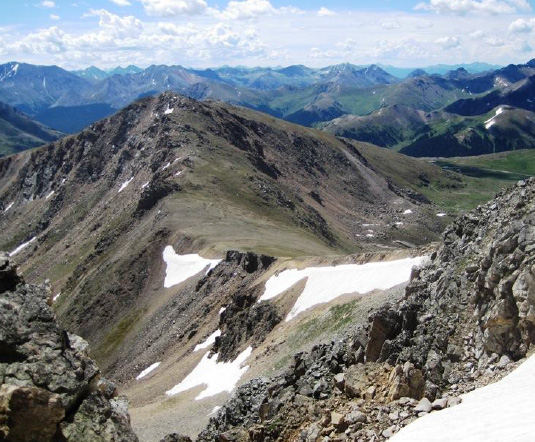
After passing the vertical rock and its rock pile, head up not quite to the ridge and bear off left under the impressive rocks on the ridge. Looking ahead to the north you'll see a peak. That is Blarney Peak at 13,520' which you will need to summit in order to see and access the route down a ridge to a saddle on the other side.
Another view - the rock pile on the right are the "impressive" rocks shown above. To the north you will see the route to Twining Peak (red) past Blarney Peak.
View down to Blue Lake from the rocky approach to the summit of Blarney Peak.
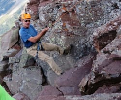
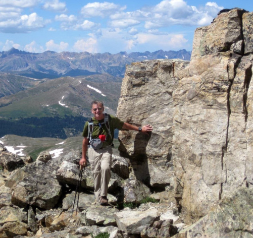
The final pitch to summit of Blarney Peak. Go straight over the summit and the rest of the route will become obvious.
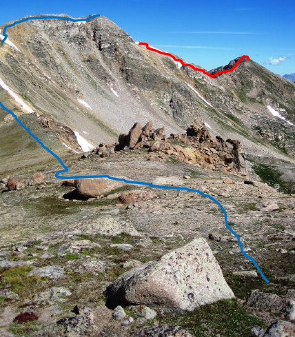
At the summit of Blarney Peak, looking down to the saddle and ridge approach to Twining Peak.
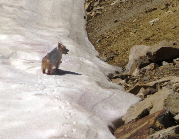
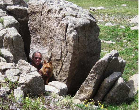
It's time to add in my companions. Here is Alfie the Australian Terrier. On a mountain Australians will always seek either a high rock to climb or snow - anything that's fun.
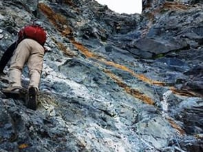
Rick Peckham making the descent to the saddle down from Blarney Peak. It is rocky and a bit loose, but not precarious.
The views are really inspiring - fourteeners all around in the distance, valleys, gullies and rocky meadows - it's a 360 degree panorama.
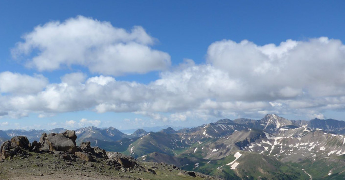
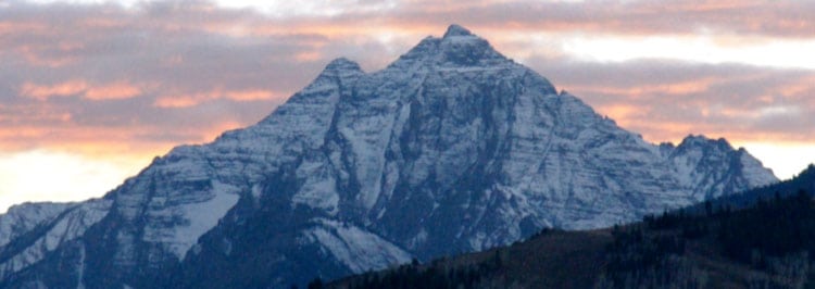
The tallest mountain on the right is Grizzly Peak - the tallest 13er at 13,995'
(see: /grizzly-peak-a-13995-east-ridge/ for climbing Grizzly).
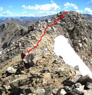
Once at the saddle, head up the ridge to the rocky final approach to the Twining Peak summit.
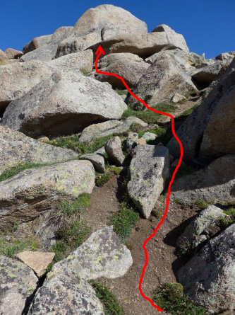
The last 150' to the summit needs a few handholds but I'd still call it just Class 2 Difficult and not Class 3 rock climbing. Still, take care that you're not grabbing on to a loose rock.
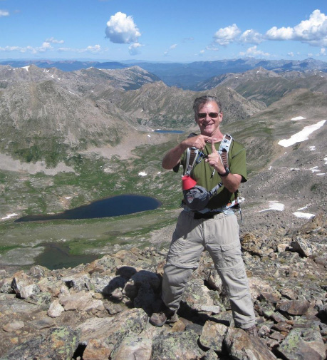
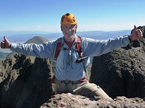
Summit Twining Peak (the "T"), 13,710' and 2 3/4 hours from trailhead.
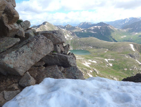
Blue Lake is down at center-left in the picture.
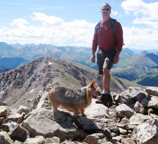
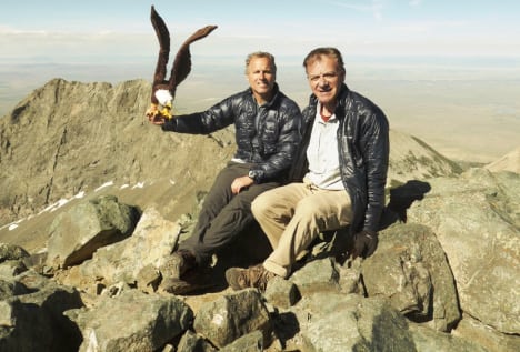
Rick Peckham at summit with Emme.
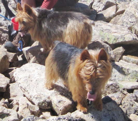
This is a Class 2 hike, (rocky underfoot) but dogs such as these who are accustomed to the terrain can make it up. They seem to know just where to place their paws.
Emme is behind and Alfie is facing front.
Looking back towards the saddle from the Twining Peak summit.
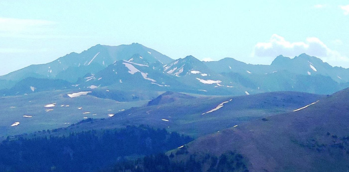
La Plata, a fourteener shown just left of center. (See: /la-plata/)
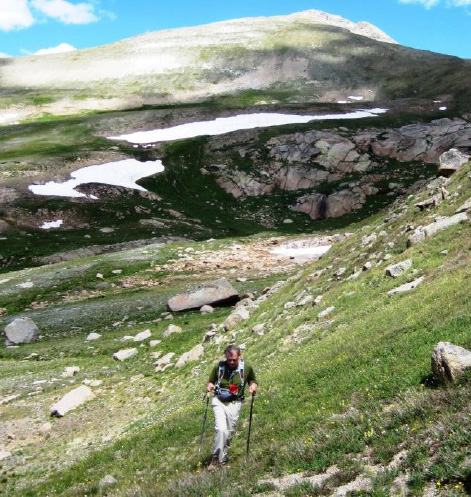
Rick C. heading down from the saddle returning via the lower meadow rather than re-summiting Blarney Peak.
If you return this way, when you're half-way down keep curving to your left (south east) or else you'll hit Hwy 82 a bit down the Aspen side of Independence Pass and you'll need to hike up to the parking lot.
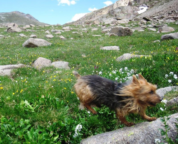
Emme having fun boulder-hopping.
Rick P. and Emme - always clowning around.

Emme left, Alfie right - almost back at trailhead.
Emme's done 12-hour climbs, and here she's still raring to go. Alfie? Not so much. This was five hours, 2200' vertical climbing - good fitness training for me for the tougher mountains to come in August. Here we're almost back to trailhead.