Difficulty: Class 3
Exposure: Some
Summit: 13,995 feet
Elevation Gain: 2,800 feet
Roundtrip: 6.0 miles
Trailhead: McNasser Gulch at 11,360'
Climbers: Rick Crandall, Laura Welch, Scott Schlesinger, Donna and Kimball Slade July 15, 2012
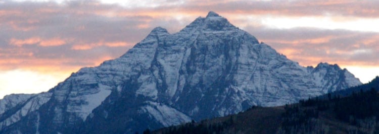
Grizzly Peak in the Sawatch range near Aspen has always intrigued me, I guess because I see it all the time on my favorite hikes on the top of Independence Pass. At one time the Peak's elevation was measured to be over 14,000' and hence a "fourteener" but more recent surveys have dropped it to 13,995'. It ranks #1 out of all 584 thirteeners in Colorado, the tallest thirteener!
You could pile a few stones on the summit (hard work) and get it back, but it is a magnificent mountain as it is. There is very little information on the best way to climb it, and after much research I decided an approach, which turned out in fact to be the best, so I'll provide those comments at the end for anyone who finds this article and wants to summit Grizzly.
In this middle of July we're deep into the monsoon season with rain and electrical storms every day, usually arriving from Arizona at about 12 noon, but that's been unreliable. We decided to go for it anyway. We left Aspen at 5:15am, drove over Independence Pass down to the La Plata trailhead and then off-roaded about 6 miles to a locked gate on an old mining road private property. There we parked and set out on the trail at 7am, a bit later than we wanted, but there you go.
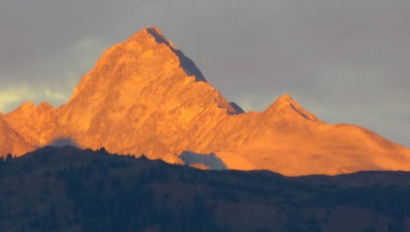
Older photo: Grizzly's familiar face (upper left with snow couloir) photo taken from hikes at the top of Independence Pass.
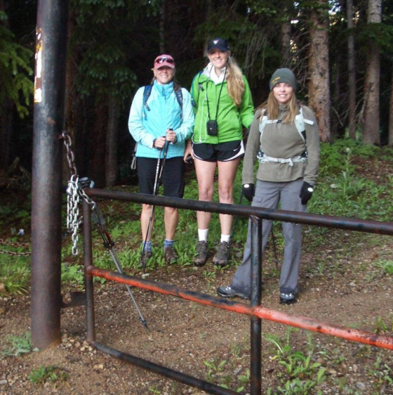
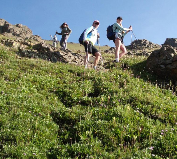
7am start. Donna, Kimball and Laura ready for adventure.
The documented route up Grizzly read like a torture novel. It calls for turning up to the ridge/saddle about a half mile past some old mines but that involved very steep, loose scree for 1200' of vertical. Here's how it's described:
"The ascent to the ridge went through three areas: Steep, Annoying, and Steep/Annoying.
1- Steep: For the first third of the way, we followed the grass and made good time up the steepening terrain.
2- Annoying: After the grass stopped the slope became scree...very loose and tiring.
3- Steep/Annoying: In the attempt to miss some of the lovely scree, we angled back towards the towers to try to find something solid. Turns out, those weren’t solid either. Nothing could be trusted as a hold, and the going was slow."
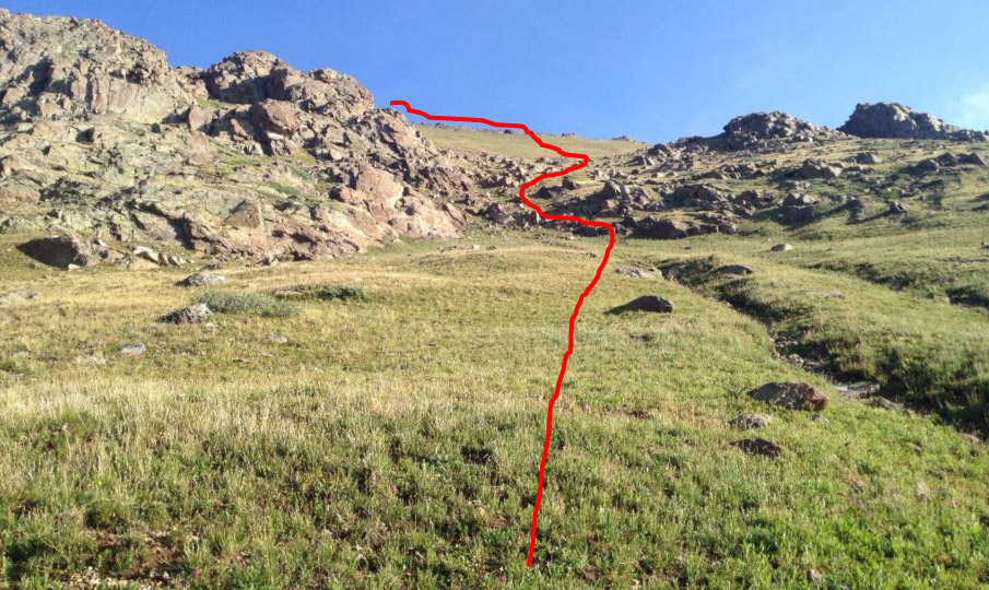
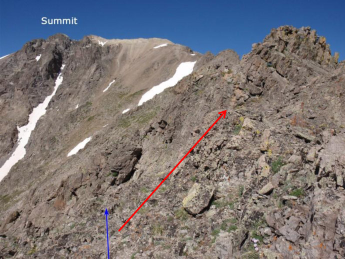
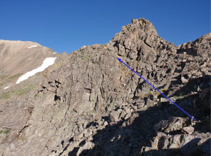
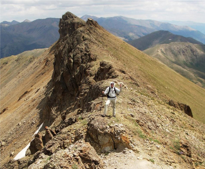
Our Chosen Route
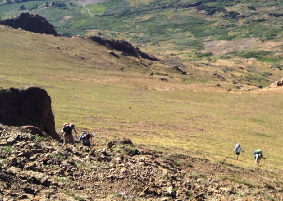
I'd read someone's blog about heading up to the ridge much earlier on a steep but grassy slope with only a few rocky interruptions and hitting the ridge much earlier, but was described as a really nice ridge walk, not gnarly although with plenty of exposure. So that was our Plan and we stuck to it - and we won!
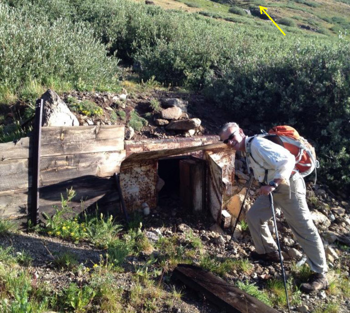
New way: up to the ridge earlier, right after the mine. Imagine climbing into a hole that small!
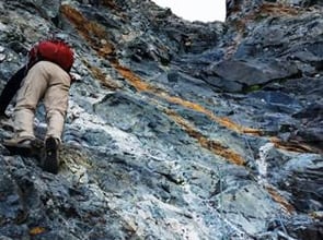
The grassy slope was really steep for 1200'; it had decent footing but was quite a wake-up call early in the morning.
This is even steeper than it looks, and long.
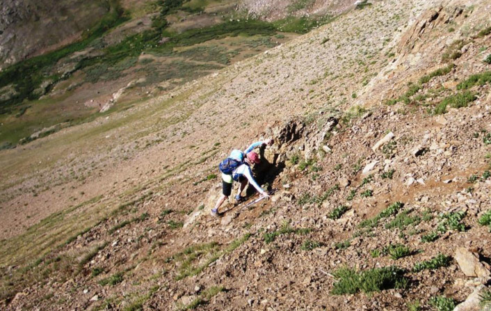
Donna "navigating" some looseness with the help of a rocky outcropping. Slipping here would be painful.
Rick and Laura up on the steep, loose scree
Finally gaining the ridge. Here Donna and Kimball decided to take it slow to the saddle and go no further. This was already quite an accomplishment.
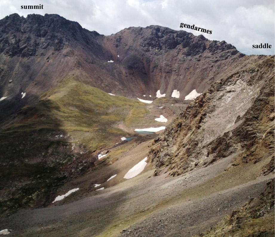
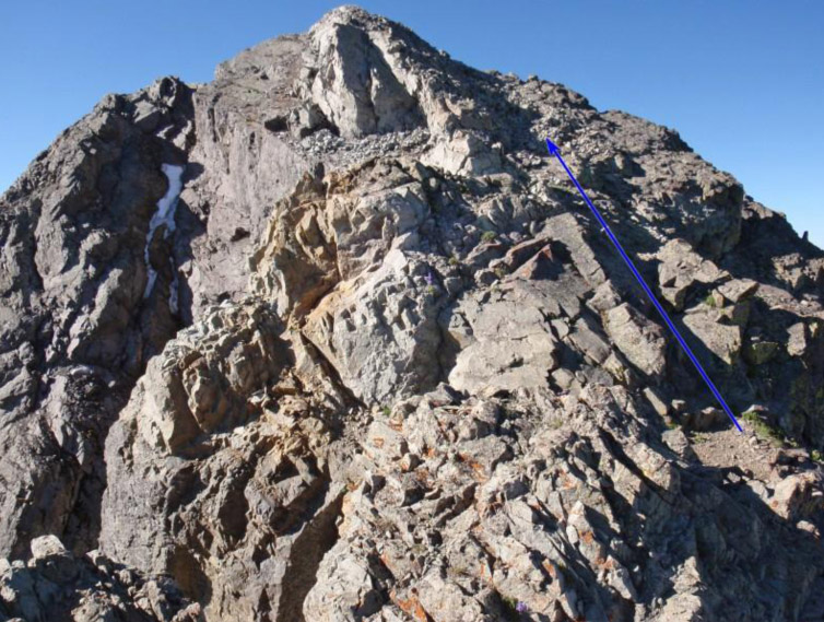
Why go no further? Look below. To gain the summit from the saddle, the ridge was blocked by three "gendarmes," (from the French: "guards) – a climbers' understated word for "you gotta work to get past me!"
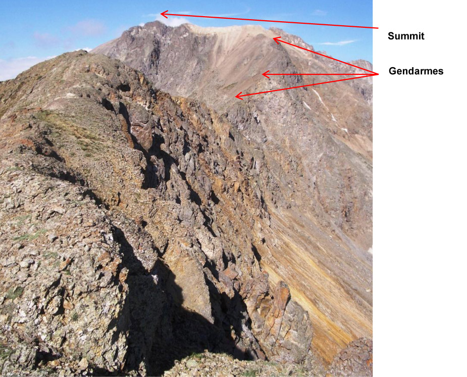
First Gendarme
Second Gendarme
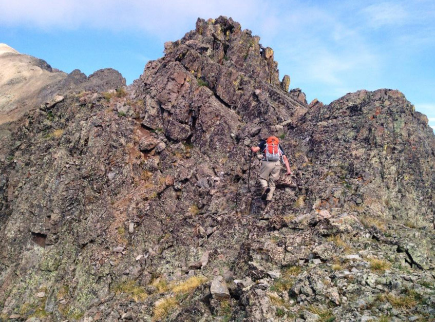
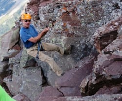
"Ranger Rick" leading up second gendarme

Third Gendarme - this one was more of a beast, skirting it got us onto the steepest, loosest scree of the day.
Looking up at those three from the saddle - well they looked impassable. But I'd done my reading carefully and I encouraged us to get closer and we'd find our way through them. For that, Scott dubbed me "Ranger F-king Rick." But we did find our way past them, at which time Scott shortened my route-finding title to simply "Ranger Rick."
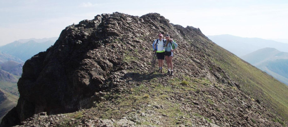
Once past the Gendarmes, the approach to the summit was a fun scramble.
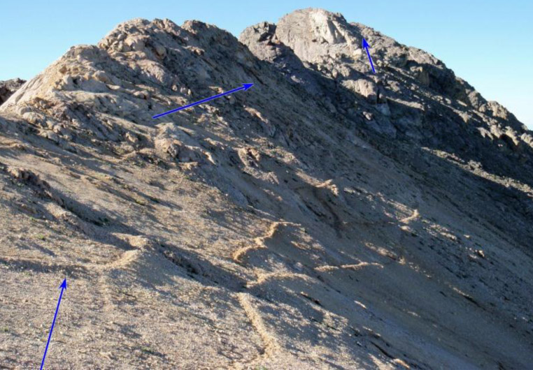
Final approach, first past the sub-summit and then to the real summit, which didn't have a lot of room up there.
Grizzly Peak summit in sight.
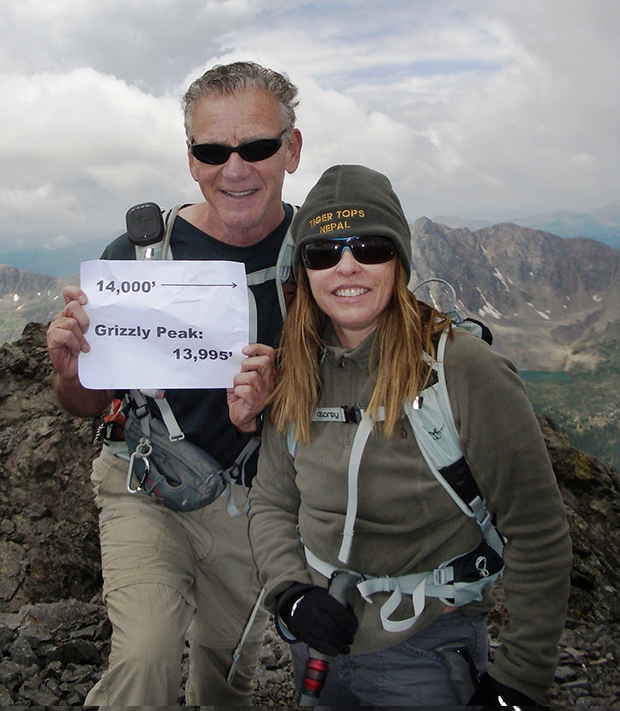
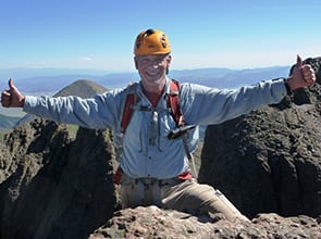
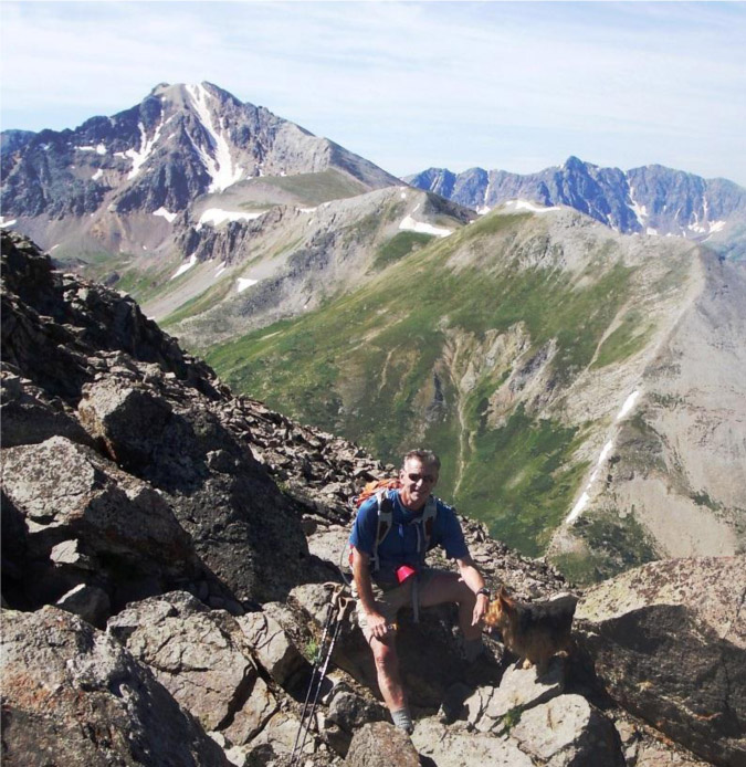
Grizzly Peak summit, 13,995' at 10:45 am, 3 hours 45 minutes from trailhead.
We figured 14,000' was about at Laura's cheeks, er,.. ears.
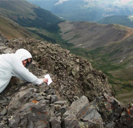
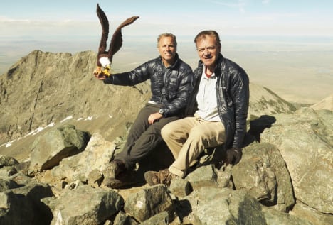
Scott wanted a similar photo, but the paper started flying away
- he almost did too but he got it short of both of them flying off the summit.

Scott self-portrait with Grizzly Lake

Readers of these reports know I am always looking out for weather, and I found some here, so we took photos, skipped eating and surveyed how to get down all the challenges.

First challenge - down-climb from the summit cap to the steep slippery slope into the waiting arms of Gendarme #3.

Didn't look any friendlier from above.

Lots of loose rock, time to be extra careful and not lose concentration.

Final Gendarme - looking outward to the inviting saddle and ridge beyond. Weather still holding, in fact, amazingly, improving!
Scott on the ridge - we decided to re-trace our route in case Donna and Kimball were still there waiting for us.
In fact, they had made it across the ridge to the saddle and got lots of great views - and then chose to down-climb before we got there.
Great shot by Laura:
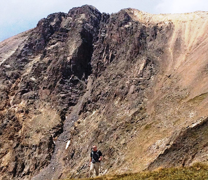
Rick just having come down the "slippery slope" on the right. Grizzly Peak is the higher one on upper left.

Hi five, back at the trailhead at 1:30 pm, a total elapsed time of 6 1/2 hours.

Donna and Kimball - a great experience.
Route Notes for Grizzly Peak "A"
I would make the route we did the "standard" route up Grizzly Peak.
- Use the trailhead 6 miles in from La Plata trailhead parking lot
- Hike to the mines and immediately after them, look up - see a grassy slope with a few zig-zags up to the ridge a good half mile away from the saddle.
Turn up at waypoint Lat: 39.04121, Long: -106.58011 - Hike the top of the ridge - great Class 1-2 walk, beautiful with some exposure.
- Hike down to the saddle where you join the current "standard" way up to the summit.
- On return, stay high all the way to the saddle - while other reports talk of descending right from the saddle, if you don't pick just the right way down you encounter cliffs and have to up-climb (as you can see we had to do, but we got our 3000' vertical!) - I suggest you just walk back on the ridge to where you came up and then descend the grassy slope - what's the rush and the ridge is great.
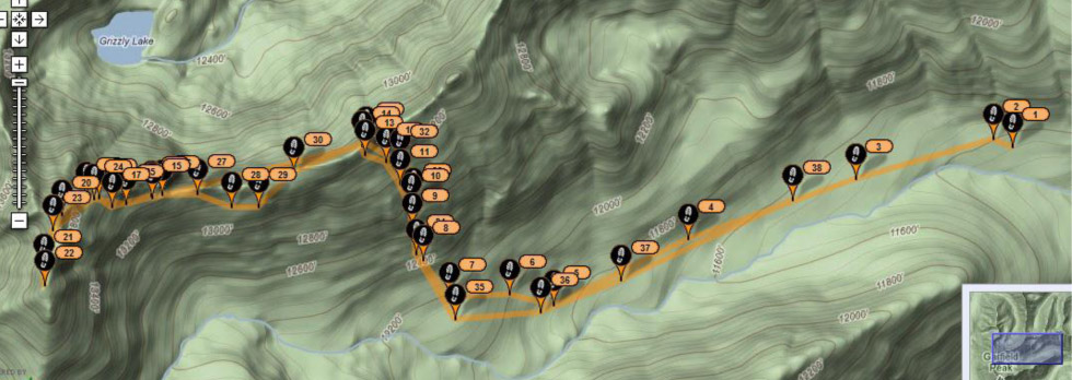
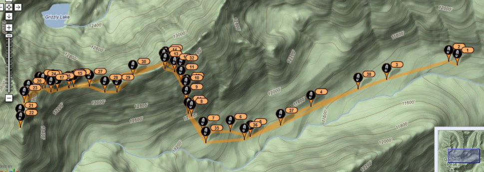
Here is the whole climb from right (trailhead) to left (summit) with new route for up-climb to the ridge shown below.