
Difficulty: Class 3 & 4
Exposure: summit approach
Summit: 14,092 feet
Trailhead Elev.: 14,092 feet
Elevation Gain:
5,800' from TH
3,200 from Snowmass Lake
Roundtrip:
5 miles from Snowmass Lake
22 miles from TH
Trailhead: Snowmass Lake TH at 8900'
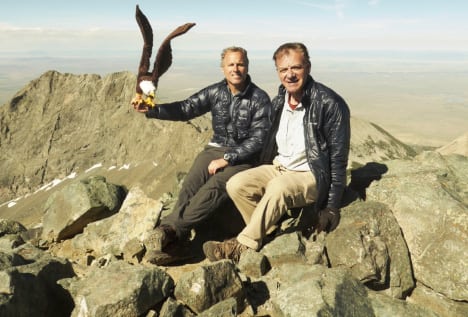
Climbers: Brett Crandall; Rick Crandall; Rick Peckham August 11, 2014
Young and experienced climbers love to extol the virtues of Snowmass Mountain, the most remotely-accessed fourteener and a member of the Elk Range near Aspen. Gerry Roach, author of Colorado’s Fourteeners says: “This is one of the truly classic places in Colorado" and "One of the most rugged of Colorado's famous fourteeners."
Well, I'm not a member of the Snowmass Mountain fan club mostly because it's such a grind. In my view, unless one were going for all the 14ers, I'd leave this one off the list. You'll see my reasons in this story of our three attempts, the third and current one finally reaching the summit.
The "challenge factor" is rated "moderately high" with exposure along the summit ridge with Class 3 and Class 4 rock climbing from ridge to summit. Climbers have died on this mountain, mainly due to loose rock fall on the approach to the very jagged and loose approach ridge. Route-finding is quite difficult compounded by the fact that according to Aspen Mountain Rescue this mountain is actually a "rock glacier" meaning sharp boulders and scree sitting atop a snow glacier underneath - constantly melting and freezing which moves around the massive quantity of rocks and boulders.
Historically, in 1873, Dr. Ferdinand Hayden, working for the Department of the Interior, surveyed the Colorado mountains resulting in his U.S. Geological and Geographical Survey of the Territories. Hayden focused on the Elk Range which he described as "a region in which the rocks have been thrown into a greater state of chaos than we have ever observed anywhere in the West." They summited only two of the peaks in the Elk Range - of Snowmass he commented:
"The slopes consist of masses of immense granite fragments, the rock-bed from which they came appearing only occasionally. When we reach the crest, we find it also broken and cleft in masses and pillars.
The industrious man with a crow-bar could, by a week's industrious exertion, reduce the height of the mountain one or two hundred feet it's so loose. Some of the members of the expedition amuse themselves by the experiment, toppling over great fragments, which thunder down the slopes ..."
From Roof of the Rockies by William Bueler.
In other descriptions: "The Elk Range has a reputation for loose and crumbling rock. Like most mountain ranges, some peaks are more dangerous than others; good route-finding skills are of paramount importance. Furthermore, these peaks require top physical conditioning and good climbing skills. In the Elks, the use of a rope can be more of a hindrance than a tool for safety. The potential for rock-fall is always nearby."
First Attempt | July 17, 2009
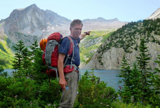
Climbers: Rick Crandall; Brett Crandall; Wayne Crandall; Laura Welch
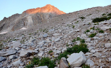
Snowmass Mountain gets its name from the bowls on both East and West sides that lead towards a jagged ridge on each side of the summit. The bowls keep their snow at least a month longer than other mountains giving distant views of this mountain its white appearance. On July 17, 2009 four of us decided to go for this mountain, with my son Brett Crandall being the only one of us with substantial mountain climbing experience in snow or any other conditions. It would be Wayne's first attempt at a high mountain.

Left to Right: Brother Wayne Crandall, me and Laura Welch
At that time I'd had little experience with backpacking long and vertical routes. Snowmass is the most remote of all 14ers sporting an 8.5 mile hike up 2500' vertical rise from trailhead just to get to Snowmass Lake where most climbers camp for an early next-morning bid for the summit.
I was not yet focused on how to minimize pack weight (or my own weight!) and so with 36 lbs. in the pack and 25 lbs. more than I've weighed in subsequent years of climbing, I was not to make it all the way to the Lake!
Son Brett Crandall flanked by me and Laura.
At approximately 4.5 miles up I'm no longer embarrassed to say I had to turn back while the others went on. For me that was it for "First Attempt." Brett went with the others. He is a Class 5 technical climber, young and strong.
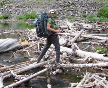
One of the features of the hike to the Lake is a river crossing at about mile 6.5. There is a huge beaver dam and log jam offering an alternative to boots-off wading through the very cold river.
Brett "dancing" across the logjam with a heavy 40+ lb. pack.
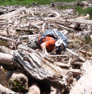
Brother Wayne, with a nearly 40 lb. pack, didn't quite make it across without a comical fall.
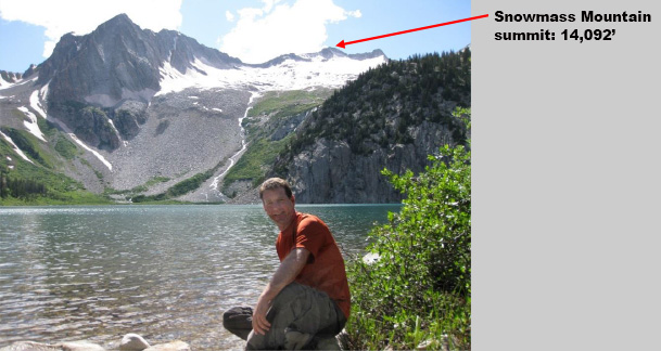
Wayne at Snowmass Lake with Hagerman Peak, a named 13er shown prominently on the left and Snowmass Mountain is in the distance above the "snowmass" bowl.
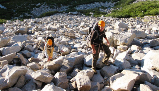
Wayne and Laura with an enthusiastic start on the first boulder-field leading up from the Lake. These have moderate steepness and most are loose and move as you walk over them.
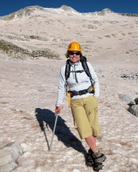
At about 12,000' the pitch eases and they were in the early part of the snowy bowl. Where Laura is it looks easy. She's got her crampons on and ice ax at the ready.
At about 12,400' with Snowmass summit in sight and seemingly in reach, the snow got too steep for Wayne and Laura. Brett parked them on a protruding rock where they watched his acrobatics toward the ridge and summit.
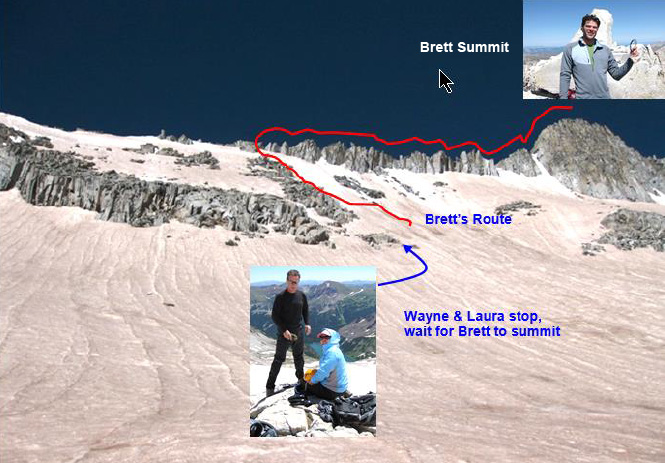
Here's the whole scene - Brett hadn't paid much attention to the instructions I'd printed beforehand, and instead of finding a Class 3 route on the West side of that impressive ridge, he climbed the ridge itself with some sketchy moves as Wayne and Laura provided the audience.
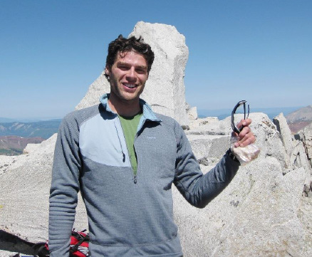
Brett at the summit of Snowmass Mountain, July 17, 2009
My Second Attempt | August 13, 2013
Climbers: Rick Crandall, Rick Peckham
Well my not being able to even get to Snowmass Lake stuck in my craw. So I dropped my weight from 199 lbs to 175 lbs (and have kept it there. Diet? No suger, no sugar-laden processed foods and no "white" foods such as bread, pastas, pizzas etc., that's it) and a self-administered more strenous physical spring prep to each subsequent summer climbing season did the trick. On August 13, 2013, Rick Peckham and I gave Snowmass Mountain a go once again.

Rick Peckham on the trail towards Snowmass Lake.

Some of the wildflower beauty along the way.
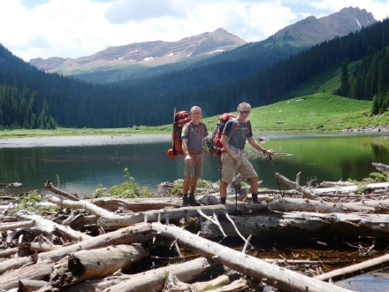
Rick making it to the Lake, 8.5 miles and 2500' up from trailhead with a full backpack!
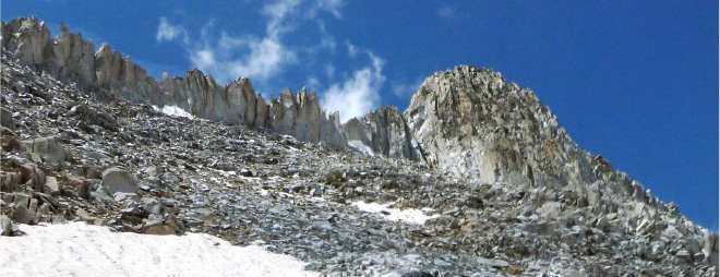
The next morning we began our assault. This time there was little snow, which actually makes the climb more strenuous over endless and steepening boulders. Absent of the snow, at least half of what you see are loose and move as you attempt to climb up.
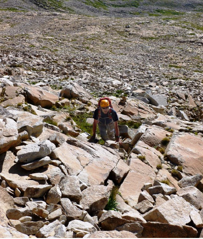
Rick C. making it up towards 13,000'

At about 13000' I turned around and did not like the weather pattern I was seeing unfold. As reported in a number of other stories - the one thing that scares me on these mountains is the possibility of being caught up high in challenging climbing conditions in an impending electrical storm. There are too many instances of death by lightning and there's no getting off these summit approaches in a hurry, 2500' above tree-line. So we made the decision, despite the effort to get to that point, to turn around.
We got back to campsite at the Lake, packed up and started the 8.5 mile trek back to the car with multiple waves of lightning and thunder overhead. All the way back we imagined what it would have been like even higher up on that mountain, totally exposed to lightning - a nightmare. So ended the second attempt, unsuccessful but safe.
Third Time is the Charm! | August 11, 2014
Climbers: Rick Crandall, Brett Crandall, Rick Peckham
In recent years I've become a self-taught weatherman. I read the NOAA detailed reports for Colorado, occasionally visiting its glossary of over 1000 words and abbreviations, and making adjustments for the way the weather bounces around our State's tall mountains.
Once again I invited friend Rick Peckham down from Alaska for a month (a competent and fit outdoorsman with whom I've done many 14er climbs). Snowmass Mountain was on our list to conquer.
Also, I have a standing request for my son Brett to visit for a few days at least once/summer to help me with a more challenging mountain. In this summer of 2014 his timing was a bit tight due to major prep he was doing to compete in the Whistler, Canada full Ironman competition. That day was July 27th and I don't mind saying that out of 1900 contestants including 20 professionals, he came in an astounding 29th overall in just under 10 hours and 1 minute!
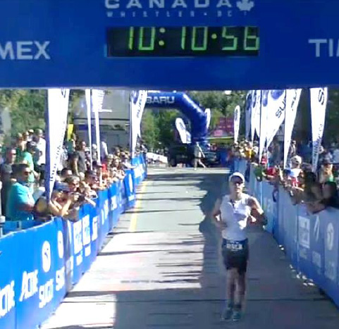
Brett finishing July 27th Whistler Ironman in 10 hours, 56 seconds (amateurs start 10 minutes after the professionals, hence the clock time difference).
The Ironman Triathlon is a 2.4 mile swim followed by a 112 mile bicycle ride and finishing with a 26.2 mile marathon run
In less than a week he'd recovered and traveled to Aspen to help me with a climb. It looked like the best weather in the State was right here in the Elk Mountains, so we decided to go for Snowmass Mountain and here's where the real summit story begins.
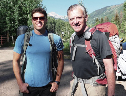
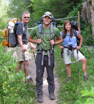
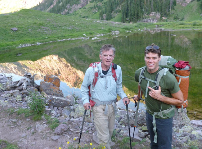
Brett and Rick once again at the Snowmass Mountain trailhead ready to start the 8.5 mile backpack to the Lake.
6.5 miles into the hike,
Rick P. and Rick C. crossing the logjam on a perfect weather day.
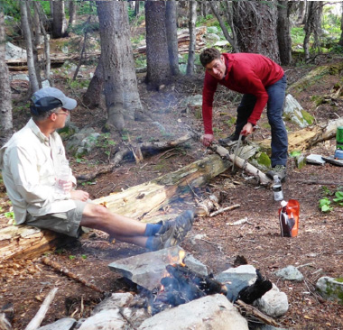
We love a campsite where you can make a real fire - here Brett is cutting logs with our portable handsaw.
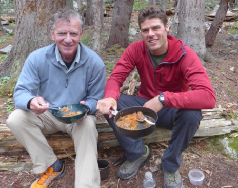
Brett and Rick P. split the extra weight in our packs - caused by two different wines and a delicious dinner prepared for us and frozen by Laura Welch, our frequent climbing companion. Usually we eat Mountain House dehydrated foods but this was expertly prepared Ossobucco followed by homemade apple pie - a total of 6 precious pounds but well worth it - especially with me not carrying it J
The Climb
We were up at 4 am and on the trail by 4:45 am. We knew from prior attempts that the first part of the day was going to be a path along the entire length of the Lake very overgrown with willows that reach out and snag you and your pack all along the way for quite a distance. Furthermore, we were in the dark pre-dawn and we knew there is a somewhat disguised important left turn in the bushes (easy to get lost due to intersecting local trails around the Lake). So the prior evening before sunset, Rick P. and Brett walked that part of the route and tied orange construction ribbon at the key turn so we could see it in the dark with our headlights. It worked great - we found the turn and proceeded through the Willows in the dark.
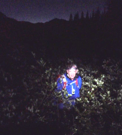
Rick C. pushing through the Willows.
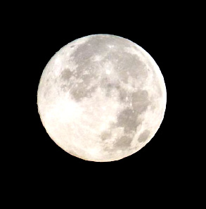
We had some help from the August "supermoon" which is called that because on this night the moon is closest (by 31,000 miles) to the Earth in its orbit. We got a perfect shot - this is when the moon is 30 percent brighter and 14 % larger than when it's the smallest of the year (January 16).
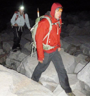
We reached the first boulder field still in pre-dawn. The sky was clear, the moon was out and we were optimistic. This is Brett leading.
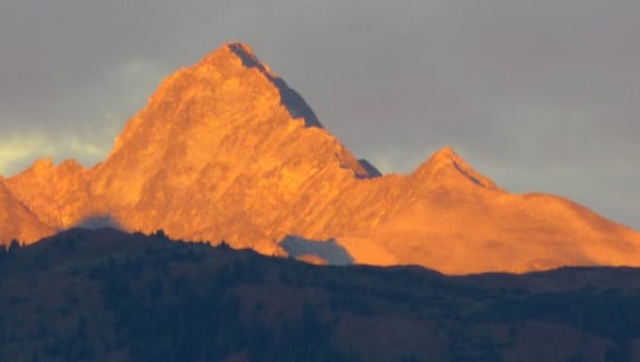
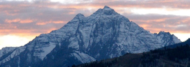
As dawn approached we caught the first "alpenglow" on nearby Hagerman Peak, a named 13er at 13, 841'
This boulder field is easier going up, but a slippery mess coming down later in the day.

This is the East-facing approach, so fairly early in the day we got the welcomed sun and warmth. Here
Rick C. is pointing to the Snowmass summit which has come into view but despite our having ascended to the bottom of the "bowl" - it's still far away.
Approaching 13,000' that is the Snowmass summit on the right. Don't be fooled - it looks like it's a walk to get there - no, no no!
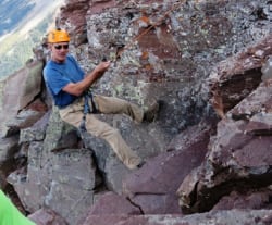
The standard "route" if you can call anything standard on this mountain is to deal with that very jagged ridge to the left (North) of the summit by traversing 1/4 mile to the left under that ridge and finding a way to get over it and to the other side. Once you do you start to see cairns marking a mixture of Class 3 and 4 moves to get back to ascending the summit on the West side.
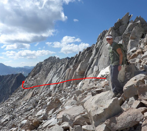
Brett leading around the ridge while Rick P. had already disappeared over it to spot where I'd be able to get up it. Having two "spotters" scampering about was my great fortune.
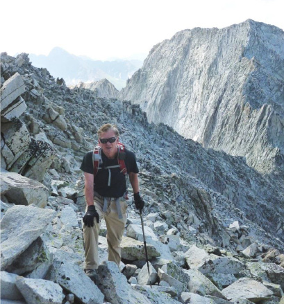
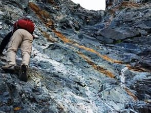
Here I'm following on loose, large and steep boulders - resting often.
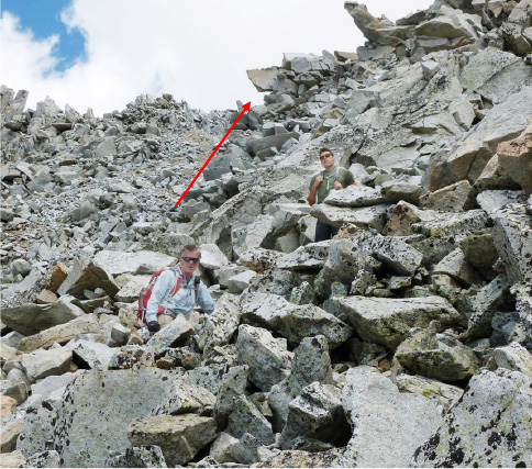
Following Brett up to the ridge crest which we finally attained to the left of that camel-head looking rock. Rick P. wanted to get on top of that for a photo op and I yelled "it's all loose, if you go up there I refuse to take the picture." This time it worked and we passed it by.
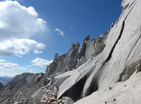
Inviting, huh?
It was about here that I had my first doubt as to whether I could actually get to summit. Weather was perfect, but almost everything I touched moved and these rocks were sharp!
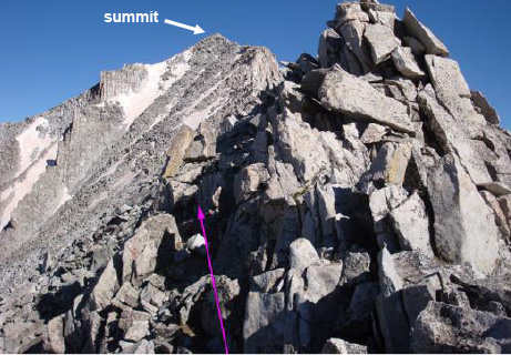
Finally we got to the top of the ridge crest and got our first look at the real approach to the summit. There was still a long way to go!
That was the second time I wondered if I could do it. We were at 13,700' with lots of exertion.
Rick P. and I got a bit head-achy. It was Tylenol time.
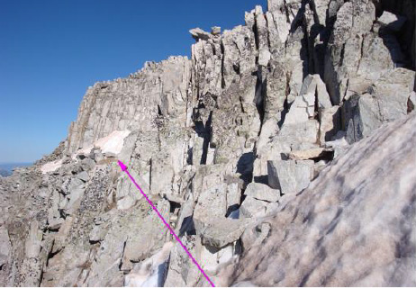
Here's the problem with the "macho" route notes you find on the Web. The advice I could find at this point (which I always print and have with me on climbs) is: "locate an easier passage over the rib that may have a cairn ..."
Easier than what? Do you see an easy passage? Cairns anyone? Actually there were cairns - too many of them leading all over the place. But I had arrows in my quiver - namely Brett and Rick P.

Here the instructions are: "scramble left to the final pitch and pick your line."
Climbers love to use the word "scramble" - piece of cake, right? At this point I stuck close to Brett like glue - I was fascinated by his moves - he didn't seem to need my notes - rather he led up in the way the mountain "spoke" to him.
I couldn't hear anything.
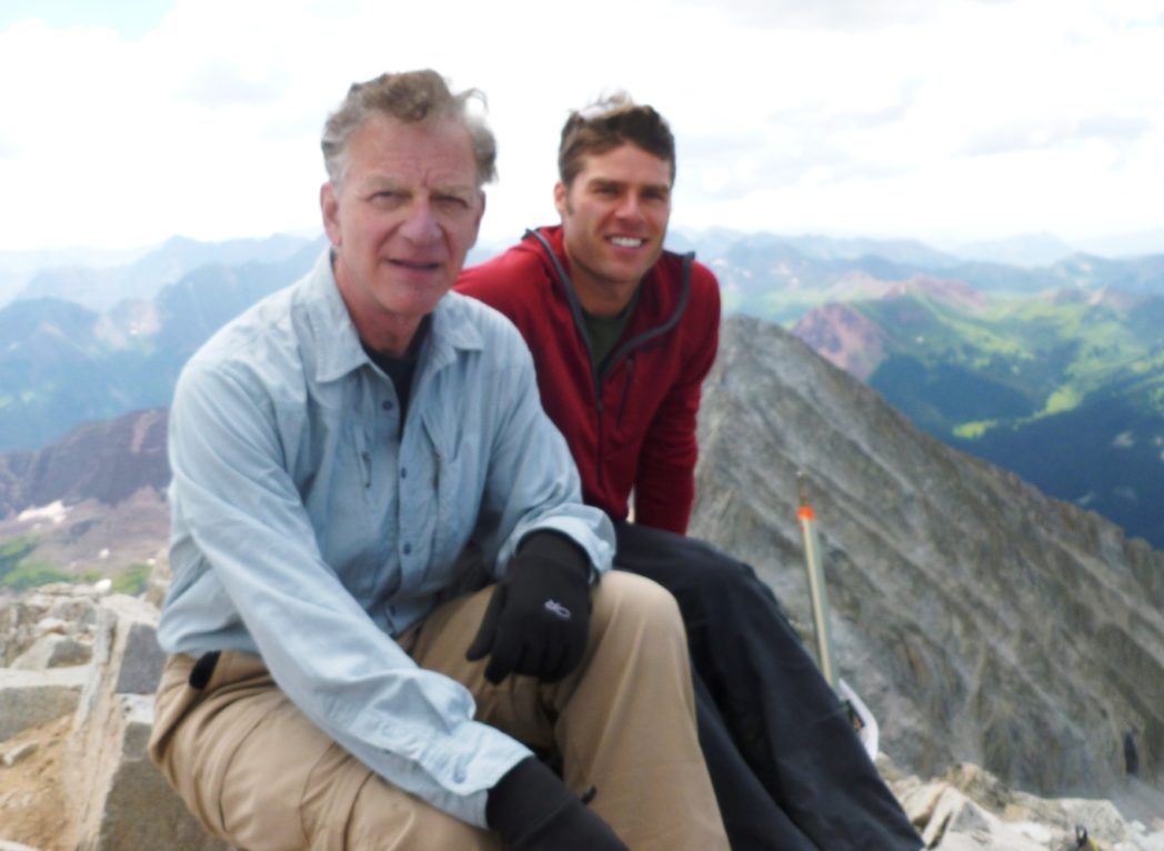
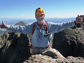
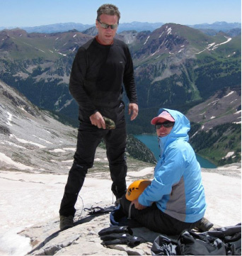
Oh yes! Summit Snowmass Mountain, 14, 092' at 11:15 am, 6 1/2 hours from camp. This was a big one for me - third attempt and a hard mountain. But I wasn't totally rejoicing yet - going down was definitely going to be tougher. Snowmass Lake is down to the left and the ridge we'd crested is down to the right.
I Bluetoothed my Spot emergency GPS to my iPhone and sent this message from summit.

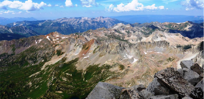
The views and colors from summit were breathtaking. Especially on such a great weather day - the first without daily storms for most of the summer so far.
We didn't stop for lunch on the summit. After about 10 minutes I was antsy to at least get down the summit cap, across and over that ridge and down to the snowfields. The first few moves off the summit were something I didn't know how to do on my own. However, Brett was never more than a foot away and started giving me lessons on "getting small" to reach down for hand grips near your feet so you can then move feet down to the next lower foothold. I began to see how more advanced climbers can get their body away from the mountain to spot the next footholds. It was all second nature to him - he was beside me, below me or wherever he needed to be to give me instructions - and Rick P. was scampering about like a mountain goat.
I know one thing for sure - if you take it all in, the mountain can look insurmountable. But, as I often advise in business - if you break the problem down into pieces and tactically just focus on the next move - step by step you progress. Before I knew it we were traversing the ridge on the West side. We re-located where to cross over and very carefully began descending our East side - rocks moving all over, some starting to slide eliciting shouts of "ROCK" from one of us so the others could get out of the way.
Working our way down - mostly facing the mountain moving one hand or one foot down at a time - with all four on different rocks in case one starts moving.
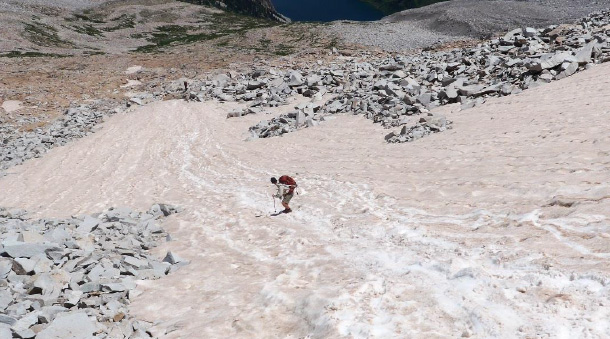
Eventually we worked our way to the top of the first snowfield - imagine a huge snowfield in the middle of August. Brett and Rick P. kind of skated down - tough to maintain balance while jerking around inelegantly (my description).
As for me? I'll do a glissade any day !!
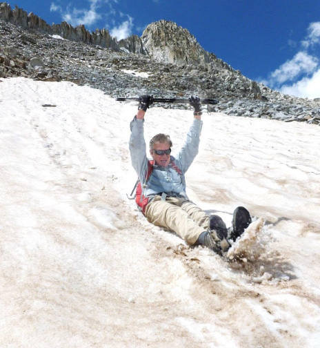
What a great shot - a fun glissade with the Snowmass summit in the background. NOW I'm having fun - at least for a little while - we still had lots of boulder fields with no snow to navigate below.
Well it was 5 1/2 hours from summit back to camp - with some stops to filter more water from melting snow, eating PB & J sandwiches and powerbars to replenish calories and protein. We'd had a big and successful day.
We'd taken enough food and wine for a second night at camp but despite the lateness of the day (5 pm back at camp) we decided to hike all the way back to the car to shower and sleep at home. The deal was if Brett and Rick took my campsite stuff I'd go for it with reduced pack weight.
They hung all kinds of my stuff on the outside of their pack - looked like a hobo Christmas tree.
By 6 pm we left camp and started the forced march out. On the way out (as well as on the way in) we met lots of people who were lost due to confusing trails, some created by animals and some were just recreational trails made by those who come to the Lake for just camping. All were unmarked.
Rick C. and Brett on the way out. He's still looking chipper but you can tell I was in zombie-march mode.
We got to the car at trailhead at 11:30 pm, the last 3 hours we hiked in the near dark with full moon overhead and our headlights back on.
Starting at 4:45 am made this a record 18 3/4 hour day.
By midnight we were home and in showers - sweet!

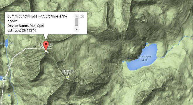
This is the SPOT GPS track from campsite, through the willows along the Lake, up the several boulder fields to the ridge crest and south to the summit on the West side.