
Difficulty: Class 3
Exposure: at false summit
Summit: 14,042 feet
Elevation Gain:
4,800 feet from TH
2060' from S. Zapata Lake camp
Roundtrip:
12.7 miles from TH
3 miles from camp
Trailhead:
Zapata Falls at 9,060 feet
Climbers: Rick Crandall; Rick Peckham; Clif Slade; Mike Ives August 24, 2014
Ellingwood Point is a fourteener named for Albert R. Ellingwood, born in Iowa in 1888 and a pioneering member of the Colorado Mountain Club. He was among the first to climb all of Colorado’s 14ers including numerous first ascents such as Kit Carson Peak, Crestone Needle, and Crestone Peak, the last of Colorado’s 14ers to be climbed (in July 1916).
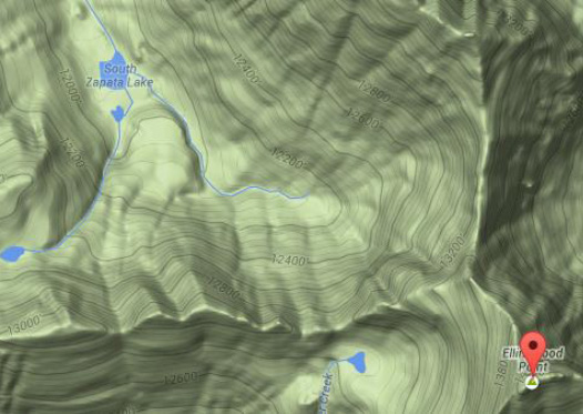
The "standard" way to climb Ellingwood is from Lake Como that is four miles up the dreaded Lake Como road (see the beginning of /little-bear-peak-in-a-snowstorm-and-a-real-bear/ ) on which macho guys in their tricked out off-road vehicles make a mess of things. I'd learned of an alternate route, much less traveled (and now I know why) that is promoted as a much better way to enjoy the climb. It begins at the Zapata Falls trailhead with a 4.7 mile and 2740' uphill backpack to South Zapata Lake for a next morning climb. Here's my assessment: UNLESS YOU ARE YOUNG, FIT AND AN EXPERIENCED CLASS 3 ROCK CLIMBER DON'T USE THIS ROUTE! Bear with the Lake Como approach. You'll see why in this report.
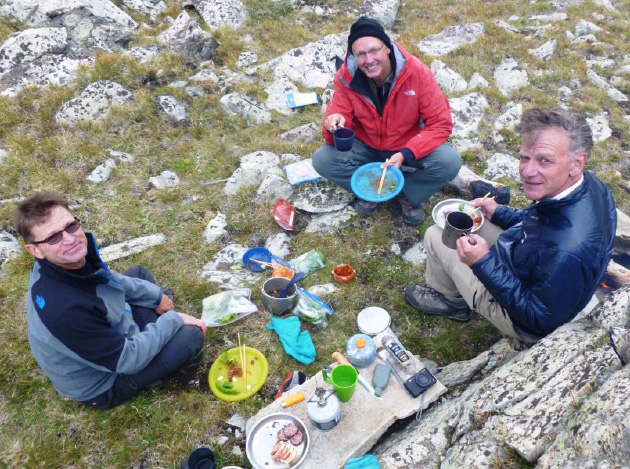
We were joined in this adventure by Clif Slade and Mike Ives who have been following these reports and working their way up the 14er list. They're now at about 35.
Clif is Chief of Opthalmology, an active duty Army Colonel (27 years of service) at Fort Carson CO, and an Iraq War veteran, Baghdad 2004, at the 28th Combat Support Hospital.
Mike is Manager at the Fort Carson Eye Clinic and Refractive Surgery; he is Retired Army Sergeant First Class, 21 years as an army combat medic; Desert Storm vet 1990-1991, 101st Airborne Division.
You know Rick Peckham from many of these reports, retired Air Force Pararescue specialist, Anchorage Alaska.
Clif and Mike drove to trailhead in the Sangre de Cristo Range from Colorado Springs where we met up with them after our drive from Aspen. The monsoonal weather we get seasonally in Colorado has been wreaking havoc with climbing due to electrical storms, but I saw a likely one-day window and so we went for it.
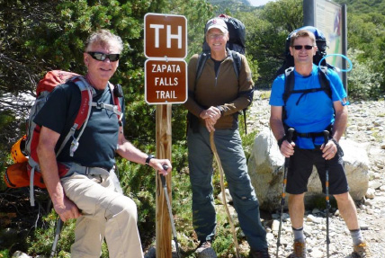
Rick C. Clif Slade and Mike ives at the trailhead start.
One of the features of this approach is a viewing of the hidden Zapata Falls which takes several stream crossings into a tight, small canyon near trailhead to see. It's worth the diversion!
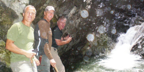
Rick P., Clif and Rick C. working their way in as close as they could get to the Zapata Falls.

I got a great shot of the Falls with sun streaming in from the top ... but
It was Rick P. who got an incredibly artistic shot:

We hoisted our backpacks and headed up the trail to South Zapata Lake.
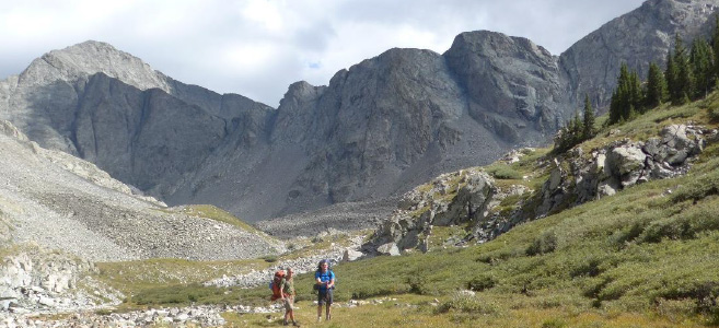
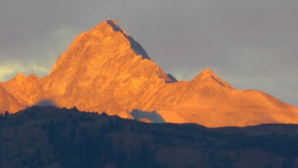
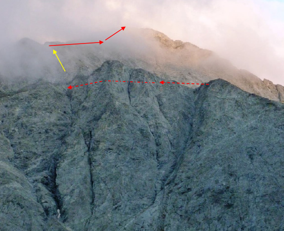
After just over 4 hours we passed through tree line and got our first view of what we thought was Ellingwood on the left above, but it turned out the real summit was behind. We ran into three different groups heading down the trail with the very disappointing news that they'd gone part way up and ran into ice from days of rain and freezing temps all over the upper boulder fields and ridges, impossible to climb. I'd seen signs of clearing in the advance weather reports so we were still going to give it a try the next morning.
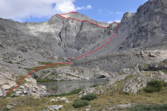
The sun did come out for a few hours (which we took as good news) and in the distance we could see what the next morning would have in store: Hike around the lake across a lower boulder-field, up a long, very loose and steep gully called C2, then across Ellingwood's West Ridge and then up its North Ridge. All had challenges we didn't expect from the research.
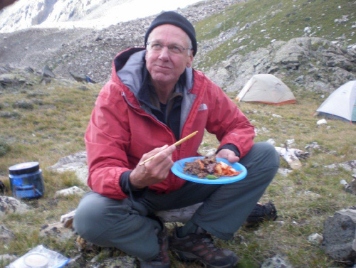
At campsite the winds were indeed howling and cold but we found a partially protected area to set camp. Rick P. did his usual magic, lugging stones to create a fire ring plus a flat rock for a table for the glorious dinner prepared by Clif's wife Chogson.
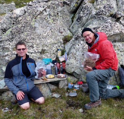
Appetizers:
Rosemary crackers, provolone-wrapped chorizo, peppered salami
Main: (all Korean)
Bulgogi
Kimchi, Black rice, garlic bulbs
Anaheim peppers & Kochujang (the red sauce)
Sesame and red lettuce leaves
Dessert: apple pie (Laura Welch)
Wine: Cabernet Sauvignon
Pinot Noir, Shiraz (Rick C.)
Oh yeah, we were camping alright!
Chopsticks for all no less!
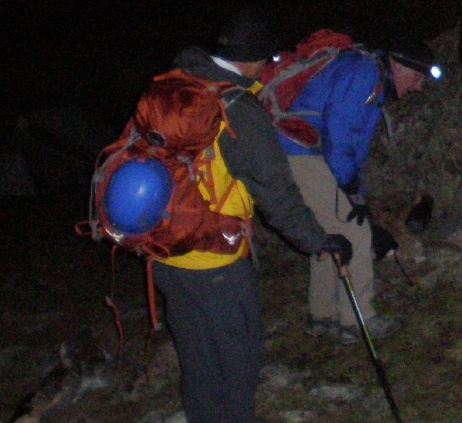
We were tucked in our tents at 9 pm and up at 5 am for a 5:50 am start in the dark.
It was cold, really cold - below freezing for sure. We had all our layers on and started by hiking around the lake and on rocks towards the base of the C2 Gully.
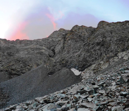
Early morning clouds with first rays of sun in freezing cold at around 12,300'. Nasty!

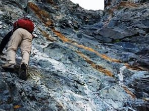
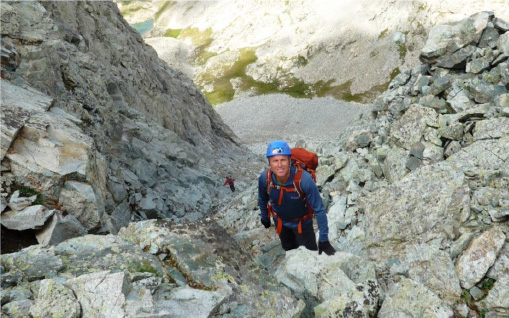
Rick P. (blue helmet) and Rick C. heading up the lower part of the C2 Gully. Just about every rock you see is loose!

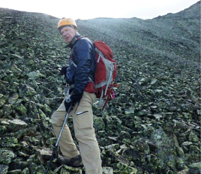
Clif with his natural branch walking pole that has been with him for his over 30 fourteeners.
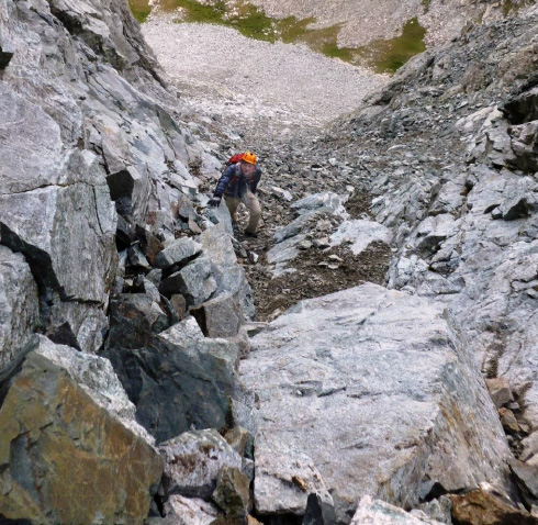
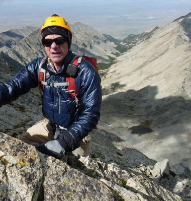
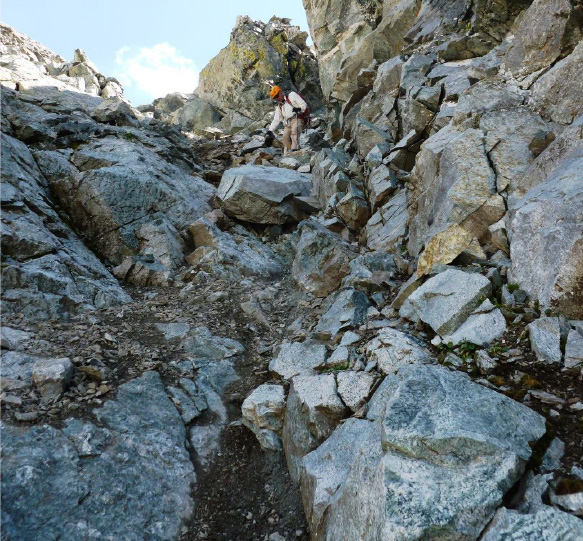
Rick C. hanging on to an occasionally solid wall on his right. What's going through my mind at this point is "and we have to come down this later - no fun at all."
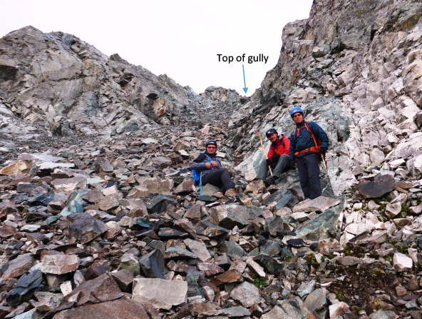
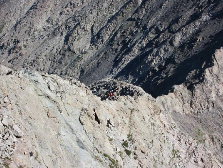
Looking up at Mike, Clif and Rick P. - there's lot's to go just to top the C2 Gully.

Rick P. at the top of the gully.
Next up is hiking and climbing the West Ridge (in front, but we're on the other side).
After the West Ridge, Rick C. is pushing up (yellow arrow in previous picture) all loose rock to the North Ridge.
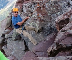
This is what Ellingwood's North Ridge looks like. It's exposed and mostly Class 3 rock climbing (hands and feet).
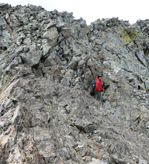
And here's Clif climbing along and up the ridge.
Note there is still no sun. We could see the sun trying to poke through the clouds but as Rick P. said:
"it's like an Alaska sun in the winter - you see the sun but there is no warming."
Despite occasional appearance of the sun, my fingers (in double gloves) had gone numb and it was getting hard to feel for the handholds.
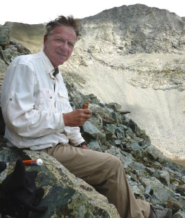
Rick P. figured that if we were going to have a chance to summit, we were going to have to take a break and find a way to warm up. Somehow, maybe 300' below summit, on the quite vertical backside of the approach to summit, he found a ledge on the East side exposed to the morning sun (about 10:15 am). I got out on it and rubbed my fingers back into feeling.
I was definitely having doubts as to whether I could get to summit, we still had a bunch of rock climbing and false summits to go. But with sensation back in my hands I was willing to give it a shot.
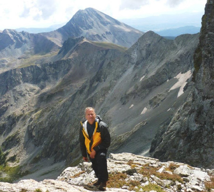
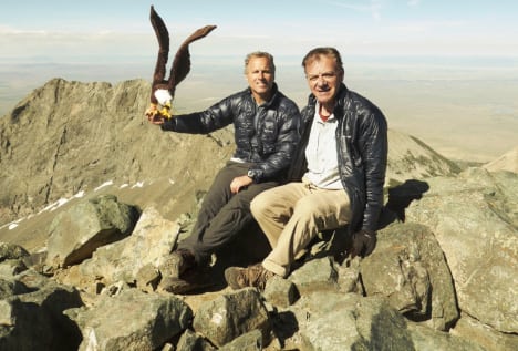
A great shot of Rick P. showing us the sunny ledge he found. In the background is Mt. Lindsay, another fourteener we climbed a few years ago.
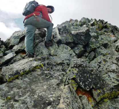
Fully warmed, we pressed upward
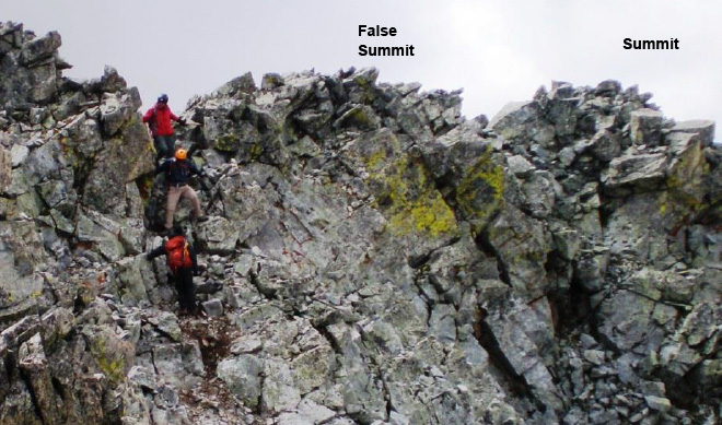
Here is Clif nearing the top ... but of what? "I think I'm at summit said he."
But when I got there a few minutes later I saw another peak nearby that was clearly higher.
"I don't think so." Said I.
A that point the sun came out and magically the wind died down. We did our final rock climb to the real summit!
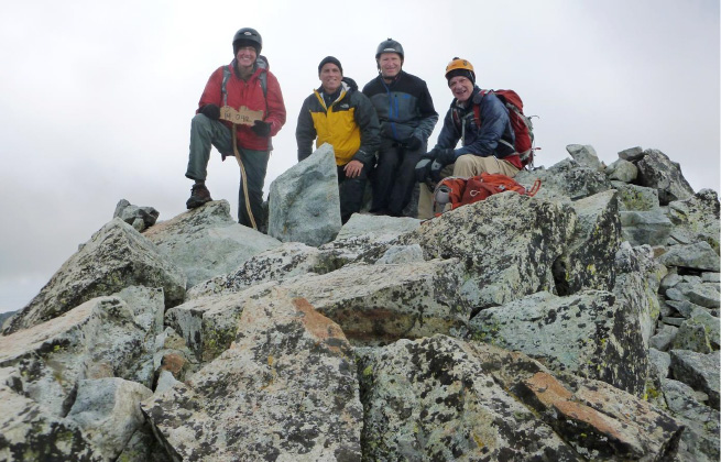
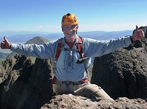
Summit Ellington Pt. 14,042' at 11:05 am, 5 hrs. 5 min from campsite at S. Zapata Lake.
SPOT at summit
I prepared to send a SPOT satellite message and I saw the battery was at red zone, so I sent a custom message, "summited, batt low, no SPOR" I misspelled SPOT, but it got the message across that while Tracking worked on the way up, it wouldn't on the way down, so don't call Mountain Rescue!
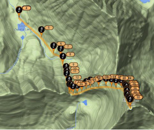
SPOT tracking showing our whole route: around the lake, across the boulder field, up the loose C2 gully, across the West Ridge and up the North Ridge to summit.
Now the job was to get back down. It was only 11 am but we decided against trying to cross to Blanca Peak - we estimated that would be a 3 hour round trip from Ellingwood and while we were in sunlight, Blanca was totally enveloped in clouds - we had already decided to save it for another day, after all, these climbs were for fun, not a competition.
Just doing Ellingwood was going to make it a long day with the descent to camp, packing up and hiking the 4.7 miles back to the car and then 3 1/2 hours drive to home. As it turned out, it was a 14 hour climb and packout.
Descending from the false summit. This was just the beginning of nearly 5 hours of steep, loose-rock down-climbing.
Rick C. getting a lift from a protein bar. I lost 6 lbs. on this adventure!
Rick P. at top of C2 Gully, ready to head down. The first 30' was a challenge how to get down without making a mess of ourselves in a fall.
Rick C. heading down the C2 Gully. This was the crappiest, most challenging gully I've been on and that includes other standard 14er routes with bad reputations for loose, steep gullies - Challenger Pt., Columbia and Sneffels.
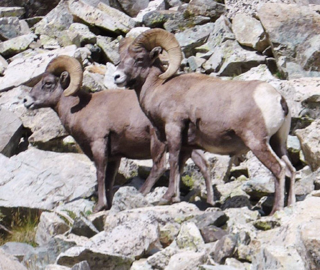
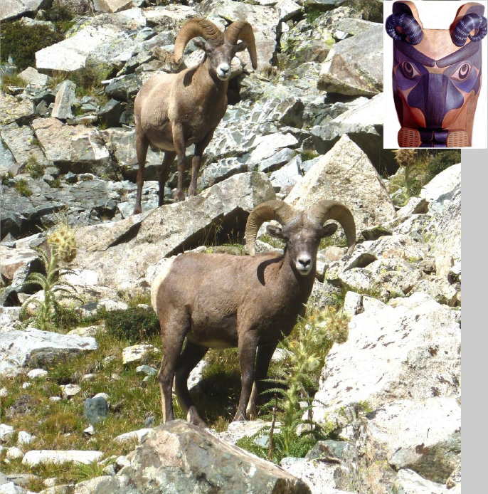
We got back down the whole set of challenges by about 3:30pm at which point we'd been climbing since 5:50 am, a solid 9 1/2 hours. As we hiked out of the last bit of the lower boulder field, there in front of us was a sight I've wanted to see and had always eluded me in all my previous fourteener excursions ... Colorado Big Horn Sheep in the wild. And there they were.
Why is this animal so special to me? Fifteen years ago I commissioned the renowned Northwest Indian totem pole carver, Duane Pasco to capture the important events in our family and to carve them as authentic representative animals on our own totem pole.
Pasco had been instrumental in reviving the original Northwest Indian tribal carved designs forgotten since the late 1800's. He has been carving in the original style and has been dedicating a part of his time re-teaching the Northwest Indian artists how to carve in their original and authentic styles.
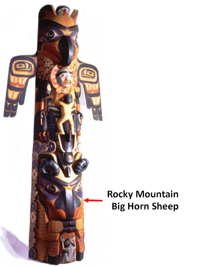
After a two-day interview in 1999 he carved us this pole (the full story including the discovery of the authentic styles and the lore behind the animals is at: /crandall-family-totem-pole/)
We packed up camp and marched back to the cars at trailhead by 8 pm dusk. There we enjoyed some forethought by Clif - cold beers that tasted oh sooo good!!
Thanks to Clif and Mike for being great camping and climbing partners - we hope for more mountains together next summer.