
Difficulty: Class 2
Exposure: Mild.
Summit: 14,229 feet
Elevation Gain: 4,700 feet
Roundtrip: 9.25 miles
Trailhead: Shavano at 9,700'
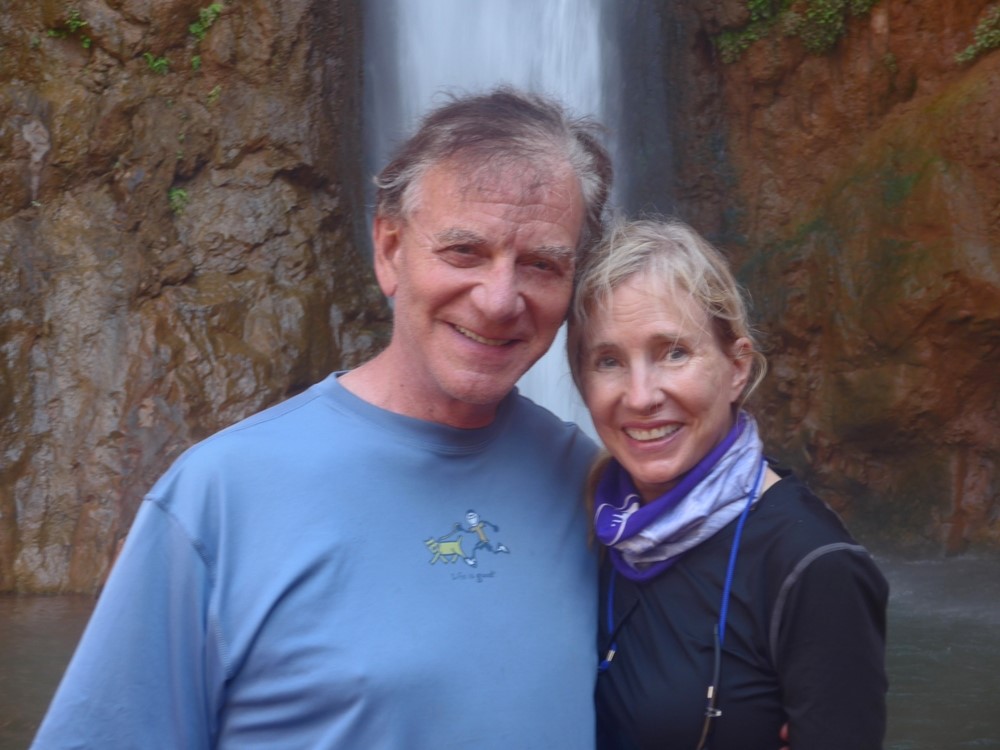
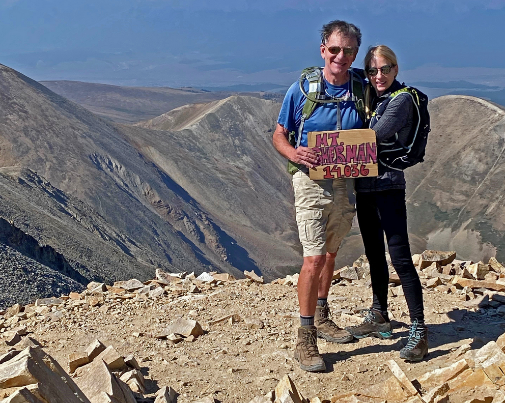
Climbers: Rick Crandall; Laura Welch September 8, 2012
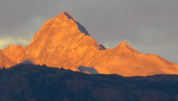
Mt. Shavano lies in the Sawatch Range not far from Salida, Colorado. It was named after Chief Shavano of the Ute Tribe.
Shavano is as much the signature mountain for the town of Salida as Mt. Princeton is for Buena Vista. A distinguishing feature of this mountain is the Angel of Shavano which is a snow feature that forms on the eastern slopes of Mt. Shavano. The Native Americans believed that the Angel of Shavano was actually an Indian princess who sacrificed herself to the Gods to end a severe drought. The princess returns every year as the Angel of Shavano and each summer as she begins to melt, her tears are sent down to the valley in the form of life-giving water. In fact, as is the case with the Cross on Mount of the Holy Cross, (see /mount-of-the-holy-cross-a-colorado-iconic-mountain-north-ridge/) this is a gully formation that appears when filled with snow in the Spring.
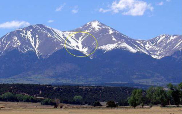
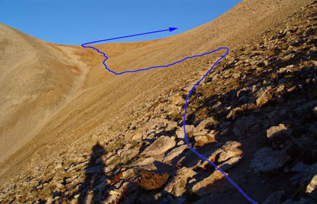
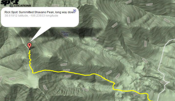
See the Angel of Shavano within the annotated yellow circle. Mt. Shavano summit is above and to the right.
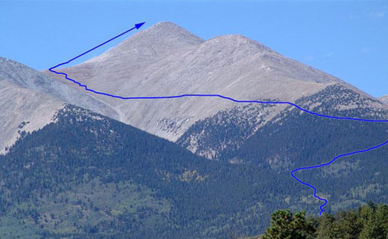
The full route is shown - long - 4700' elevation gain in a little over 4 1/2 miles.
As with the nearby fourteener Tabegauche Peak (see /tabegauche-peak-a-bit-more-than-we-bargained-for-and-a-great-wine-at-summit/), we overnighted in Salida to get an early start in the morning. We'd been ducking weather, mainly the daily monsoonal thunderstorms coming up from Arizona all summer, so a major weather watch concluded this was the day to go for this long hike/climb. I've included some notes on my amateur mountain weather forecasting accumulated over the past several years that has kept us out of weather trouble for all but one of the 33 fourteeners I've now summited to date.
A trip report from other hikers a few weeks before reported a pre-dawn start and they practically bumped into two mountain lions resting right on the path! They had bright headlights and observed that the animals were bothered enough by the lights to wander off.
We also had planned for a pre-dawn start due to the expected length of the day at my speed, so you can imagine I brought plenty of lumens for me and for Laura.
As it turned out, the approach road to trailhead was longer than I'd expected so we got a 6:30am start right at dawn - no headlights.
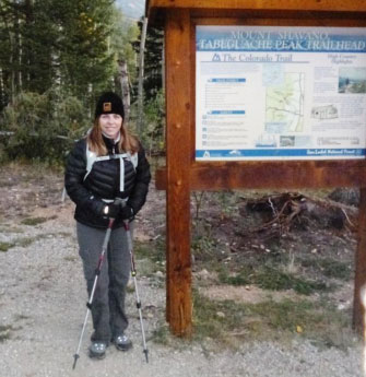
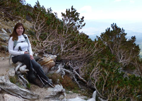
Laura - 6:30am at the trailhead.
After a few hours of grind through a forest we started traversing a long slope towards a saddle. As the Shavano summit came into view, cloud cover appeared - but I wasn't concerned, these were clouds that don't produce rain and while on this day we'd heard of horrific monsoon activity in Phoenix, a high pressure area above us kept their weather away all day.
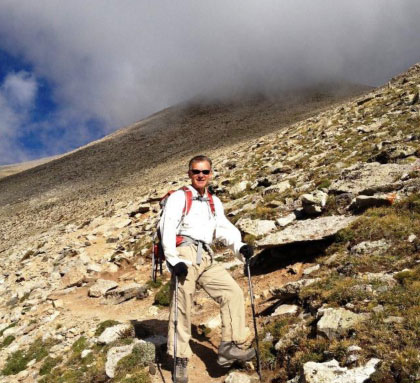
Rick analyzing the cloud cover.
We finally made it across the long traverse to the saddle at 13,400'. The cloud cover cleared and we had a glorious day - sun and no wind, unusual for saddles - that continued all the way to summit.
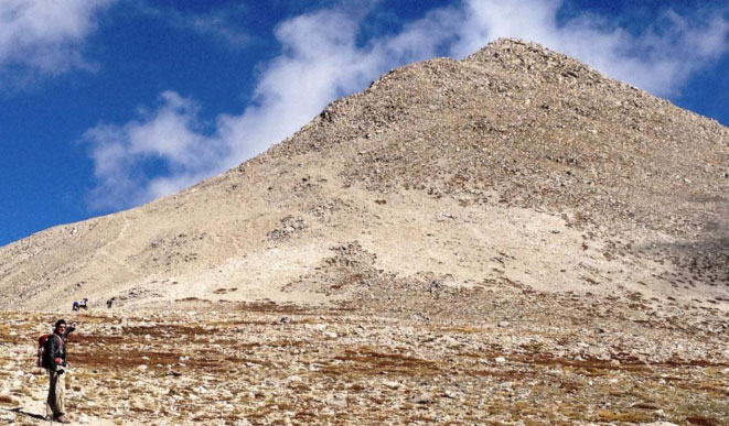
Rick on the saddle at 13,400' pointing up to the Shavano summit another 830' up.
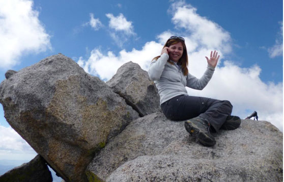
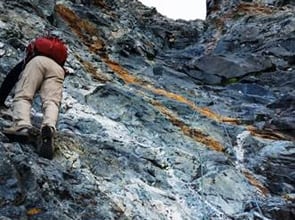
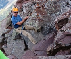
As usual, Laura scrambled up the Class 2 rock to summit first, found cell service and was conducting business by the time I came huffing up.
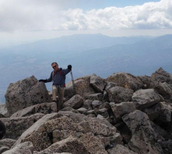
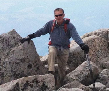
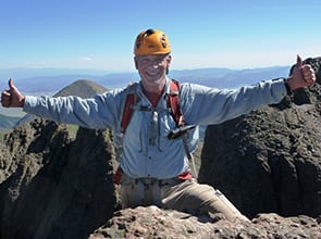
And here comes Rick, actually a bit surprised he's still feelin' good after 4700' up!
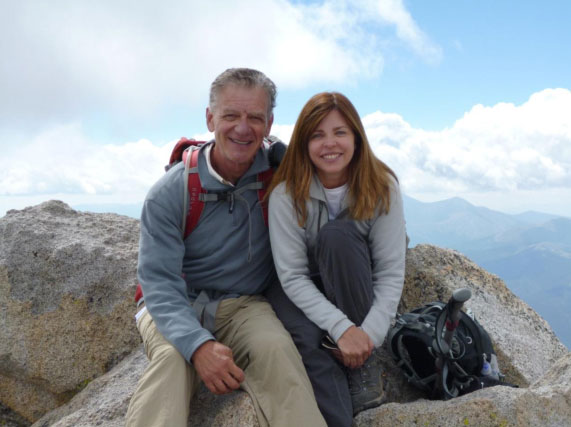
Summit Mt. Shavano 14,229' September 8, 2012; 11:30 am, 5 hours from trailhead.
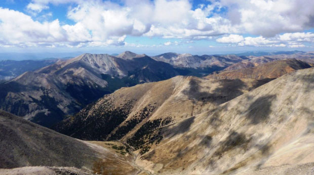
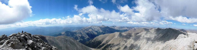
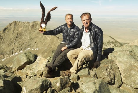
Views from the Shavano summit. The panorama shot is a feature on Rick's new camera - a full 180 degrees from the summit on the left and sweeping to the right.
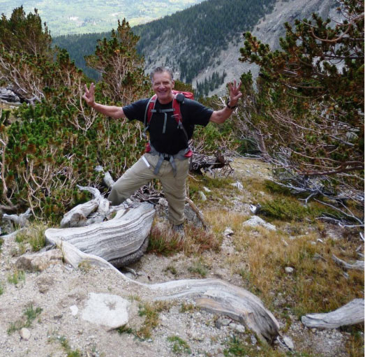
The long way down - Rick celebrating his 33rd fourteener summit!
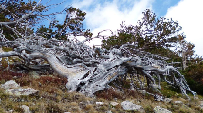
Wind damage causing amazing sculptures.
We rocked back down from summit to trailhead by 2:45pm, only 2 3/4 hours down. It was a gorgeous day and as we got down into the Aspen trees, color change was already apparent, two weeks early from normal.
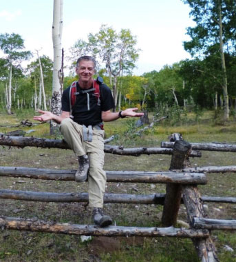
Rick at trailhead "that wasn't so bad!"
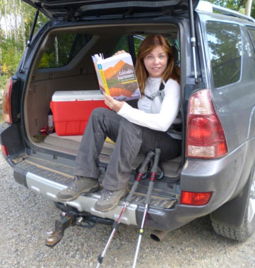
A fired up Laura ran right to her Fourteener book even before taking her boots off:
"Let's pick the ones for next summer ...!"
A Short Course on Storm Forecasting -
(and what to do in an approaching thunderstorm.)
I'm no weatherman, but to date I've avoided major weather issues in over 30 fourteener climbs during a half dozen Colorado summers, paying great attention to weather. In my experience, in the Colorado mountains we get weather basically in two ways - 1) traveling storms, typically from the West or Northwest (these can be longer but easy to see coming on radar 100's of miles away), or 2) gathering cloud formations going vertical and dark, typically coming from the southwest caused by summer monsoon wind patterns from Arizona- these often occur after 2pm and do include brief (30 -60 minute) electrical discharges but are very dangerous and must be avoided above tree line.
Cumulonimbus clouds
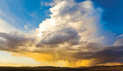
When a moist warm air mass hits the mountains and is forced to rise it creates friction and rapid cooling causing water vapor to condense, creating cumulus clouds of increasing height and darkness. The result is thunderclouds piled high and the friction creates static electricity which discharges as lightening. Note the broad, dark base.
Cumulonimbus clouds can develop in as little as 20 minutes. The faster, taller, and darker they build up, the faster and more violent is the energy release: downpours, wind, lightning, and hail.
Warning signs: Watch for mid-level, puffy clouds that gather in height and get increasingly darker.
Clouds that usually produce lightning have vertical development and dark anvil-shaped bases. Lightning usually coincides with rainfall, but not always. Strikes can come from almost clear skies-the literal “bolt from the blue.”
Even if clouds have yet to produce lightning, electricity may still be in the air. The best method of detecting danger is to closely observe your or your hiking partner’s hair. If you see that hair is beginning to rise into the air, take cover - at that point a strike is probably imminent.
The typical thunderstorm is 15 miles in diameter and lasts an average of 30 minutes.
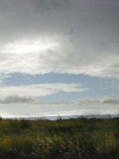
Altostratus - Mid-level clouds- storm in near future
Some clouds are OK, and I like weather better from the West (easier to avoid) than the South.
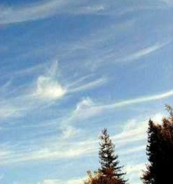
High Cirrus clouds – good current weather
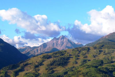
Low clouds around Pyramid - stratocumulus are bumpy and don't cover the whole sky - no rain for hours but watch if they pile higher rather than moving off.
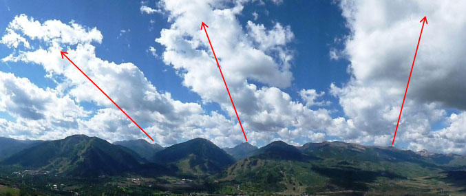
Same low clouds two hours later - starting to build 3 columns from 14ers. Still these look like light rain or drizzle, no anvil bases. Arrows are from Castle Peak, Pyramid and Capital, left to right
Summer monsoons: Precipitation increases in July with the advent of the Arizona summer monsoon. During this time a large dome of high pressure sitting over eastern New Mexico and Texas drives warm, moist air from the Gulf of Mexico into the Southwest. A broad counter-clockwise circular wind pattern drives the moist air north to Colorado. Rapid daytime heating combined with forced updraft to clear the tall mountains leads to rapid upwelling of the moist air and the formation of widespread and occasionally intense thunderstorms. The monsoons can continue into mid-September but more commonly ends in late August or early September.
Precautions: Thunderstorms in Colorado typically build up steam between 12:00 p.m. and 3:00 p.m. If thunderstorms are in the forecast, you should never be above timberline after 1:00 p.m. If you are above tree line when a storm rolls in, rapidly descend to shelter. Avoid caves – they channel electricity and are extremely dangerous in a storm.
Avoid isolated trees and high points. It is always better to seek shelter in a thick forest versus an isolated stand of trees. Lightning favors small groupings of trees over dense stands. Likewise it is best to locate camp in a thick stand of trees instead of next to an isolated grouping.
If you are in an exposed area far from cover, find the lowest point.
If you get caught: If there's lightning, drop backpacks with frames, hiking sticks and any other metal; spread 15 feet away from others, squat on top of insulating material or on the soles of your boots, with your head down, feet together, and arms wrapped around your legs (for a safer lightning path in case of a strike). Never sit or lie down on the ground and stay away from puddles. These positions facilitate greater ground-body contact, and lightening is seeking a path to ground.
Always follow the “30/30 Rule" of the National Weather Service: Upon first sight of lightning, count the seconds that pass until you hear thunder. If the number of seconds is 30 or less (i.e. 6 miles or closer), seek shelter immediately. Stay put for 30 minutes after the last lightning flash or rumble of thunder. The National Weather Service estimates that 50% of all lightning deaths are sustained after the storm has passed.
National Weather Service technical weather forecasting:
http://www.nws.noaa.gov/view/prodsByState.php?state=co&prodtype=discussion
Some NWS jargon:
POPS - probability of precipitation
Ridge - elongated area of high pressure
Trough - area of low atmospheric pressure; opposite of ridge
High pressure - usually associated with clear weather
Low pressure - usually accompanied by precipitation, cloudiness and some wind.
Shortwave troughs - mid-to-high level disturbance causing upward motion ahead of it
contributing to thunderstorm development.
Convection – often used interchangeably with thunderstorms, although they are just one form of
convection - visible with towering cumulus clouds if moist convection, but dry convection shows no clouds.
ACCAS - alto cumulus - mid-level clouds with upper portion show cumulus development, taller
than wide - sign of instability preceding rapid development of thunderstorms.
Low-level convergence - more air entering an area than leaving; if at low level, causes upward
forcing which increases odds for thunderstorms; if at high levels, forces downward forcing which presents no issue for climbers.