
Difficulty: Difficult Class 2
Exposure: Some near false summit
Summit: 14,155 feet
Elevation Gain: 4,000 feet
Roundtrip: 8 miles
Trailhead: West Ridge from Jennings Creek at 10,500'
Climbers: Rick Crandall, Clif Slade, Mike Ives June 23, 2015
This climb was to Tabegauche Peak (pronounced "tab-a-watch") in the Sawatch Range not far from Salida, Colorado. We were greatly enthused that we were at the beginning of a new climbing season, despite continued snow-fall at high altitudes all through May in Colorado. We were mindful of highly-documented warnings what to avoid and a touch of adventure re-creating a route that avoided the sections which warranted its closing by the U.S. Forest Service in 2002 due to erosion.
This route was reportedly more beautiful and less populated than the new standard route over the top of another nearby 14er, Mt. Shavano that we'd already climbed before. However there is less information on how to do the final summit approach to Tabby from this side (the West ridge). So this story is about dealing with the early-season snow on the ridges plus creating some documentation on the best way to summit the Peak.
We were the only people on this climb all day.
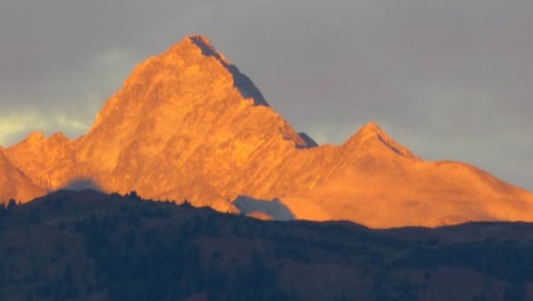
Tabegauche Peak
There are three 14ers in the Sawatch whose names come from the Ute Indians - Antero, Shavano and Tabeguache, the latter being the name of a nomadic band of the Ute who were known to roam from southeastern Colorado to northeastern New Mexico. The mountain was first called Ouray before it was known to be a 14er, originally named after a Tabaguache Indian who was the most famous Ute chief of all, Chief Ouray. The Tabeguache were moved to a reservation in the early 1870s to south-western Colorado, and there they became known as the Uncompahgre.
Historians tell us that Tabeguache is a Ute word meaning "people living on the warm side of the mountain."
The Night Before
Some research produced a few climb reports that found a way up the Jennings Creek valley avoiding the problem ridge and we decided to go for that route. For some who would go for this climb, you could overnight in Salida and drive to trailhead early in the morning. We opted for car-camping at the Angel of Shavano Campgrounds at the very end of CO 240 which would just leave a 3.8 mile 4WD off-road ride to the trailhead in the morning.
Car-camping has its advantages when possible on a climb, especially if you're going with the likes of Clif Slade and Mike Ives since they bring the whole kitchen with them and the resulting dinner has ALL the fixings.
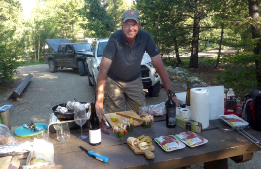
Oh yes, that would be shrimp cocktails, steaks, baked potatoes and all kinds of other goodies. I did contribute a few things including the Hansel Pinot Noir that I knew would go well with no matter what food was on the table.
Jennings Creek Trailhead – We were asleep by 9:30 pm and awake by 4:30 am. After some quick breakfast and coffee, we headed off at dawn to find the trailhead. The research on how to find the abandoned and disguised trailhead was to travel 3.8 miles past the Angel of Shavano campground and locate a 12' boulder which is just past some tree stumps at the mouth of the trailhead. Easy to miss, but here are some pictures for those wanting to do this climb this way:
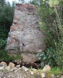
The 12' boulder and the abandoned Jennings Creek trailhead
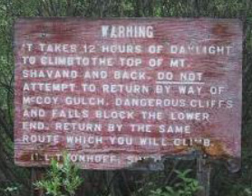
Trip reports of other climbers I'd read had plenty of warnings to avoid descending from the ridge too early into McCoy Gulch. There were so many warnings that I created pictures and a warning chart to keep it in the forefront of our thinking for the descent.
Here is McCoy Gulch
One of the classic 14er route-finding errors is to drop south from Tabeguache too early when descending the Jennings Creek route. This puts one into McCoy Gulch instead of the Jennings drainage and has led to numerous calls for search-and-rescue teams to locate stranded hikers. What appears to be another reasonable route off the mountain turns out to be an invitation to a narrow, difficult canyon not visible from above.
"WARNING! Hikers descending from Tabequache should avoid McCoy Gulch!! This gulch is very deceiving in that it appears easily accessible but is in reality blocked by steep cliffs. Numerous hikers have become trapped over the years and several deaths have resulted from descending McCoy Gulch."
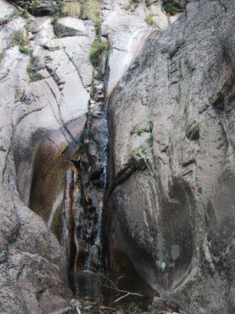
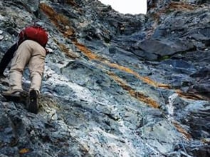
The first part of the unpleasantness awaiting a climber attempting to descend McCoy Gulch
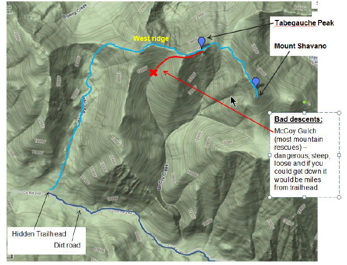
The Route with Warnings
The Climb
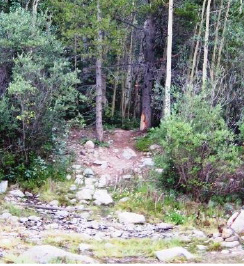
We started hiking at 6am. At first the path is very visible although starting to get overgrown. It's a pretty steep uphill wake-up for a while then you'll top out at the start of a long valley marked by a tarn (mountain-snow lake). This is where the path to the old (closed) route veers right. Stay straight keeping scree on the right and Jennings Creek on the left.
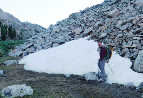
Rick loaded up with snowshoes, ice ax, spikes, new emergency DeLorme InReach GPS - already seeing snow at 10,500'
We hiked 1 3/4 hours up the whole valley to a gully leading up to the West ridge.
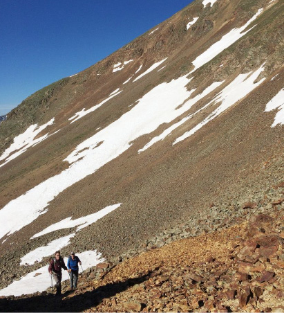
Mike (left) and Clif at 7:45 am reaching the end of the Jennings Creek valley and about to head up the rocky slope to a notch in the ridge. Carbonite Mountain, 13,663' in the background.
Rick and Clif working up to the West ridge.
Once attaining the ridge, looking back. Taylor Mountain, 13,657' in the background on the right. Lots of snow still around. That's Mt. Princeton peaking over the middle.
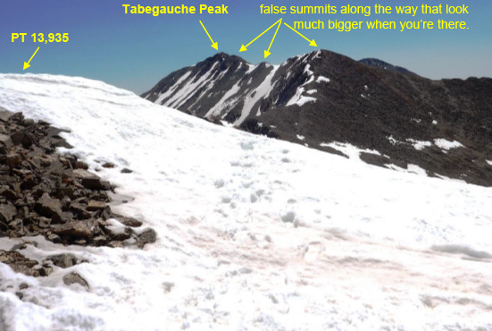
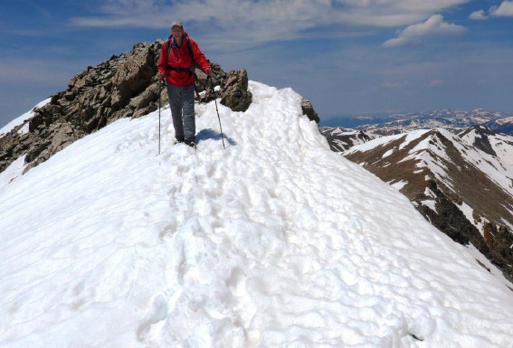
Further up on the West ridge heading towards the first 13,935' false summit. We hiked the most level parts of the snow to prevent slips - it was still early morning and the snow was thankfully not soft enough yet for post holing.
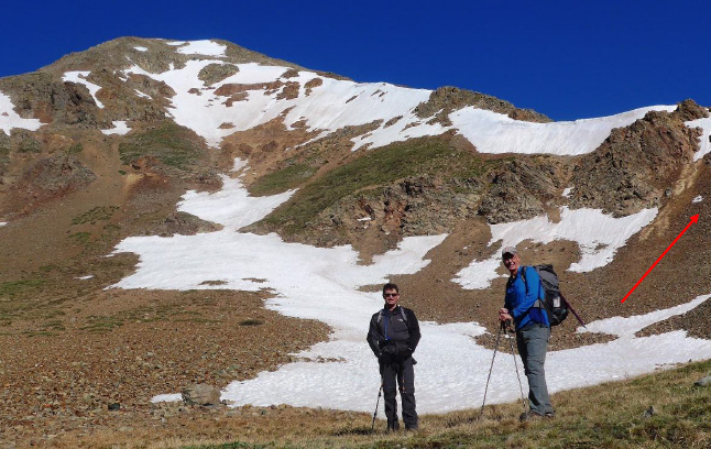
We headed up the ridge into snows. The first peak we saw ahead, I knew was PT 13,935' but when we got there at 11:10 am (5 hours into the climb), Mike and Clif thought we'd done enough and we'd summited Tabegauche!
I couldn't believe it'd been so easy, so a quick look at my GPS told the truth. We were at the 13,935 first false summit, nowhere near the goal!
The far peak we could see now for the first time was Tabegauche with several more false peaks in front of it. Clif looked at me questioningly, to which I responded immediately:
"Weather looks good, we're going for it!"
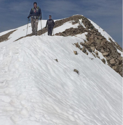
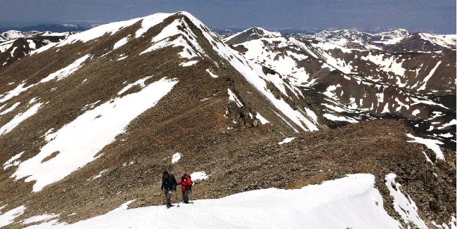
Rick and Mike staying right on the snowy ridge top from Pt 13,935 down to another saddle en-route to the next false summit.
We got to the top of the final false summit on the ridge (marked "P") at noon, fully six hours from trailhead. We started scratching our heads about how to get across to the summit. We were up on the ridge and saw no good way down continuing on the ridge. It appeared the ridge point there just fell over a cliff (see dotted red line). We looked to the right (option #2) and that didn't look good either because to get to it we'd need to glissade a quite steep snowfield with rocks at the bottom (see red line through snow) which is a pretty standard threat to avoid in climbing - if you don't arrest firmly enough you smash into the rocks below the snow field and that doesn't end well.
The other problem with that approach is that if we got below the snow field, we would then have to ascend a totally loose and very steep approach to summit (see red line to summit).
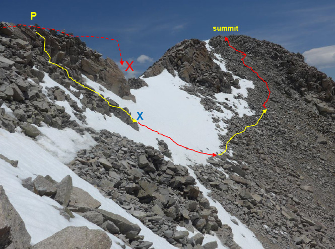
Clif was not to be turned back this close to summit. He started climbing down from the ridge top, apparently going for option #2.
The next thing I saw was that he'd found the shortest way down the steep snowfield by climbing down to the jump off point (the blue "X"). He surmised the noon sun would have warmed the snow to where he could jam his feet into the snow and shove his way down to the rocks below at a reasonable speed (the red line through the snow).
Mike and I followed very gingerly and with great care.
Rick and Mike downclimbed from the ridge point "P" to the blue "X" in the prior photo;
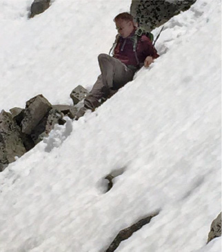
Rick in the steep-snow glissade to join Clif in the rocks below.
The Crux
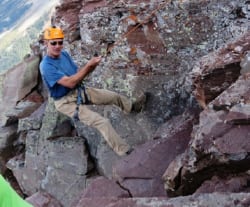
The next part was no fun at all and definitely the crux of the day. Referring to the prior marked-up photo, It took us a full hour to lateral under the snow (yellow line) and then to step, kick and pull our way up that steep, loose mess (the red line) towards summit. At one point in that last very steep section I got on a pile of rocks with feet and hands on each of four different rocks and the whole side of the mountain started to rock slide with me on it. This happened to me once before a few years ago when an accomplished climber was coincidentally nearby. I recall he shouted then: "hold on, don't move, you'll accelerate it. Ride it down. Odds are it will stop." It worked then so that's what I did this time - and it worked again. You will see no photos of it because no one was going to take a hand off the mountain to take a photo at that point.
Well I'm writing this story so you know that we successfully pulled and slipped our way to summit – at 1:10pm.
There was no way we were going to safely descend that mess, so we sent Mike, the more accomplished climber of the three of us, to scout the peak - looking down from our height, to spot what must be a better route.
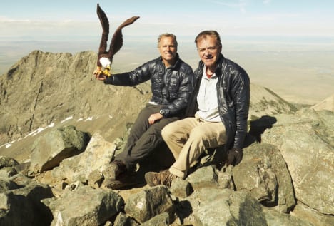
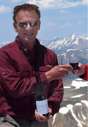
In the meantime, we had some celebrating to do! While we had no idea we were going to be this challenged, but we'd done it and this was our first climb of the summer, 2015 season. Normally we carry wine in a special plastic wine "skin" designed for wine so there is no bottle weight to carry. But I wanted to check off a special request of long-time friend and winemaker Bob Cook (Dancing Hares wine, my favorite red wine blend of all makers) whose friend in the Napa area is Walter Hansel, the maker of one of my favorite Pinot Noirs called Walter Hansel (from the Russian River area in California).
So to Walter: We uncorked a real bottle of your 2011 on the 14,155' summit of Tabegouche Peak to celebrate our victory and your wine, which suffered not at all from the journey!

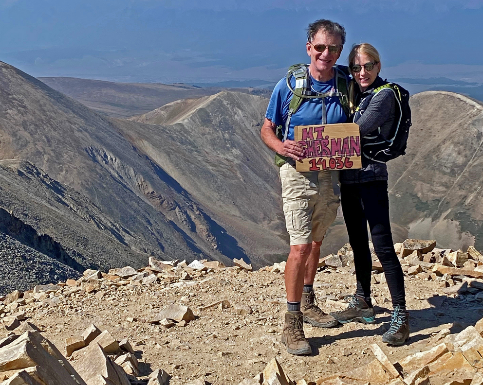
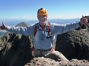
Summit Tabegauche Peak, 14,155' June 23, 2015
7 hours 10 minutes, 4000 vertical feet and 4 miles from trailhead
Rick and Clif above, Rick and Mike below celebrating with Walter Hansel wine

OK then, it was Mike's job to find a better way down, and he did. With the advantage of now being higher than everything else, he was able to look down at that last high-point on the approach ridge marked with the yellow "P" in the earlier photo. From our summit perspective he could see that there was indeed a way down and up that ridge point directly from the Tabby summit. For all you climbers choosing to go for Tabegauche from the West Ridge side, here's what it looks like:
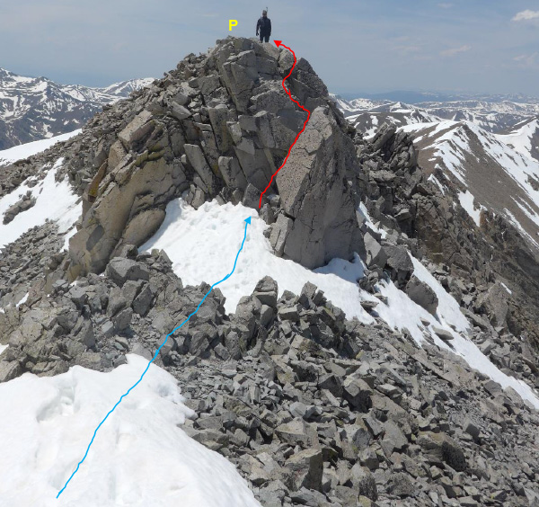
In this photo taken from the Tabby summit, Mike has already descended the west side of the summit and ascended to the high point on the West ridge via the red line - a Class 3, somewhat exposed move. That's the way to do it both ways!
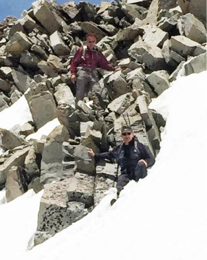
After that, a bit more rock-climbing on the upper part of the ridge gets past any tricky stuff and we started moving with greater assuredness and speed.
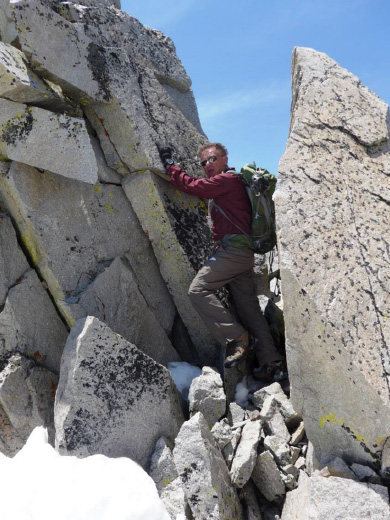
Rick above and Clif below, making our way back.
The snow was softer and we post holed more but we didn't take the time to don our snowshoes. We just pressed on up and down the false summits on the ridge towards the notch where we descended to the valley.

Further down the valley this stopped me cold. For a second I thought it was a deer (or maybe a Unicorn J ) stuck in a mud hole. I soon realized I was looking at a weather-worn tree stump shaped almost perfectly like a deer head, with eye, horn and all!
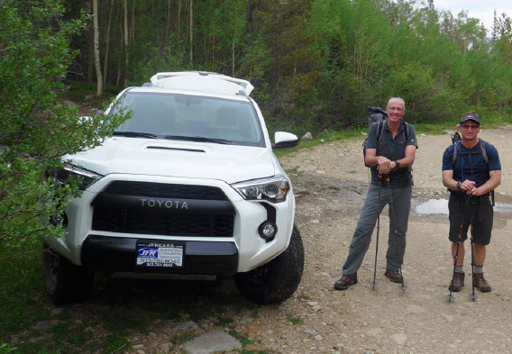
6 pm, exactly 12 hours from start, we got back to my new ride - a Toyota 4Runner TRD PRO just waiting to float over the bumps for 3.8 miles back to our camp site. Thank you Clif and Mike for a great partnership navigating a super adventure!

Delorme InReach tracking of our day from my "MapShare" web site - showing our progress in 10 minute intervals between dots. They were obviously much closer together on the way up than the way back down.
Note that the actual summit of Tabegauche is mis-marked - the cartographer made the same mistake Clif and Mike did - thinking that Pt 13,935 was Tabby! The red arrow points to the real summit. Mt. Shavano is marked correctly.