
Difficulty: Class 2
Exposure: None
Summit: 13,193'
Elevation Gain: 1800'
Roundtrip: 7 miles
Trailhead: Independence Pass parking lot at 12,050'
Climbers:
Route 1: Rick Crandall; Rick Peckham July 11, 2015
Route 2: Rick Crandall, Shan Stuart & Emme the 14er Dog July 20, 2006
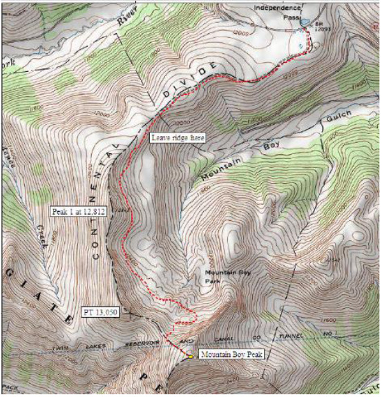
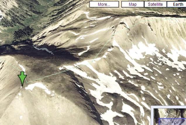
Mountain Boy is a ranked Colorado 13er you see from the top of Independence Pass east of Aspen. It has no recorded route, nor any obious path. I've tried this mountain several times, at first getting trapped in steep, loose scree as we were eliminating possible approaches. Finally in the summer of 2006, along with Shan Stuart and Emme our amazing Austrailan Terrier mountain climber, we found a way (called Route 2 shown with the red dotted line below), although only accessable by mid-summer when the snow cornices have melted sufficiently.
I've always wanted to try another way right along the ridge of the Continental Divide. In early summer, 2015 while prepping for bigger 14er climbs, climbing-friend Rick Peckham and I decided to take a shot at the ridge approach, called Route I and shown in the black dashed line on the Divide shown below.
Cutting to the conclusion: if you want to do this peak, use Route 2.
Both will be described here which let's me tell one more Emme story as she's no longer climbing the big mountains since age 11 in 2012.
Route I: Rick Crandall and Rick Peckham; July 11, 2015
Both routes start at the Independence Pass parking lot. Walk part way up the paved path to the Observation Area, but take a well-defined dirt trail leading off to the right (southwest). This easy trail is right on the Continental Divide and heads toward the first objective, which is Pt 12,800. This in itself is a nice 1 - 1 1/2 hour Class 1 hike with beautiful 360 views.
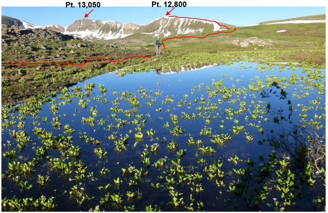
On the way to Pt. 12,800 with the early morning sun reflecting off the lilies in a snow-melt pond that will dry up by mid-summer.
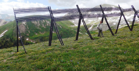
Along the way, see fence remains of a failed project to keep the snow on the Aspen side of the Continental Divide. The objective was for the Spring snow-melt water to flow West towards Aspen rather than East.

Rick Peckham at the summit of Pt. 12,800 with Pt. 13,050 in view on upper right
and Mountain Boy on upper middle of photo.
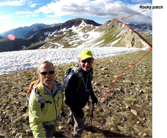
The route to Pt. 13,050 crosses a brief rocky patch with a bit of exposure -
short-lived and the final scree-walk is solid and easy, still Class 1.

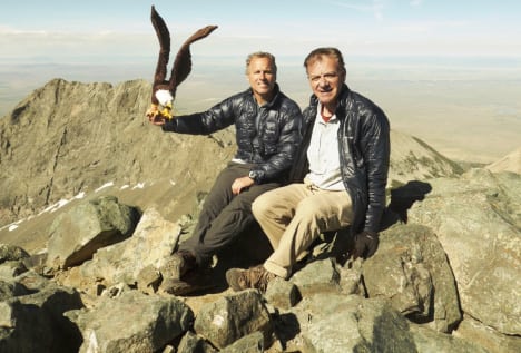
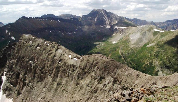
Rick C. and Rick P. at the summit of Pt. 13,050 resting on a stone enclosure created long ago. The views are 360 and wonderful. This is the end of "easy."
The hike so far is a pretty and easy one for a nice few-hour outing to the "summit" of a 13er. But our objective was to find a new route to Mountain Boy. Looking South one can see elements of a trail segment in the scree leading right off the summit and steeply down towards the saddle to Mountain Boy. It is steep and loose and obviously some have been down this way so we decided to try it.
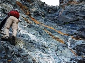
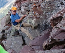
Rick C. going over the steep side from the summit of Pt. 13,050. There were good handholds, although plenty of loose rock. Not recommended for Class 1 or 2 hikers -and it gets worse

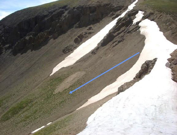
Here is a view of the backside of Pt. 13,050 from the saddle to Mountain Boy. The red arrow points to the very first pitch down - definitely Class 3 and the next pitch gets worse (blue arrow).
We decided not to try the rest of this approach. It actually looked like it might be somewhat more inviting climbing up which is always easier than climbing down a steep, exposed and loose pitch we've never seen before. So we re-climbed to Pt.13,050 and returned after a nice morning in the sun. Our thoughts turned to doing this as a loop. Hiking to the summit of Mountain Boy via "Route 2" (see below) and returning via this Route 1 which would entail ascending this ridge. That looked to be a cool climb.
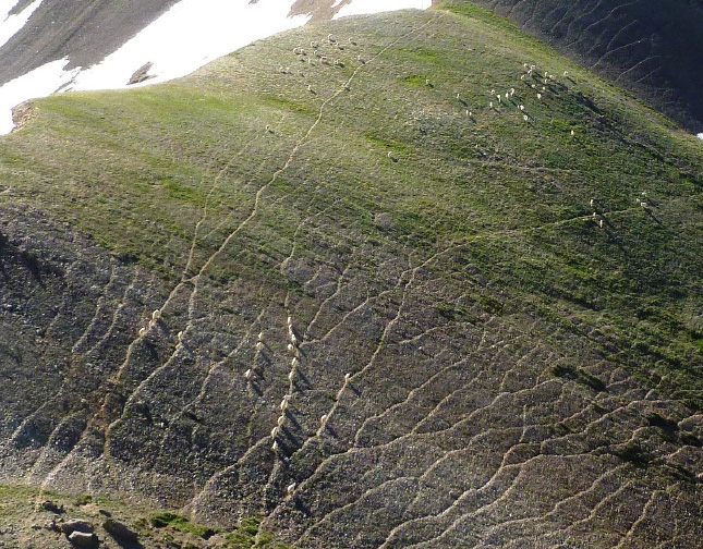

Just before we turned around, looking down at the saddle at 12,540' leading up to Mountain Boy we saw nearly 100 mountain goats lined up on the paths they wear into the tundra.
Route 2: Done Originally by Rick C., Shan Stuart and Emme July 20, 2006
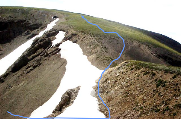
Here is the easier way to summit Mountain Boy. Recall back to the start of the hike at the parking lot of Independence Pass. Start out on the same hike as above - but instead of going up on the ridge to Pt. 12,800 and 13,050, about half way along when you see the metal fence - go just beyond that and some willows and go over the left side where the snow cornices are in early season. It may not look like it, but there is a way down to the lower plateau. The full route is shown by the blue line.

Just past the fence shown below, pass some willow bushes and then head over the side as shown in blue above.


There may still be some snow cornice but just edge along and eventually bushwhack down to level ground below.
Here Shan and Emme are making their way down staying between the rock and the cornice. It's not as hard as this might look.

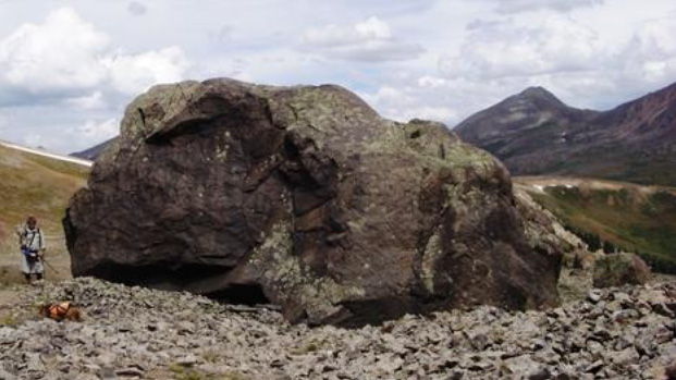
Once down from the snow ledge, aim across the meadow towards an obvious boulder field. As you get closer you'll see these boulders are enornous.
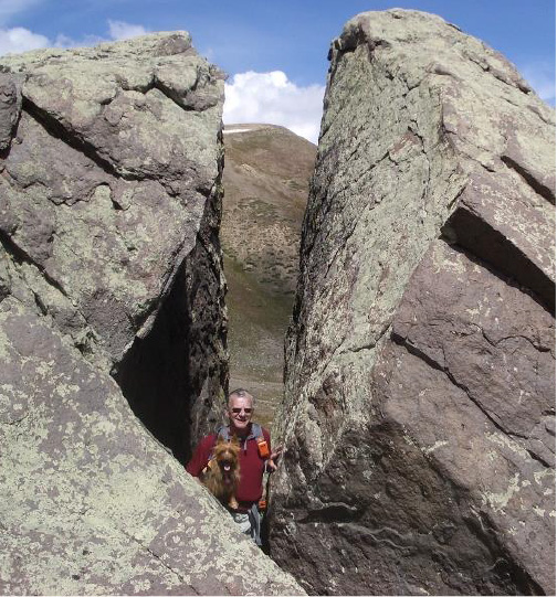
Rick and Emme in the impressive boulder field. There are no boulders that have ever foiled Emme - she finds a way through them, around them or over them. I've never had to lift her even once in the 17 fourteeners and countless other mountains she's done.

After the boulder field, cross the loose, steep, sandy and unstable slope to get to the area where there are grass patches. Then head up to the right of the snow-filled crevasse, using the grass patches for traction.
You'll gain the saddle and can then traverse left above the snow and find a goat path leading up the final pitch to the Mountain Boy summit.

Emme is always ahead of me, but never leaving me out of sight. The orange vest is so I can see her despite her natural coloring nearly matching the rocks she's on.
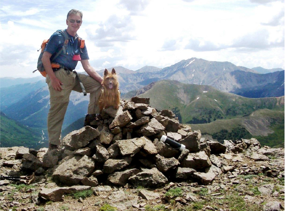
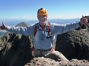
Summit Mountain Boy Peak, 13, 193' with La Plata, a nearby 14er in the background. Total vertical 1800' from the parking lot - and 6.7 miles round trip.
Rick's Spot GPS marking the summit.
Message: Rick’s SPOT check. Emme, Shan and I are attempting Mountain Boy 13er today
Surrounding views are amazing. That is Grizzly Peak in the background - it is 13,995', the tallest 13er (see story at: /grizzly-peak-a-13995-east-ridge/)

Now we have to go down -
Oh yeah - down that!
Rick "skating" down the loose scree and dirt

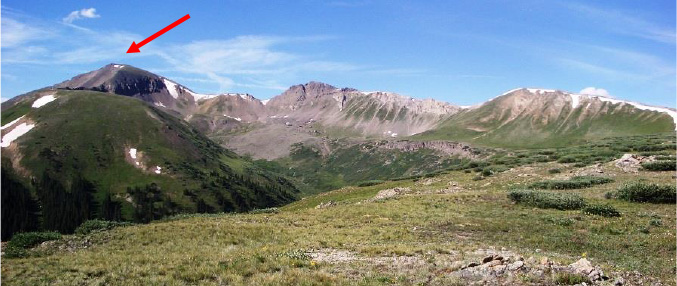
Nearly back at the initial path we could look back at the whole panorama we'd done. The red arrow points to the Mountain Boy peak we'd just been on.