


Mount Daly– a Most Prominent Peak via South Ridge
Difficulty: Class 3
Exposure: Along the ridge
Summit: 13,305’
Elevation Gain:
4,100’ from TH;
1,800’ from Capitol Lake camp
Roundtrip:
14.4 miles from TH;
1.4 miles from Capitol Lake camp
Trailhead: Capitol Lake at 9,205’
Climbers: Rick Crandall; Rick Peckham August 23, 2016
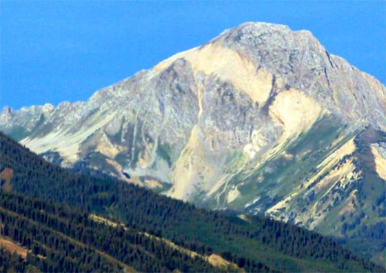
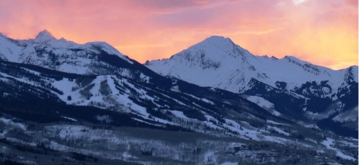
Mount Daly is a named “thirteener” that is the most imposing and perhaps most well-known mountain near the Aspen area, mainly due to its prominence and its characteristic diagonal “stripe.’ It dominates the view to the southwest on the ride into Snowmass Village. Daly is yet another mountain I see daily from my home – to some it looks bigger than Capitol Peak because it’s closer and not blocked by mountains in front.
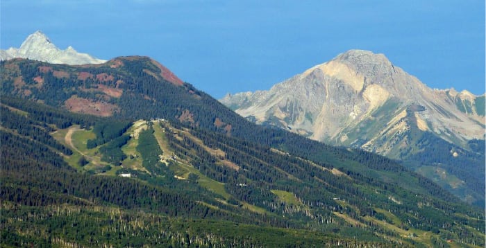
A view from my deck – Capitol Peak in the distance is on the left and Mt. Daly on the right. The Snowmass ski runs are in front. From this perspective, Daly’s south ridge is the ridge on the left leading to its summit.
Mount Daly is named after Augustus Daly, a president of the National Geographic Society.
The stripe across Mt. Daly is a geologic dike. A dike is an intrusion that cuts across preexisting layers. Dikes cut across the rock at a different angle. They are usually a different color and texture than the enclosing rock around it. Dikes are younger than its surrounding rock. The dike on Mt. Daly is an igneous intrusion caused by magma flow into a large fissure.
An arête is a sharp knife-edged ridge, created when two glaciers diverge from the same point. It creates a sharp ridge that has steep sides. Both sides of Mt. Daly are arêtes.
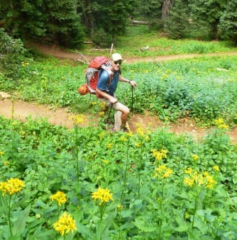
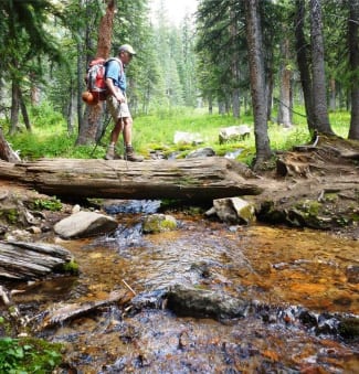
Experienced and youthful climbers could climb Mt. Daly in one day, typically starting from the Capitol Lake trailhead. It’s a long day – 14.4 miles round trip and 4100’ vertical. The hike to Capitol Lake is one of the prettiest in the Aspen area and the Lake itself is a great place to camp for a night. With summer monsoon weather still threatening, but looking like we would at least have a morning clear for climbing, we set out for the Lake with full backpacks for camping.
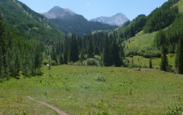
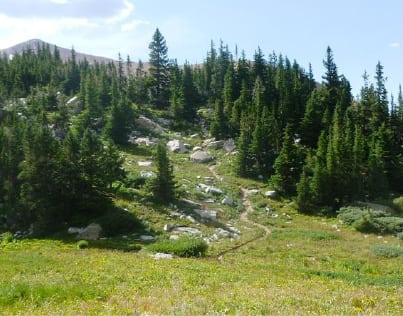
The 6.5 mile hike to Capitol Lake is full of beauty, with Mt. Daly on the left and Capitol Peak showing on the right like a painted mural backdrop.
Many people do this hike half-way to Capitol Creek and turn around, others hike all the way to the Lake for the day or overnight to fish for trout. Some go to attempt Capitol. Few seem to go for Daly.
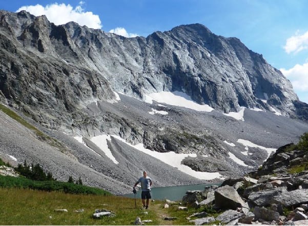
Here is Rick P. arriving at Capitol Lake – with Capitol Peak in our face – Just to the left of the Capitol summit is the dramatic drop-off from the knife edge.
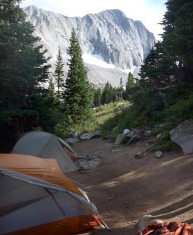
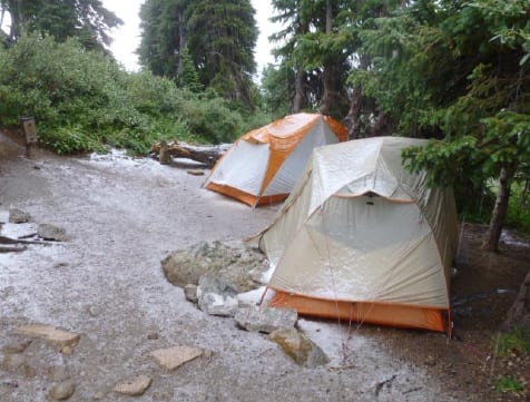
We found a great campsite in the very last bunch of trees at 11,600’ with a pretty cool view from our tents!
The Climb
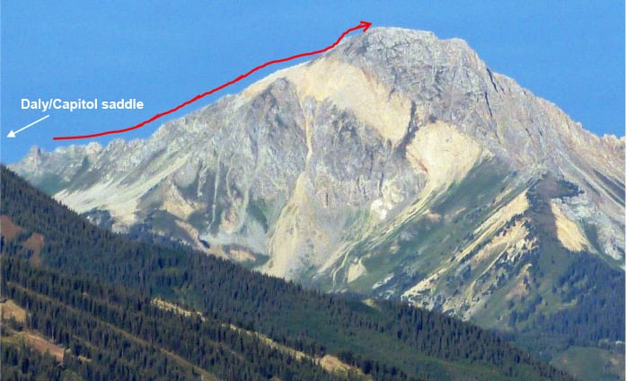
Here is a close-up of Daly from our house. The route starts with a 900’ hike up switchbacks to a saddle between Daly and Capitol ( see below), and then mostly up the narrow south ridge (in red) all the way to summit.
However we found out that following the ridgeline had some wrinkles to it and it turned out to be more of a Class 3 rock climb although on pretty decent rock and fun once we figured it out.
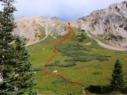
Being later in the summer, dawn arrives at about 6:15am and the sun would rise on the other side of the saddle so we decided to start at about 4:45am in the dark which would comfortably get us up the 900’ of switchbacks to the saddle at 6 am.
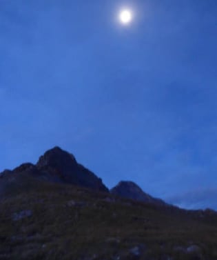
We had a nearly full moon but still needed our headlamps to hike up to the saddle.
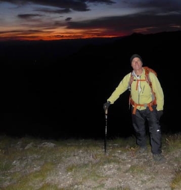
Rick P. at the Daly/Capitol saddle at 6 am with sunrise just starting to the east. There we ate some breakfast until we had a bit more light to continue.
In all the research I did on the Internet I found very little on climbing Daly. Summit Post merely said: “reaching the Daly Saddle is key to the route.” As you will see I disagree with that – in fact getting to the Daly saddle is the easiest part of the day.
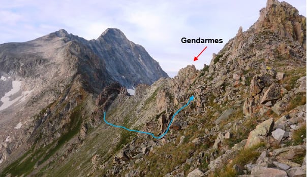
From the saddle, to the right is Capitol. For Daly you go left (north) off the saddle and you’ll immediately find a Gendarme in your face with no apparent route. That alone would put off casual climbers.
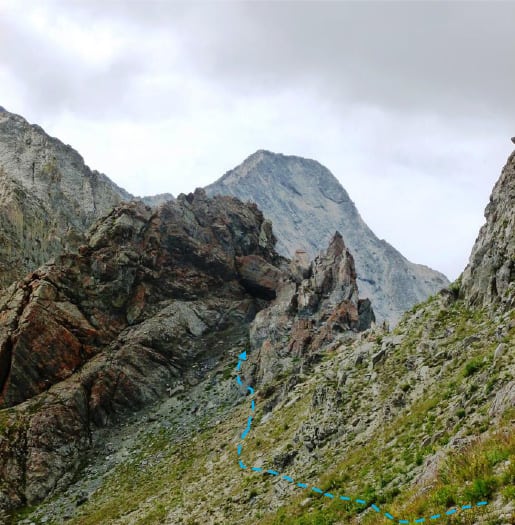
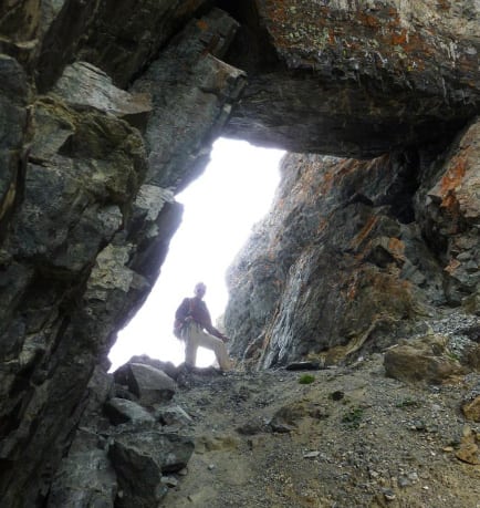
So our first move contoured around the Gendarme’s left side right along its base to a very loose, steep gully. We worked up the side of the gully for 50’ to a keyhole or arch you can’t miss.
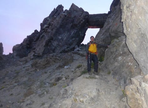
Rick P. about to go through the keyhole.
Once through the keyhole, we were on very loose, steep junk. This is the most important (not the most difficult) part of the route – deciding how long to stay below the ridge and when to ascend to the crest.
Descend just enough to stay under the Gendarmes that guard the ridge crest. We were on very loose rock but there’s no way at that point to stay on the ridge.
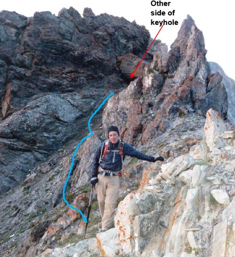
The blue line shows the approximate route from the exit of the keyhole, down and across the loose stuff until you’re past the Gendarmes, and then angle and scramble up to the ridge. We didn’t do this on the way up and instead stayed below the ridge for a while which was not fun and took a long time. We corrected on the way back and it was great fun – good Class 3 climbing with mostly solid rock.
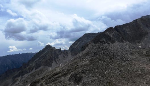
Here is what the ridge crest looks like. There are places you can walk, and others you need to climb up and down the ridge contour.
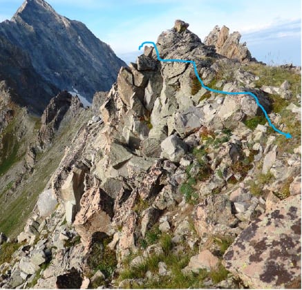
About half of the route from the saddle is rock climbing – we kept it at Class 3 the whole way, although at some points there was big exposure because the ridge is narrow and the west side is mostly cliff. After the Class 3 festivities, things got easier – pretty much Class 2 and Class 2 Difficult hiking.
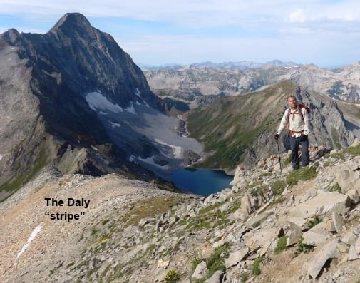
Here Rick P. has just crossed scree of a bright orange color – that is the famous Daly stripe!
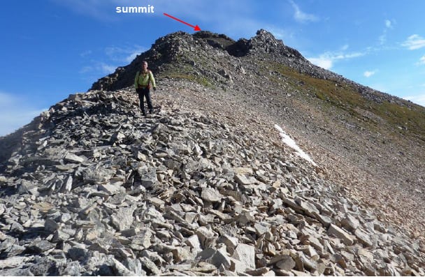
The final approach to the Daly summit is all Class 2 hiking.
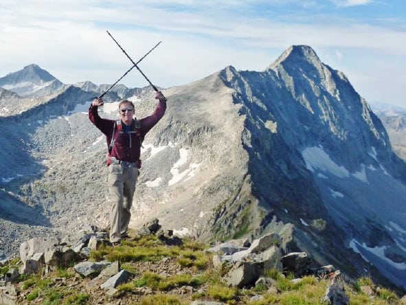
Summit Mt. Daly, 13,305’ at 9:30am, 5 hours from camp.
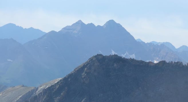
The views of Capitol, K2 and the Knife Edge in the background are breathtaking.
Rick P. did lots of route-finding, so our ascent time was slow (5 hours). On the descent we got everything right – 3 hours from summit to camp.
Views are everywhere. There is Snowmass Mountain, on the right, a fourteener on which my son Brett was my guide! That story is at: https://www.rickcrandall.net/snowmass-mountain/
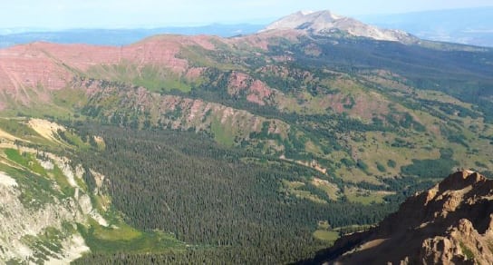
Mt. Sopris is in the distance – looking west showed beautiful weather, as it was on our mountain, but…
Looking east to the Maroon Bells (center) and Pyramid (far left) I saw a cloud pattern I knew would come our way and it meant trouble.
We took our photos, I sent my satellite summit message, ate quickly and headed down at 9:45am. Our weather was still great and the descent was super fun, but I kept my eye on the weather development to the east and hoped we’d beat it, at least to the Daly saddle.
By the time we got past the rock climbing and onto the final loose traverse to the keyhole, the storm clouds were gathering over Capitol.
You can’t see the relief on my face, but making it to the keyhole before the sky opened was major. We were only minutes from the Daly saddle where the trail down was very good in any weather but electrical.
We got to the Daly saddle at about 12:45. I shouted to Rick P. – take ALL your layers out of your pack and put them on NOW. This is the truth – not 60 seconds after we were suited up for weather, the sky opened – but not with rain, rather with intense graupel! Groupel are pellets like hail but more like snow.
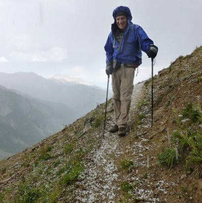
Big smile on my face 🙂
We headed down the good trail 900’ towards camp and our tents. Photos never show the severity of rain or hail, but we were getting pelted. However, we were warm, well-protected and literally giddy that we’d gotten to the good trail before the weather.
Also graupel is more favorable than rain – it’s not as wet, although it’s very slippery under foot.
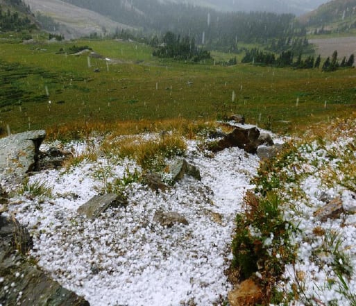
We got to camp only to find our tents covered – and the grounds were wet and got muddy as we walked in it. Just then the storm went electrical with big claps of thunder. Once again we didn’t care, we were down from up high.
We dove into our tents and proceeded to make a mess of stuffing everything into our packs. After about a half hour the thunderstorm passed. We took down the tents, stuffed them wet in our packs and merrily headed down the 2400’ and 6 ½ miles to our car.
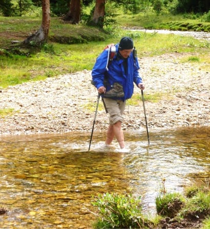
Halfway back to trailhead is the Capitol Creek crossing – boots off, freezing water from snowmelt, but the sun poked out. On the other side of the Creek we stripped down to shorts and tee-shirts for the rest of the hike.
The weather up high continued storming. We wondered how some others fared who we had seen at camp and aiming for Capitol. We soon had our answer. Rick P. heard a helicopter in the distance, and sure enough we saw it doing loops around Capitol. As we got closer to trailhead we ran into three Aspen Mountain Rescue volunteers who were hiking as backup if the helicopter couldn’t help the climbers. We learned they’d gotten across the knife edge but couldn’t or were too scared to come back in the storm. Today (Monday) wasn’t a good day for climbers:
One after the other: Two 14er rescues Monday
Mountain Rescue Aspen volunteers had been out of the back country for about 45 minutes Monday when emergency dispatchers received another call about stranded climbers on a nearby fourteener, officials said.
So two more teams headed out into the field to pluck two more ill-prepared, stranded hikers off another one of the highest peaks in the state, said Alex Burchetta, director of operations for the Pitkin County Sheriff’s Office.
This time, the hikers were on Capitol Peak, located near Old Snowmass, he said. The man and woman were stuck on the peak side of the Knife’s Edge, which must be traversed on the way to the Capitol Peak summit, Burchetta said.
“It’s snowing and thundering up there,” he said before the two were rescued
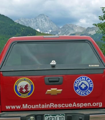
When we got back to trailhead at 5:15 pm, we looked back at Capitol right over the roof of the Mountain Rescue car – it didn’t look pretty.
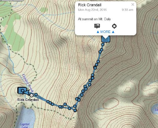
We’re always equipped for any condition, watching detailed weather forecasts before a climb and we’re always with our satellite GPS. The three Rescue guys on the trail thanked me for carrying a DeLorme which lets me send and receive texts and our location should a problem develop. It also sends our track in real time to a web site – shown.
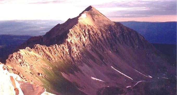
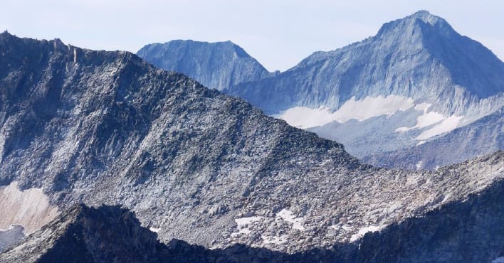
Here is a shot of the whole Daly south ridge taken from the summit of K2, the sub-peak I was on a month earlier that leads to the Knife Edge and Capitol. As you can see from the next close-up, while staying exactly on the ridge crest is the way to go – it’s definitely Class 3 rock climbing and exposed – each of the ups and downs on the ridge are 10 – 20’ high and it doesn’t ease until the yellow bit 3/4ths of the way up.
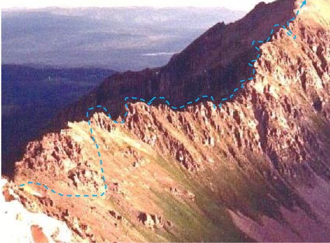
Close-up of the Daly south ridge with dotted blue line showing what we think is the best route.
As for us, we were thankful we had a great day of adventure, exploration and befriending another great mountain
I’ve now summited the pair – Capitol and Daly – and every other mountain I can see from my house including two other 14ers, Pyramid and Conundrum. I can remember fondly the entire way up all of them!