Difficulty: Class 3
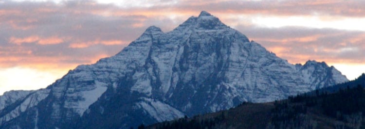
Summit Elevation: 14,042 feet
Elevation Gain: 3,500'
Round-trip Length: 8.5 miles and 11.5 hours.
Trailhead: Huerfano car-camp at 10,700'
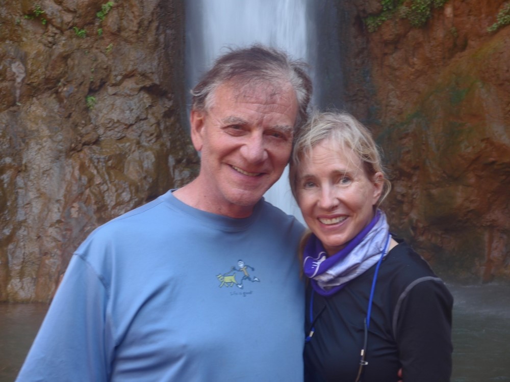
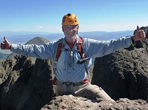
Climbers: Rick Crandall, Rick Peckham, Laura Welch Aug 16, 2011
This was our most arduous fourteener yet - 11.5 hours from trailhead and back to trailhead for reasons that are part of the adventure of this day. There are two ways up this mountain, one being a Class 3 rock climb to a Class 4 short vertical pitch with solid rock that avoided the steep, loose gully approach that some call the "shooting gallery" due to frequent rock fall and some danger if other climbers are on it before you are. At a minimum, helmets are imperative.
We rock-climbed all the way to the Class 4 wall, and despite Rick Peckham being ex- military para (chute) rescue, we voted not to try once we got up close and personal to it. That meant we had to Class 3 down-climb from the ridge and go up the gully approach - that probably added two hours and a lot of extra effort to the day!
It all started docile enough - we drove 4 1/2 hours the afternoon before to get to trailhead (nearest town is Gardner, CO, never heard of it) to set camp while we still had some early evening light. The setting took our breath away.

The road in was rough as usual, but our trusty 4Runner took us in with no hits to its skid plates.
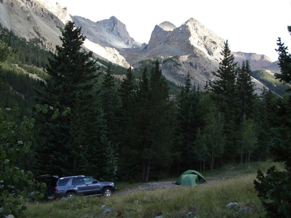
As soon as we set up tents, Laura went about organizing a feast she'd prepared for dinner, and Rick and Rick hiked around for dead logs and branches for our fire. Deer abounded on our way in and we'd passed two bears we hoped wouldn't pay a visit that night.
The weather forecast was for possible thunderstorms in the evening, with a hopefully clear morning and more thundershowers the next afternoon - that would mean an early start.
Laura, being the gourmet cook she is - laid out a feast that would have worked for any Aspen home gathering - but here we were in the middle of nowhere.
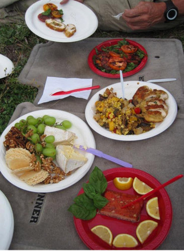
Le menu:
- Arugula and basil salad, heirloom tomatoes, extra virgin olive oil, creme de balsamic vinegar and black hawaiin sea salt
- Poblano stuffed chicken breasts, sliced with fontina cheese, roasted summer vegetables (egg plant summer squash and onions);
- St. Andre cheese and triple-cream blue cheese with grapes and honey-roasted walnuts
- Smoke salmon with lemon
- Open faced peach pie with oats and coconuts and streusel on top.
- Bottle of Lous Martini Cabernet
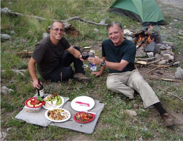
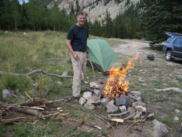
The fire-builders, Rick P. and Rick C.
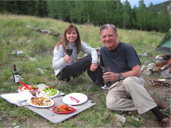
Laura the chef.
A good time was had by all.
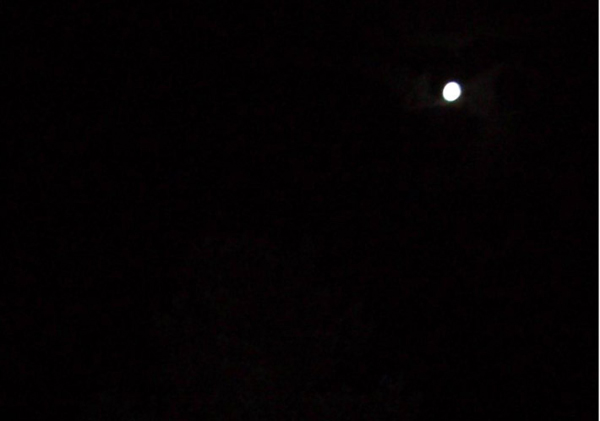
By 10 pm we were in our tents; the weather stayed perfect, still warm and ... a full moon to boot!
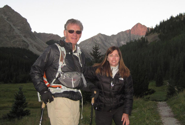
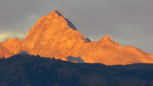
The next morning, the real adventure began. We were up at 5 am, we had a quick breakfast, the campsite was totally picked up and we were on the trail by 6 am - alpenglow was just starting to show on Blanca Peak, another 14er that might be in my future. Alpenglow is supposedly where the Sangre de Cristos (Blood of Christ) got their name.
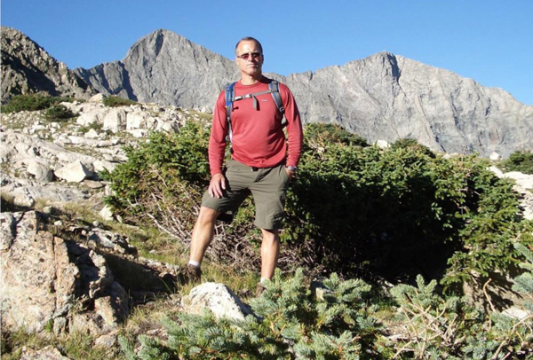
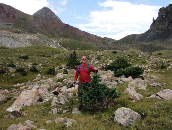
The weather looked great, but it was still early morning. After the first 1000' of vertical and a few miles we were in sun - and at tree-line. That's Blanca Peak and Ellingwood Point in the background - two other fourteeners in the Sangre de Cristos.
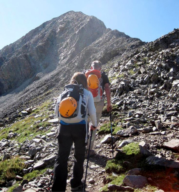
Rick C. and Laura nearing the approach to the real rock climbing - and a decision as to which approach to take towards the summit.
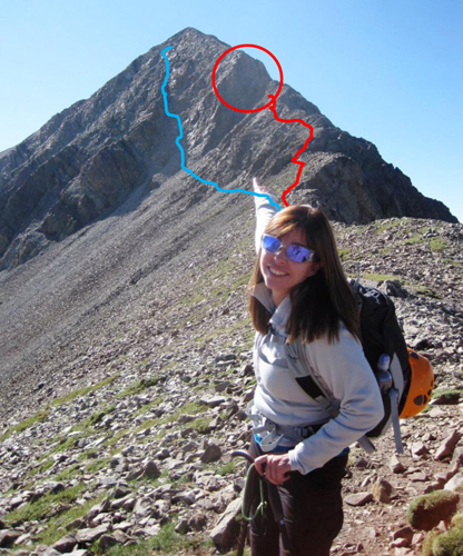
Here's the issue: The blue line is the easier route but ascends two steep north-facing gullies with very loose rock; to avoid that we first climbed the NW ridge marked in red - Class 3 scrambling, but we were worried about that Class 4 pitch encircled in red.
By the way - as we learned later - that peak is not the summit – it's a false summit and there's more to go when you get up there.
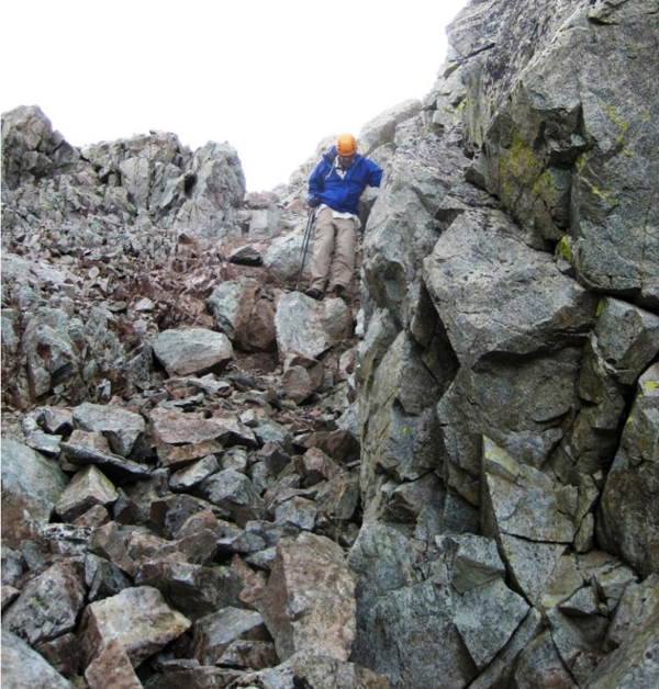
Rick starting the scramble up the NW ridge.
We got up on the ridge in front of the Class 4 pitch and not only did it look intimidating, we couldn't even figure out how to get to the base of it from where we were.
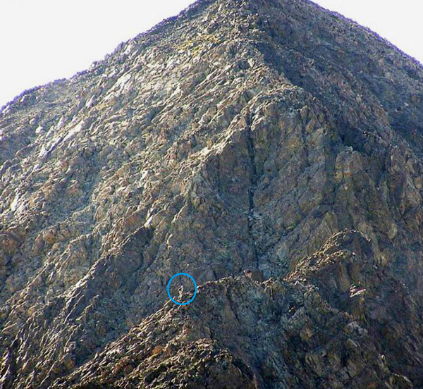
This is a stock photo, notice the climber on the ridge (circled in blue). Getting from there over to the base of the wall evaded us.
I've since researched what we didn't see, here's another climber's route report:
"BTW, we thought the hardest move was the jagged ridge before the crux wall. There is a nasty little exposed down-climb over a fin into a notch from which you traverse to get to the crux."
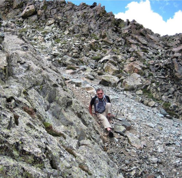
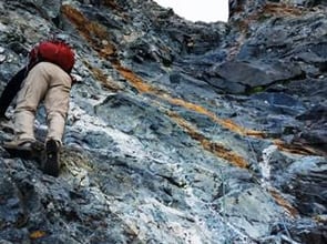
Well that wasn't happening, so after all that uphill rock climbing, we climbed back down to a small loose gully, and I skated down on one foot while braking with the other.
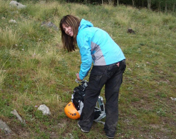
Laura took that section fully on her derriere - with attendant destruction to her posterior as I'll show later.
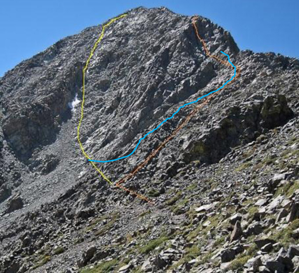
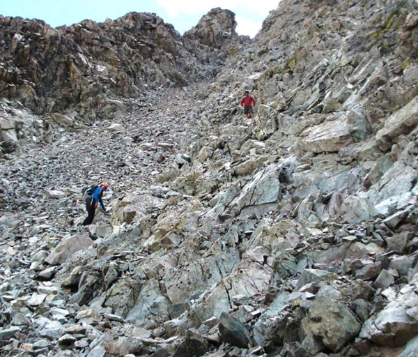
After coming all the way down the blue line through rock and gully, we were still determined to summit, even after staring up the main gullies - the yellow line is the route to the top.
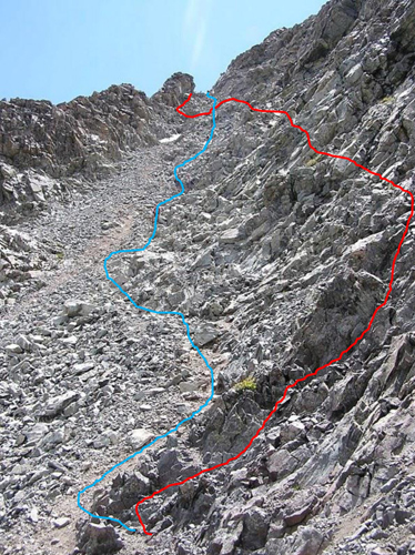
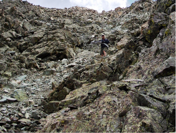
This was the first, main gully. I climbed up the rock wall up on the right side where I found solid rock on a fun Class 3 scramble (red line). Laura went up the right side of the gully (blue line) and met a few challenges which Rick P. helped with as it got steeper and looser near the top.
Rick P. (upper) and Laura (lower) headed up the gully
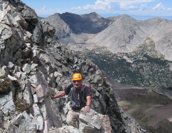
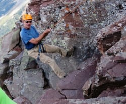
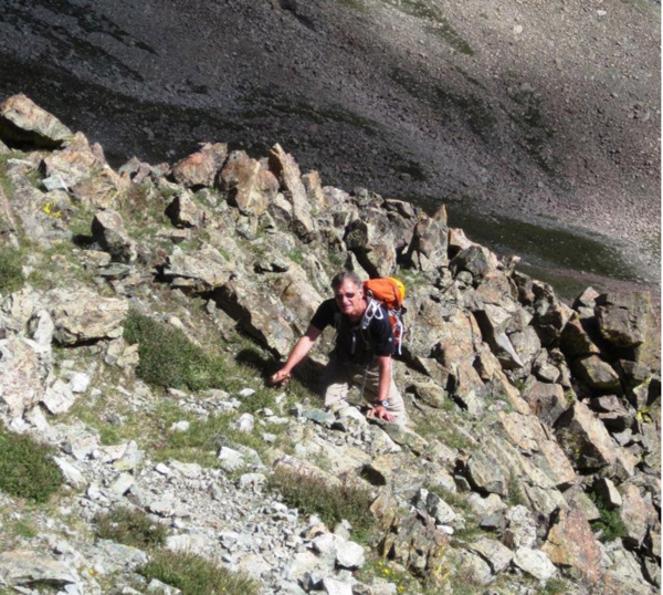
Rick C. avoiding the gully, climbing up the side.
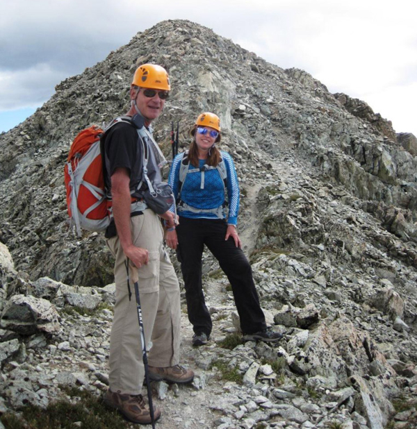
Rick C. and Laura at what we thought was the top, but turned out to be a false peak - an easy path to the real summit leads up behind.
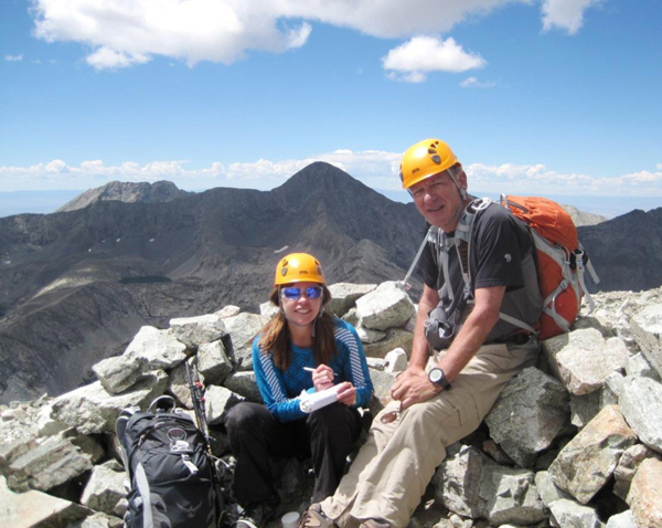
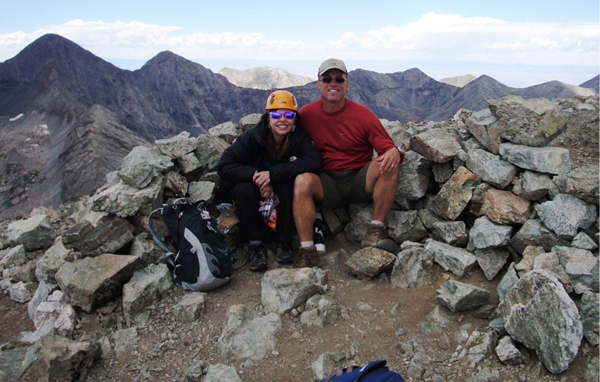
Summit Mt. Lindsey 14,042' at 12:10pm (above, Laura signing the log)
The weather looks good, right? WRONG! I looked to the left and up - and that cloud is not a good sight when you are on a 14,000' summit, plus you have to cross a false summit to get away from exposure. This menace had another worry - going down those steep gullies and rock when wet was not a happy prospect.
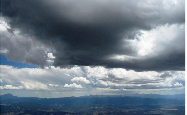
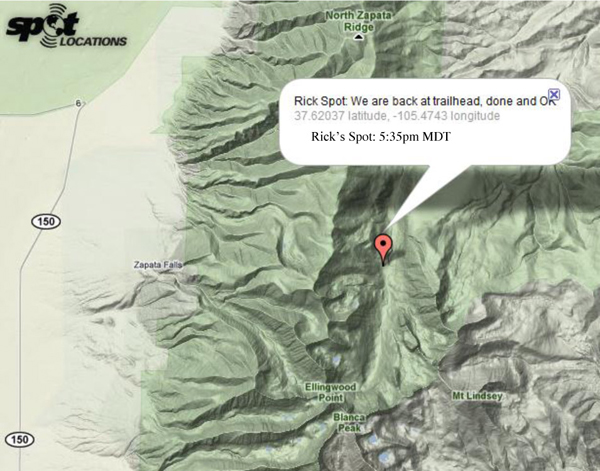
I pushed the "I'm OK" button on the SPOT GPS transmitter, and then turned to Rick and Laura and said, "Put your sandwiches away, we're getting out of here as fast as we can!"
We got over to the false summit and started down the top gully and I felt a few drops - so we put on our rain gear and headed down.
Rain was bad, but hail was worse because it made everything slippery under-foot like greased marbles. I was almost ready to declare that we seek cover and ride it out, when magically it stopped!
We got near the bottom of the lower gully and Laura realized that when she was skidding down the smaller gully on the earlier down-climb she'd lost her white sweater. Amazingly we spotted it, so Rick P. summoned energy we didn't have, scooted up and got it.
Then I was amazed to get a call from Pamela on my cell phone, which I'd inadvertently left on. She was all nervous because it had already been 8 hours since she got the Spot message from the trailhead and had not gotten one from the summit. Good that the mobile call went through because they were ready to call Mountain Rescue. I figured out what went wrong - we got off the summit really fast and coming down the North face didn't allow the Spot to see the satellite so the summit Spot never went out - that points out a problem with the Spot service.
Anyway, we hauled down for hours on all the switchbacks, ridges and rocks - finally reaching tree-line where the trees are miniature.
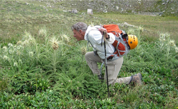
We'd been hiking and climbing for 10 hours by the time we hit the valley floor, with another 1 1/2 hours to go. Our legs were feeling it and we were hungry. I got a little giddy - convinced the wild looking thistles were from The Little House of Horrors ... that's me yelling "Feed Me!"
4 pm and still hiking.
.. and then the rains came for real, but we were close to the trailhead feeling very lucky about missing the bad weather at the summit.
Oh yeah and a promised look at Laura’s “back” from all the gully slides 🙂