
Difficulty: Class 3
Exposure: Significant
Summit: 14,156 feet
Elevation Gain: 4,800 feet
Roundtrip: 12.00 miles
Trailhead: Maroon Lake at 9,600'
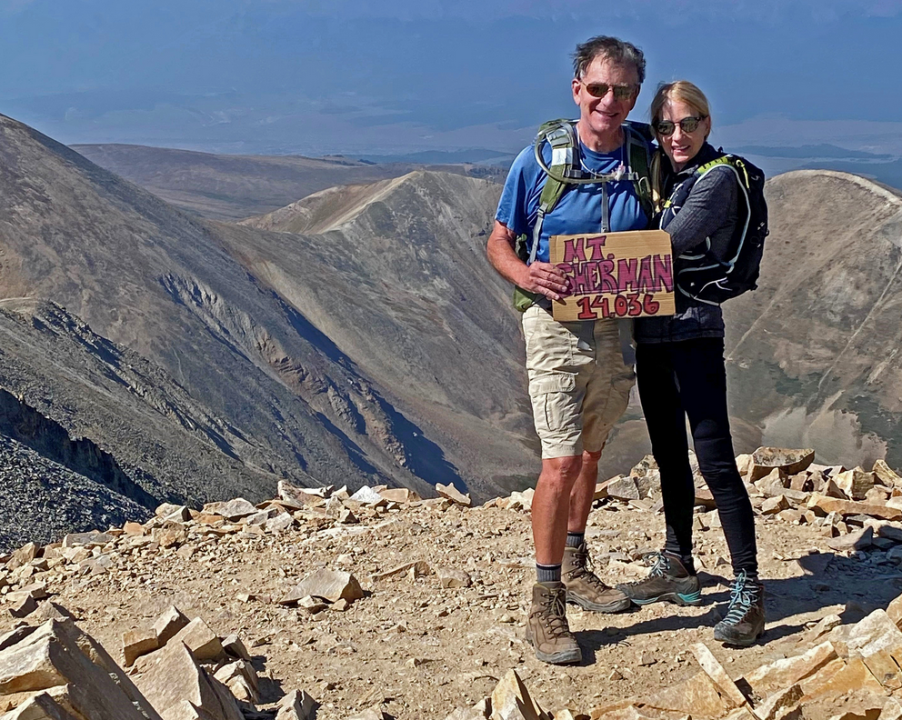
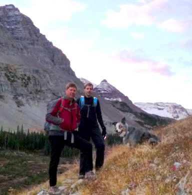
Climbers: Rick Crandall; Rick Schultz and Andy Mishmash with his dog Stormy Oct 11, 2012
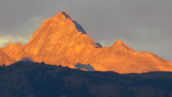
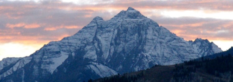
Undoubtedly, the Maroon Bells are Colorado's most recognized mountains, and they are often cited as the most photographed mountains in North America. These peaks are stunning to look at. It's that simple. Nothing beats their pyramid symmetry framed inside the gorgeous Maroon Lake u-shaped valley. It's why over 250,000 people visit these peaks in the 4 1/2 month season per year.
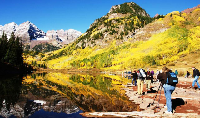
Hundreds of photographers arrive at the north side of Maroon Lake each Fall to capture the exact moment when the Aspen trees are at peak yellow, the sun rises to eliminate the shadowing on the pine trees on the left, the lake is an undisturbed mirror of the peaks, and the first snow up high has filled the angled ledges on the Maroon Bells. That usually happens at about 9 or 9:30 am before the wind picks up and stirs the lake surface.
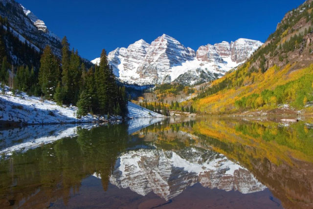
This is about as perfect as the shot gets (taken a few years ago) when all conditions are met. The left (actually higher but further) peak is the main Maroon Peak and the sister peak to the right is North Maroon.
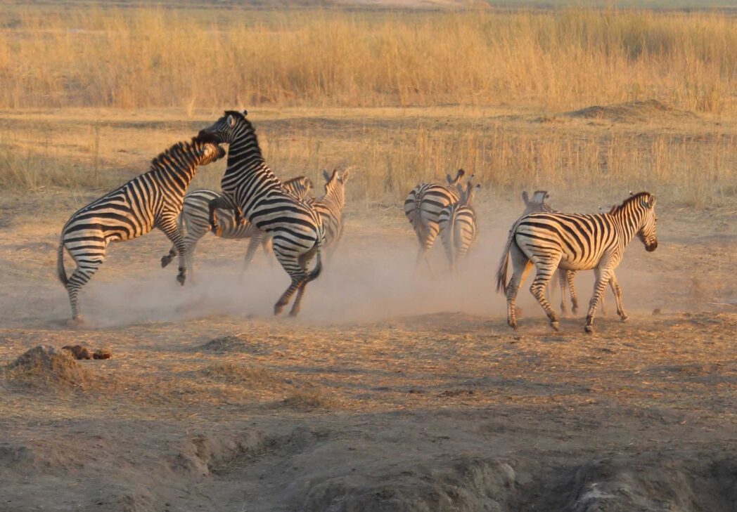
The Maroon Bells are fourteeners in the Elk Range near Aspen. The Maroon formation is made up of iron-stained siltstone forming the brilliant blood-red colors of the Bells and Pyramid Peak.
Having finished my climbing season with the memorable ascent of Pyramid Peak in mid-September, I was busily dealing with other priorities. It had not escaped my attention that after an early snow, there had been weeks of sunny weather and even up high the snow was receding. Then I got a call from friend and expert technical climber Andy Mishmash: "If the weather holds one more day, I think we could sneak in one more climb!" Now that was intriguing, especially since we'd tried to plan a 14er climb weeks earlier with friend Rick Schultz (the Autograph Source in Aspen) who had never done a fourteener but is a fit and avid cyclist. I looked up the weather and saw that a major front was coming in from the West but a high-pressure ridge was holding it off until the next evening, leaving a small window of exactly the next day to go for it.
The three of us quickly decided to go for Maroon Peak.
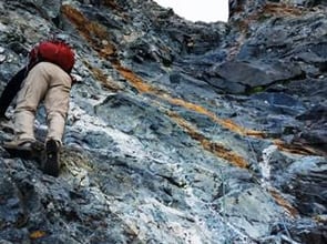
If you read the Pyramid climb story (see: /pyramid-peak-a-dream-climb-2/ ) then you know all about the Elk Range being notorious for their loose rock and dire warnings, in fact being named "The Deadly Bells." While Maroon Peak is rated Class 3, that doesn't begin to describe what happens if you go even a little off route, nor does it describe the approach grind up the steep South slope with its 2800' vertical gain up loose rock, sand and "marbles."
Here's what the Summit Post has to say: For Maroon Peak, I would describe the South Ridge Route as a strenuous exercise in route finding and determination. The route is only Class 3 but it is long and steep. For most, the route will take maybe 9 to 11 hours to complete. Please understand your physical limits. Everyone will respect you for turning around as much as they will respect you for making a summit.
I wasn't worried about route-finding. Andy spots his own routes based on safety and enjoyment, and he's summited the Bells nearly a dozen times.
We knew this 12 mile route was going to be a long day (although we didn't figure on 15 hours) so we agreed to meet at the Maroon Lake parking lot at 5 am. There were no other cars in the lot; we were going to have the mountain to ourselves!
This time of year that meant we were hiking for two hours in the dark with headlights under a starry sky. Andy showed up with his amazing dog Stormy, a 9 year old Australian Shepherd who has done many surprising climbs, even Class 3 & 4 mountains (see: Wetterhorn at /wetterhorn-peak-a-class-3-4-adventure-with-andy-mishmash/ )

Andy and Rick S in pitch black. No worries about bears - they were already down in Aspen town foraging since the berries were already gone in the higher elevations. Andy did have to keep Stormy away from a porcupine he spotted just in time.
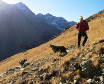
The first part of the day was a 3 1/2 mile hike up past Crater Lake, and then along West Maroon Creek, about 900' of elevation gain - not much compared to what lay ahead. This is the start of the popular summer hiking route to Crested Butte.
7:15 am dawn breaks. Andy,
Rick S. and Stormy (right).

The next leg of the route leaves the valley and heads up one of the biggest grinds of any fourteener, the slope to the South Ridge. As one route description states: The South slope is steep and gets steeper as you go-and the upper portions are covered with a hideous mix of loose rock, loose dirt, and ball bearing scree. It’s one of the tougher obstacles on any of the 14er’s standard routes. The elevation gain on this leg is 2800' in just 1.5 miles.
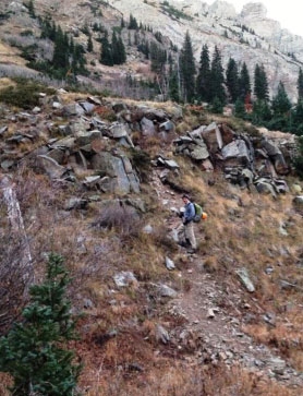
Left: Rick C. starting the South slope
Above: Andy pushing up the endless slope

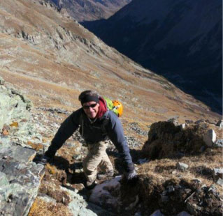
More South slope: getting rockier, looser and steeper ...
Andy and Stormy patiently waiting for my final trudge to the small saddle which ended the South slope trek.
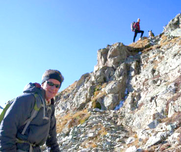
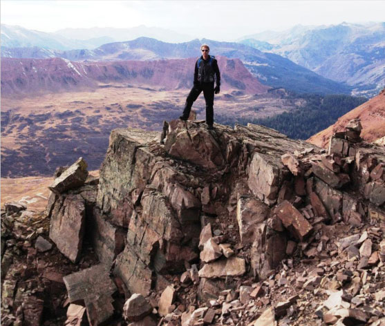
Finally we reach a small saddle on the South Ridge near 13,250'. As the standard route comments say: "Conquering the South Slope is a major achievement, but now the more technical terrain remains. If the weather is brewing or you have some very tired party members, the saddle is a good place for a decision on whether or not to proceed. If you aren't speedy, plan on 2 or more hours to reach the top – then there’s the descent (and I'm definitely not speedy).
Rick S. at the small saddle, gaining the South Ridge. The time was 10:30 am, weather holding nicely, but it was obvious this was going to be a longer day than planned.
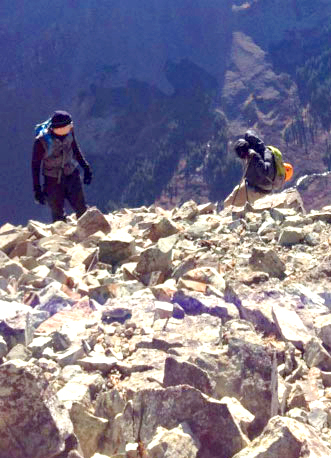
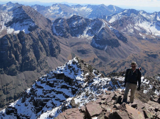
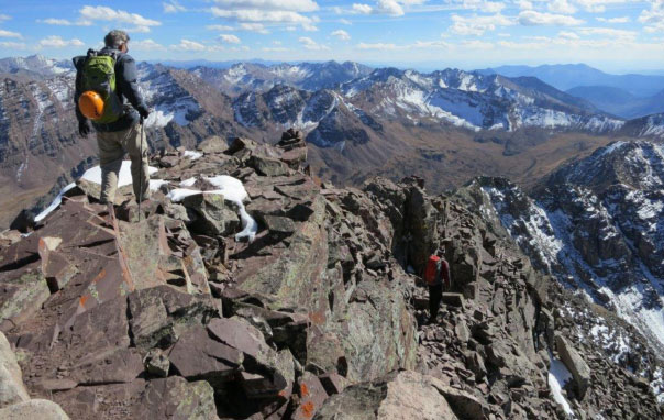
Now it gets interesting. The remainder of the way up is a climb, mostly Class 3, maybe a few short Class 4 moves, but lots of traversing across the Bells' classic ledges that collect the snow and make for such photogenic peaks.
Andy starting the lead. Only parts of the route can be seen. The goal is a lot further away than it looks in this photo. The route shown is his, the last third deviates from the standard route by climbing right up to the approach ridge avoiding a less steep, but a very loose, ugly gully.
At times we encountered very strong winds (almost blow-you-down force) which we had seen in the past few days in Aspen. They were the leading edge of a major weather front coming in. We looked up and saw clouds racing along at high speed, which portended strength at the ridges and summit - you get that often at the higher reaches of fourteeners.
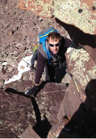
Rick and Rick heading across.
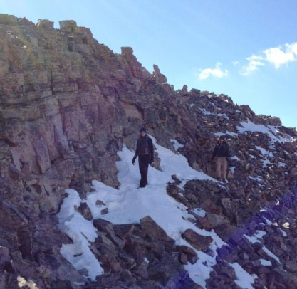
We had occasional snow under foot, but it was soft and we were able to make steps that held as we crossed. We brought kotulas (under-boot pull-on short spikes) but found no need for them on this day.
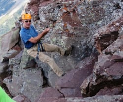
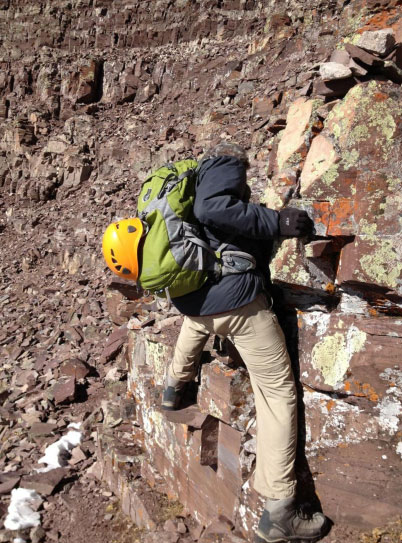
We had several chimneys to climb - fun Class 3 action. We never donned our helmets - there were no other climbers on the mountain; we didn't even see goats nearby, so no one to kick rocks down on us.
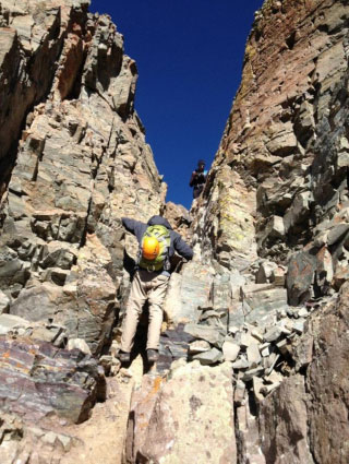
Rick C. (orange helmet) and Rick S. going up a chimney.
The rock was stunning with all of its colors, clearly not granite, but rather the compressed mudrock, unstable and falling apart.
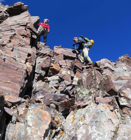
Then we got to the ledges to move across the face towards a major gully that would lead us to a false summit: Point 13,753'.

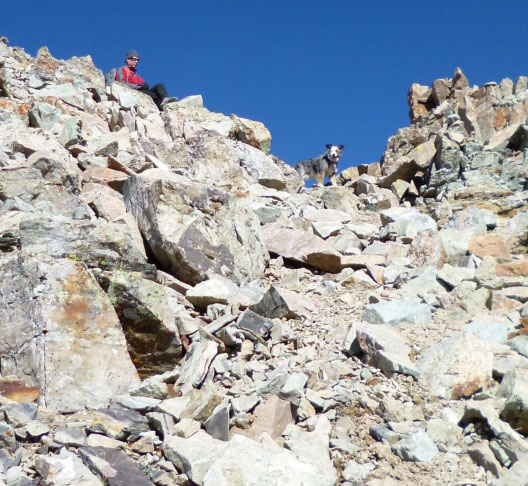
Andy with Rick S. standing on a ledge with beauty all around and pointing to the next phase of the climb.
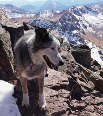
Stormy was best equipped for the ledges - four feet and claws - she was climbing this mountain like a mountain goat.
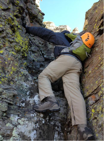
In some places the ledges got a bit narrow and exposed, but there were always good handholds, however we tested every rock before putting pressure on it.
The headless climber is Rick C., bent over to spot the next move.
Here's Andy and Stormy leading the way across the ledges.

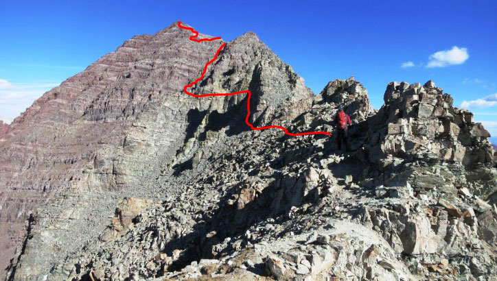
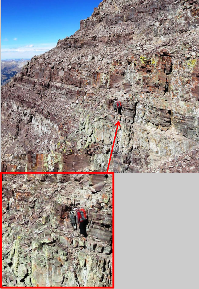
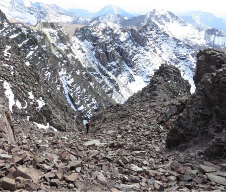
Photo#16: After rounding a corner, reach a couple of steep, loose gullies between a ridge point and Point 13,753′. This is a dangerous area.
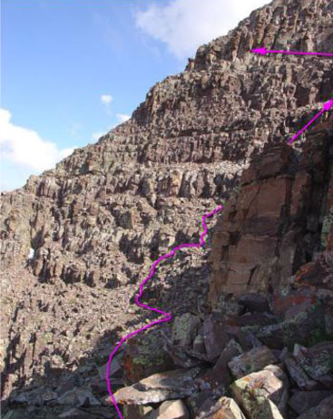
Finally we got to the gullies leading to the upper ridgeline. The magenta lines in the stock photo are the "standard" routes which cross well below the upper ridgeline and lead to another very loose, junky gully that we avoided with Andy's alternate route shown in red. We climbed the first gully all the way to the upper ridge and traversed right over Point 13,753 - it was way cool up there.

Rick S. part way up the major gully. This picture gives some idea of the challenge, but it was actually an OK hike up. Rick C. is the dark blotch below to the right picking the way up in the rear.

Here's Rick C. exiting the top of the gully - you can see how loose and steep that gully is, but we stuck to the left side and had solid rock to hold on to even when our feet were slipping around.

Hiking the upper ridgeline at the false summit.
We got to Point 13,753 at 12:07 pm and we still had more down and up-climbing to get to the real summit, so clearly we were trekking an hour or more later than the plan. But look at how glorious this is - weather is perfect, the wind disappeared, and that is none other than Pyramid Peak to the left of my head that we'd summited just a month ago!
We were going to be late, and Andy asked me if I was up for continuing. I didn't care if we got back in the dark; this was too good to miss!
We down-climbed a bit from the false summit and then went for the final pitch to the real summit.
We passed under some cliffs to reach the last bit of steep terrain just 200' below the real summit.
Oh yes, we were approaching the summit!
The wind disappeared - just for us!

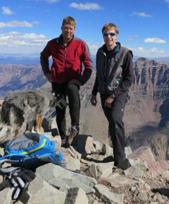
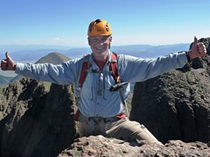
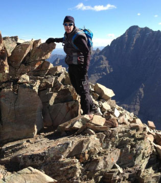
Summit Maroon Peak 14,156'
1:05 pm October 10, 2012
8 hours, 6 miles and 4800' from trailhead

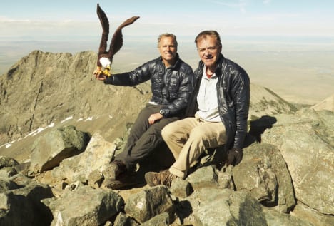
Andy lugged up a bottle of Champagne for our celebration ...
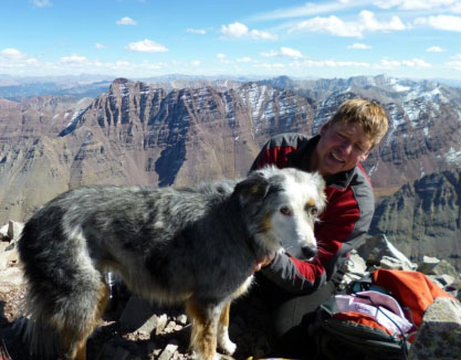
Stormy at the summit - What a dog!

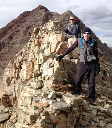
Rick and Rick enjoying the summit. C'mon, this peak is worth a bunch of photos!
Andy spotting his house in Missouri Heights.
The views were awesome.
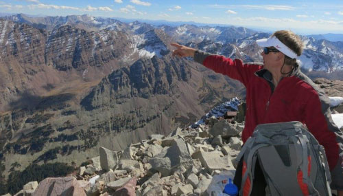
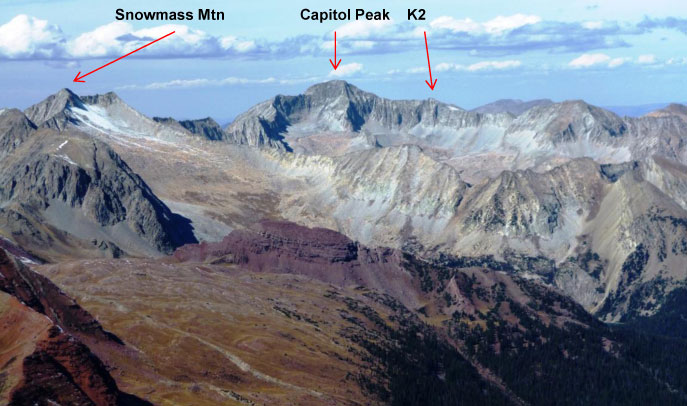
Looking west - there is the clearest view of two other heralded fourteeners, to the left is Snowmass Peak (not the ski mountain) and front and center is Capitol Peak and it's famous knife edge approach from K2, a named thirteener.

Looking East - there's Castle Peak on the upper right and Mt. Hayden to the left of center. In the far distance, center of the photo is Mt. Princeton, the iconic fourteener in your face in the town of Buena Vista. The foreground ridge leads to Pyramid Peak off-screen to the left.
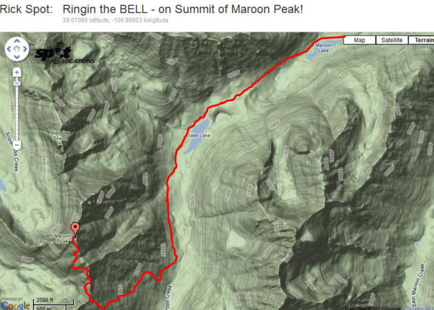
SPOT GPS terrain map of our route.
Well, we were gawking, eating, drinking and basking in the ideal conditions; meanwhile Andy was worrying about how long we took to summit and how much longer it was going to take to get back down. We had a very long way to go. So at 1:50 pm we bid adieu to a magnificent place, and headed down.
... down the messy gully ...

... across all the ledges...
Oops, I forgot to tell you that the Maroon climb had a "leap of faith" cut in the ledges that needed to be jumped - a smaller version of the one on Pyramid!
Rick Schultz admiring the beauty on the way down.
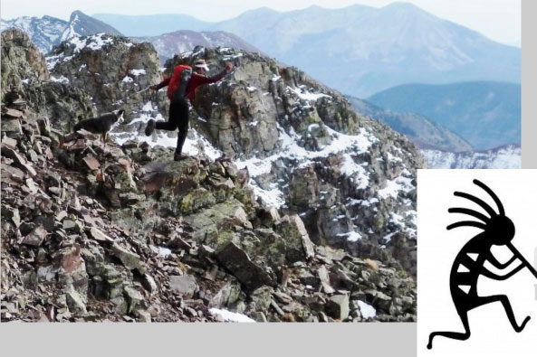
Andy in his Kokopelli pose -
homage to the mountain.
At 4:20 pm we put Maroon Peak behind us, but we still had a long way down - 2700' down that long, steep and loose slope, then another 3 1/2 mile hike to Crater Lake and then down to the Maroon Lake parking lot.
At about 6:30 pm we lost the sun and by 7 pm we had our headlights back on. Both Ricks had run out of water and Andy had sacrificed his own drinking to leave a few cups of water for us (mainly me) to sip very sparingly as we headed down. We did walk along the creek for a while, so Stormy drank, but we humans wanted to avoid giardia. I had purification pills but they take a half hour to work and we wanted to haul.
We got to the parking lot at around 8:30 pm, 15 1/2 hours after we started. When in peak summer shape and with more sleep I probably could have chopped about 1 1/2 hours from that time. After all, Percy Hagerman, who made the first known ascent of Maroon Peak on August 25, 1908 did it in 11 hours but he rode a horse the first 3 1/2 miles up Maroon Pass trail, and only then proceeded on foot up the peak's southwest face!
When we got to the parking lot we dashed for the water fountain, but it was already shut down for winter. Despite our lateness, somehow 3 minutes after we arrived, Rick's wife Tricia drove in with window down announcing "Anyone want a slice of pizza and some water!"
At first I didn't see that it was Tricia and my brain couldn't process who would be delivering a pizza at Maroon Lake that is 8 miles up from town. It was a great and surprising finish to an unforgettable day


Morning alpenglow on the Bells - from another day.