Hayden Peak; North Hayden; South Hayden (finding the way) August 9, 2015
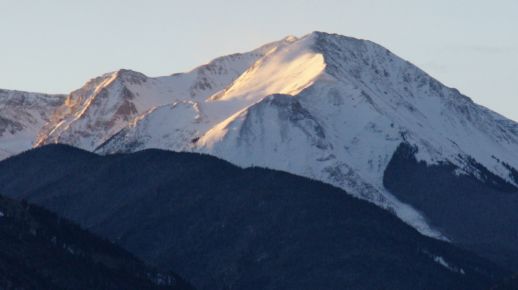
Hayden Peak 13,561 feet
South Hayden 13,540 feet
North Hayden 13,316 feet
Hayden Peak, a “named” thirteener, is another big mountain I see from our home every day. I’ve felt I “have to climb it” someday, but I could find no specific route instructions from anyone including Mountain Rescue, the U.S. Forest Service or the Internet.
The Haydens are located in the Elk Range surrounding Aspen. They are just north of Electric Pass and northwest of American Lake which is a popular Aspen hike destination. The confusing thing about finding the way to Hayden is that it is actually three peaks. There are several more along a ridge, including Electric Pass Peak that is even higher. This story is about figuring out which peak is Hayden and how to get there. As you’ll see, my respect for the early explorers of these peaks has risen dramatically – they must have done a lot of wandering and map-drawing since once you get in amongst these big peaks, nothing makes intuitive sense.
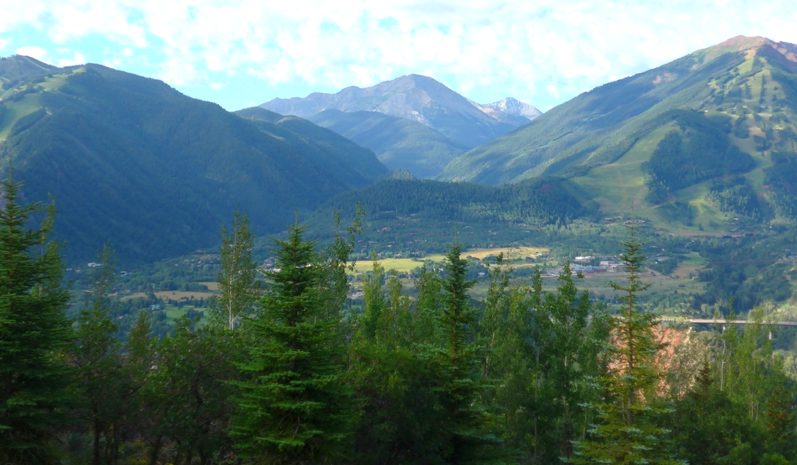
The best known of the three Hayden summits, and the one so visible from Aspen, is actually the shortest of the three. It is North Hayden which is also called “Ski Hayden Peak.”
Ski Hayden Peak was very close to becoming Aspen's developed ski mountain! During the late 1930s, a group of investors (Billy Fisk, Ted Ryan, Tom Flynn and others) built Highland Bavaria Lodge on Castle Creek at the base of Hayden Peak. They hired Andre Roch, a ski-area engineer and famed French mountaineer. Roch and his assistant named "Ski Hayden Peak" the best mountain for skiing in the area. The combination of World War II and Fisk's death interrrupted the investors' plans and afterwards Roch settled on the more readily-accessible Aspen Mountain. A chair lift went in and Aspen Mountain was born.
Closer view of North “Ski” Hayden. It is one of the most imposing mountains seen from Aspen. The other two Haydens are hidden behind. Presumably the big bowl (sunlit) looked attractive for a ski resort.
We saw a one-day reprieve from the frequent stormy weather in this summer of 2015, which is not enough time to camp and climb a remote 14er but enough time to explore the Haydens as a preparatory exercise event in anticipation of the more difficult fourteener summits ahead in August and September.
Dr. Ferdinand Vandeveer Hayden
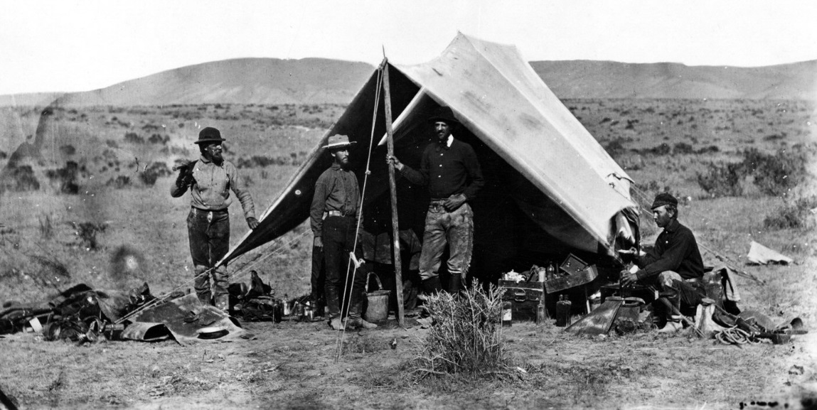
Dr. Hayden was a geologist who pioneered surveying expeditions of the Rocky Mountains in the late 1800’s. In 1871 at the age of 42, Hayden led a survey into the Yellowstone region and was instrumental in convincing Congress to establish Yellowstone as the first U.S. National Park.
Camp of the Hayden Geological Survey, 1871 by William Henry Jackson.
Camp of the Hayden Geological Survey, 1871 by William Henry Jackson.
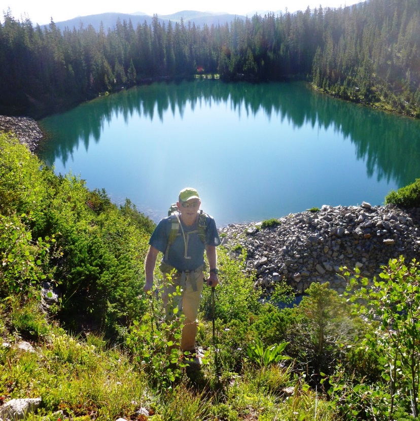
Ever mindful of the unpredictable weather, we started early at 5:45am hiking on the popular 3 mile trail to American Lake from trailhead at 9300’ to the Lake at about 11,300’ about 2 hours.
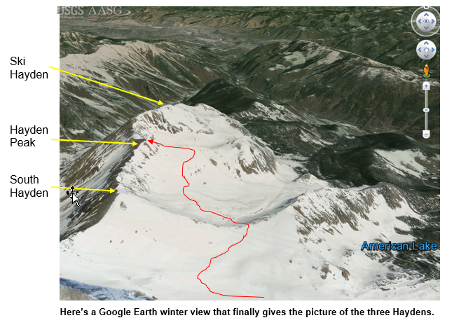
If you translate the brief comments from the USDA’s Aspen Ranger District note on Hayden, you would conclude the above, as I did in my first attempt last year. I now know that the above labeling of summits is wrong. The summit labeled Ski Haydon above is actually Haydon Peak.
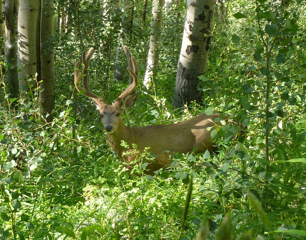
A handsome buck mule deer on the way to American Lake
A handsome buck mule deer on the way to American Lake
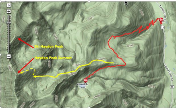
Once at the Lake, walk along the near (west) shore all the way to the end and then head up steeply along occasional trail segments.
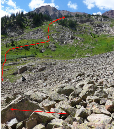
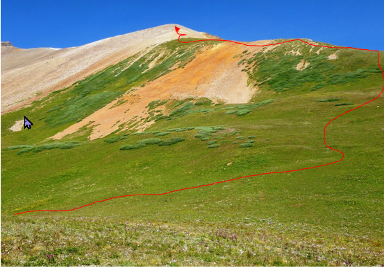
You’ll eventually top out above a boulder field which can be skirted on the left. Head towards the rise (red arrow) that will give access to the bowl we thought was the target.
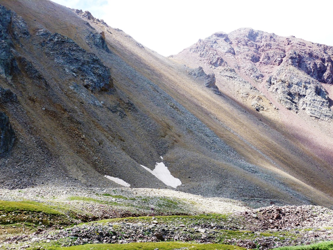
Once atop that rise, an impressive bowl opens up. So which peak is Hayden? All three Hayden peaks have rounded tops and that center-right peak (above), while high, didn’t qualify.
Panning across the bowl, that peak on the far right looked good for Hayden, so we proceeded to cross the bowl.
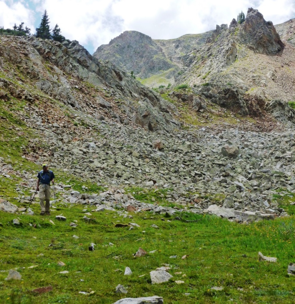
The bowl is huge, but not hard to cross. We aimed for the far ridge that would give easy hiking access to the Hayden summit, as some comments we’d read previously had indicated.
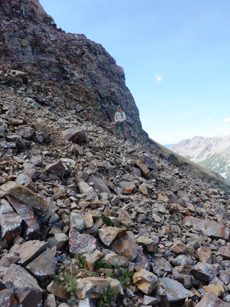
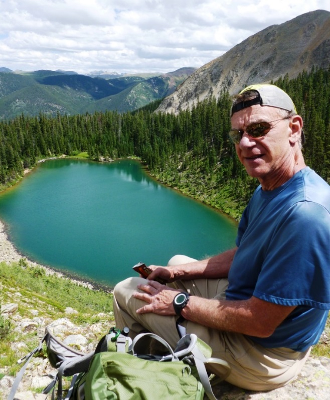
11:15 am, on the summit looking down and back at the way we came.

However we were not ready to declare victory since we looked to the south and saw a higher peak. We also saw a ridge-path that seemed to head towards it (in red). That mountain looked nothing like what Hayden was supposed to be but Rick P. got summit fever and so off we went down to the saddle and up towards that peak. When we got to the steep rocky bit beyond the saddle, we found very loose, exposed and dangerous conditions and so we turned back. Hayden is a walk up, I figured this couldn’t be it.
I decided to head down, actually skating down the very loose slope that would make great skiing in winter but not such fun in summer (yellow line).
Rick P. was determined to check out that summit so he actually crossed the steep scree field and clawed his way to summit (green arrow).
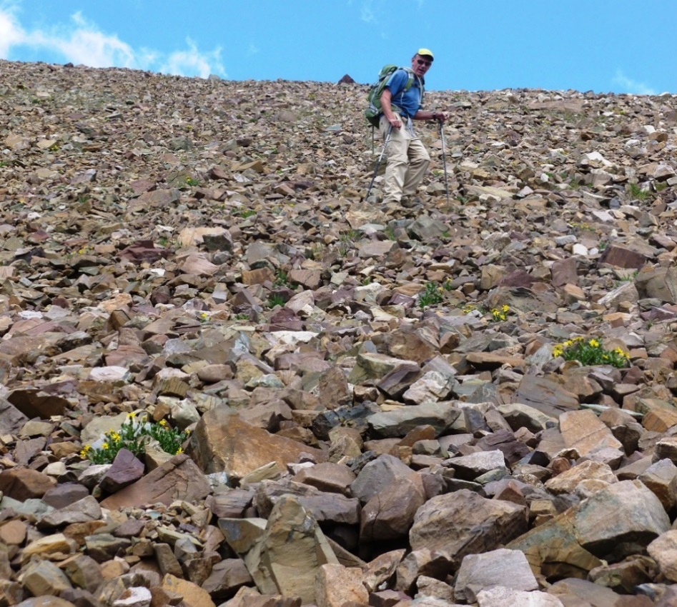
Rick C. coming down the loose, rocky slope.
Rick P. crossing to head back up to the mystery summit.
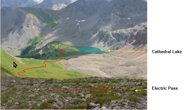
About an hour later, we linked up again and Rick P. described what he saw on the other (west) side of that summit – those of you familiar with the area will recognize that is Cathedral Lake and the well-marked path (red) is the route to Electric Pass. Rick P. had just summited Electric Pass Peak, another 13er that at 13,635’ is indeed higher than Hayden!
Haydens!
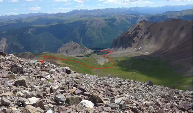
Getting South Hayden was good enough for me, there’s only a 21’ difference between the peaks and we’d finally sorted out which peaks were what. As for route info, to get to Hayden Peak you’d need to cross over the ridge that we took to the South Hayden summit and cross another whole bowl as shown in red. Without overnight camping at American Lake, it would be a very long day.
By the way, for those of you thinking of it, the ridge from South Hayden to Hayden Peak did not look good at all. The ridge from Hayden Peak to Ski Hayden is reportedly a good Class 2 (rocky) hike.
So we achieved our day of experiencing a very small piece of what “surveying” must have been like 145 years earlier. We headed back to the Lake. The rest of the day was perfect weather and, of course, nothing like the hardships Dr. Hayden must have experienced.
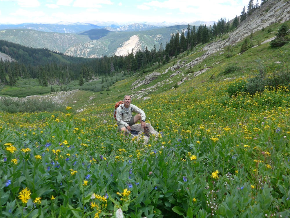
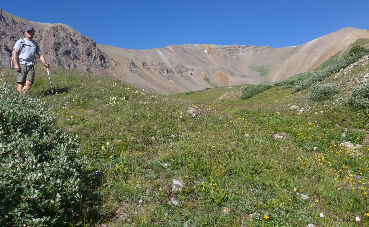
Despite this being early August, there’s been so much rain, the wildflowers were
still abundant and easily as impressive as the well-known hike to Crested Butte.
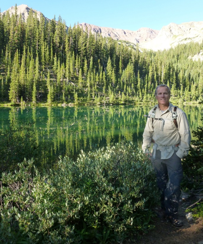
Back to American Lake and the final 1 ½ hour march down to trailhead.
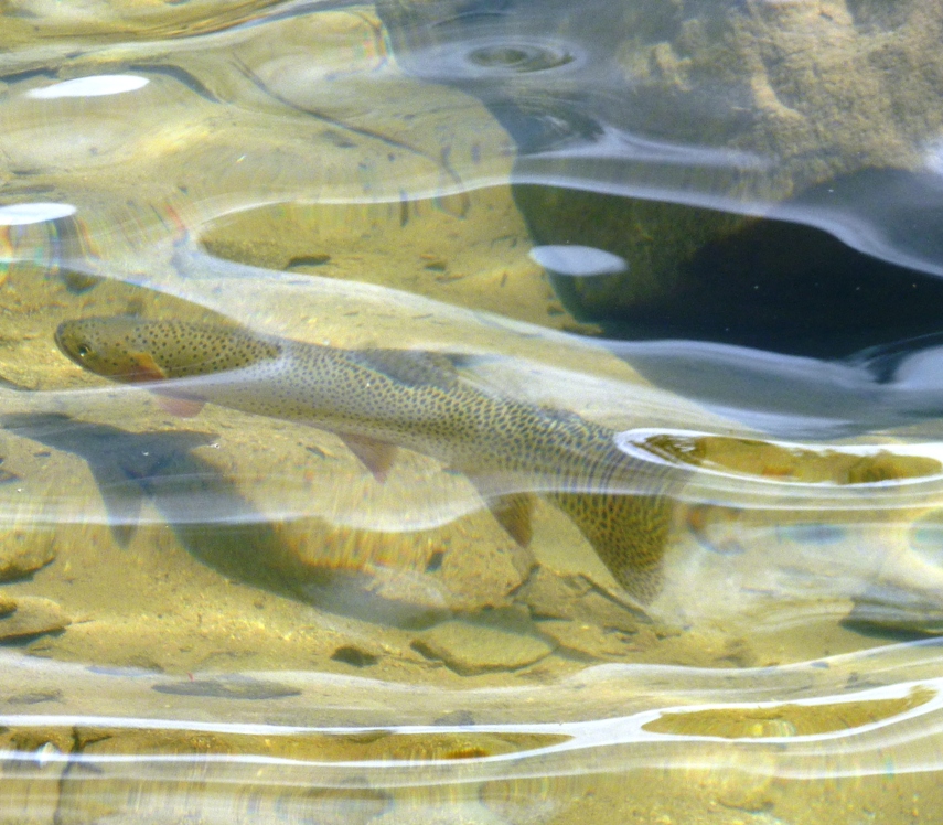
There are fish in the Lake – this is surely a trout of some kind.
We got to the car at 4:15pm which made this a 10 ½ hour day of wandering around Colorado’s finest gems – the mountains, the bowls, the flowers and the animals.