
Difficulty: Class 2 with one Class 3 pitch
Exposure: None
Summit Elevation: 14,067 feet
Elevation Gain: 3150'
Roundtrip: 5.25 miles
Trailhead: Missouri Gulch at 10,950'
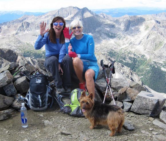
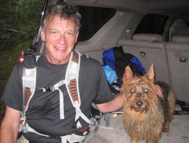
Climbers: Rick Crandall, Laura Welch, Shari Applebaum & Emme, the Australian terrier August 28, 2011
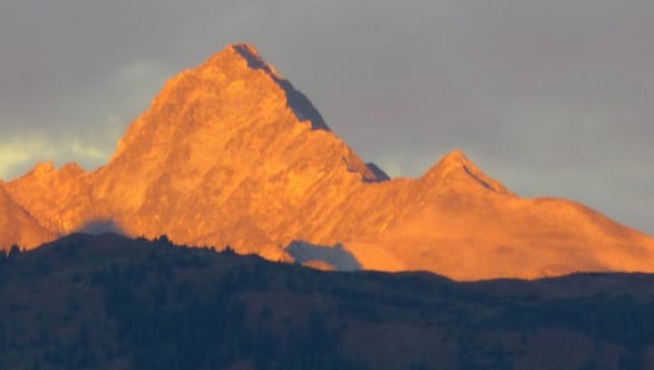
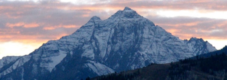
Missouri Mountain is located near Buena Vista in the Collegiate Peaks in the Sawatch Range. We decided to go for Missouri mainly because Laura is in part a Kansas City girl - we had no hesitation despite the July deaths on Missouri of a Boulder doctor and his daughter, both experienced hikers, at about 12,000'. The Colorado fourteeners do claim lives each summer - it's not clear whether the prevalent reasons are over-confidence, a loose, untested rock or just bad luck.
For weeks the weather in Aspen and surrounding areas including Buena Vista has been following the daily monsoon pattern of clear in the morning and rain clouds gathering just after noon transitioning to electrical storms later in the afternoon. We were getting tired of waiting and so decided to make an early morning start with an estimated summit at 11am so we could be off the high terrain by 12:30 or so - getting wet is not the problem, getting electrocuted is. Although as we learned, wet rocks are no fun either.
Shari is a new fourteener climber, this was to be her second - but she's fit and braver then the average bear - she's a photo-journalist specializing in the insanely rough locales in the Middle East and elsewhere, for example, including Yemen, Pakistan and North Korea. The chatter on the climb got really interesting. For me it was like listening to a CNN review of badass areas in the world. My own radio station on the hike!
We decided we didn't need to overnight anywhere - instead we met at 5 am in Aspen and drove over Independence Pass in the dark. Research had warned us that the approach road to the trailhead required high-clearance, short wheelbase 4WD vehicle ... and then there were two significant water crossings, especially with the volume of recent rain storms. They weren't kidding and my driving took a half hour longer than I'd planned to get to the trailhead. We began at 7:30am instead of the 7:00 am plan.
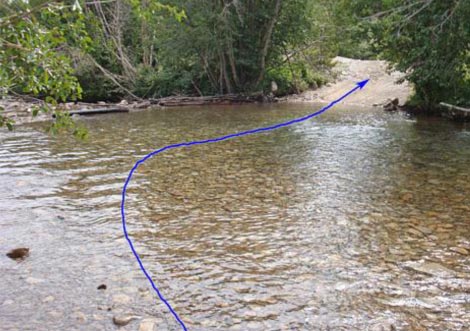
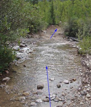
Long stream crossings, our 4runner was a boat!
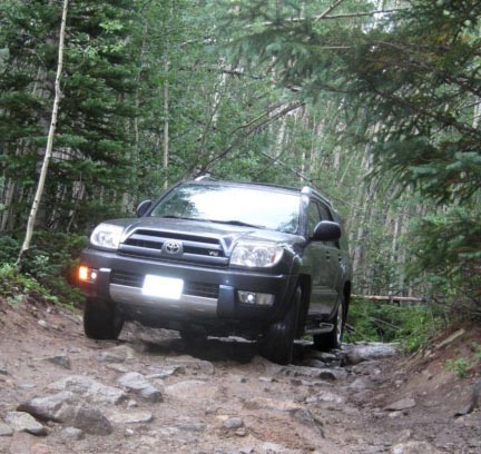
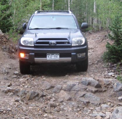
The road was a killer - I couldn't get out to photo the really big ones but these shots should give a feel - 3.1 miles of it that took forever.
We left the car, started hiking a bit of flatland, but too soon we headed uphill - no nice long, level meadow to start the day - just immediate elevation gain which never stopped. That woke us up from early morning stupor in a hurry.
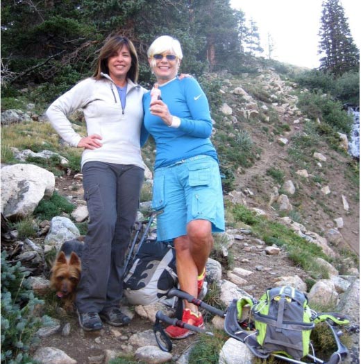
Laura (left) and Shari (right) while still below tree-line.
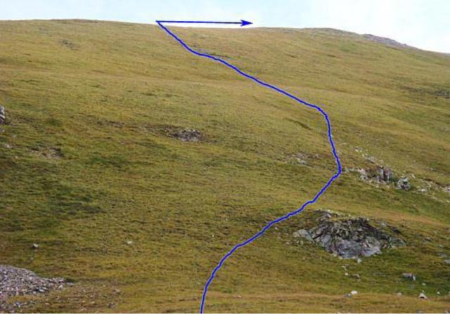
After about 1000' of elevation gain we emerged out of tree-line and headed up a long, broad, grassy slope to reach the crest of the west ridge. All trail elements disappeared, so we just bushwhacked, assuming the mountain was up to the right somewhere.
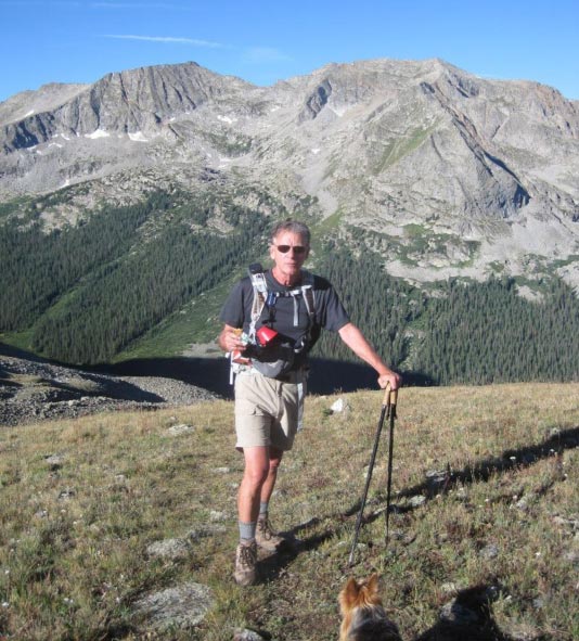
At 12,400': Rick munching on an energy bar, weather still looking good, but it was still early, not even 9 am.
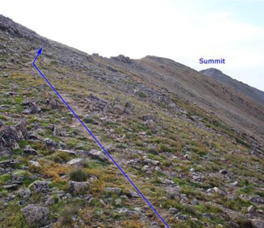
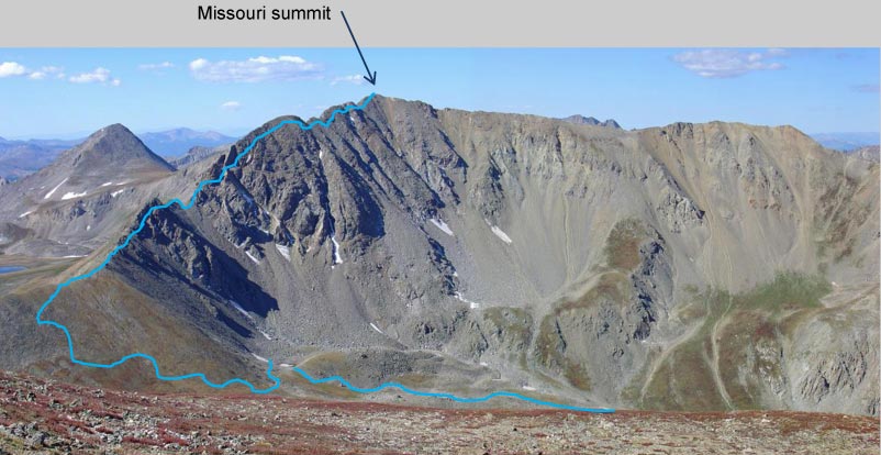
Finally, the false summit and real summit in view for the first time.
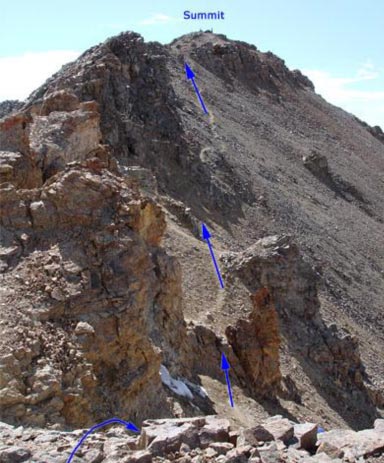
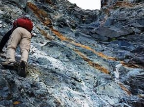
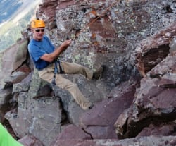
(Above) Up towards the false summit at the crux of the hike.
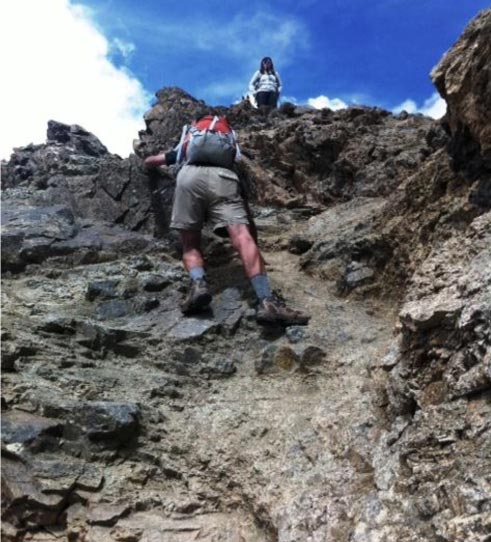
(Below) Rick down climbing the Class 3 crux of the climb. After this it was easy Class 2 to the summit.
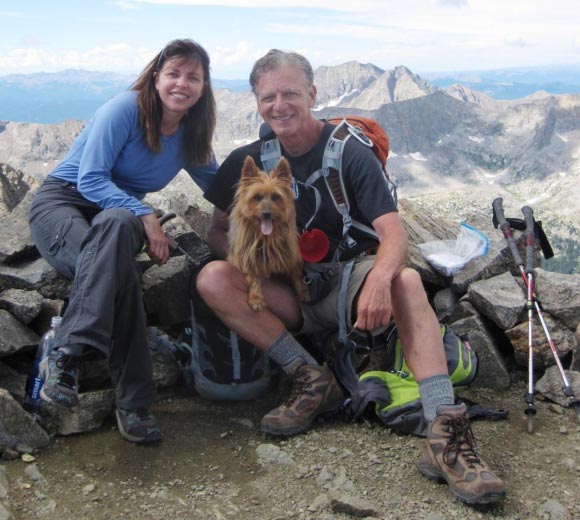
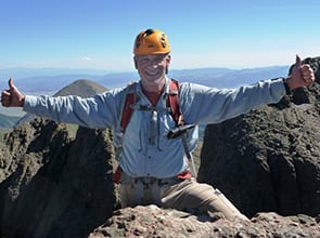
Summit Missouri Mountain, 14,067' 10:15am, 3 hours 15 minutes from trailhead.
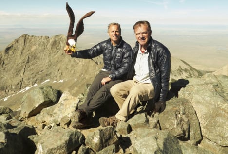
Laura, Rick and Emme above; Laura, Shari and Emme below.
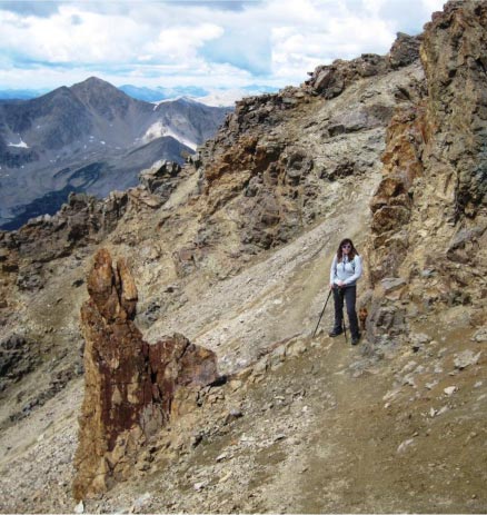
We'd made great time up and despite the 1/2 hour late start at trailhead, we were done with lunch on the summit "on time" and started heading down at about 10:45. Yet even then, the clouds were starting to gather. Not immediately threatening, but we wanted to get off the summit, past the false summit and even down the steep slopes below before they got wet and the clouds got electrical.
We got lucky - clouds were gathering and threatening but winds were blowing them parallel to our path down.
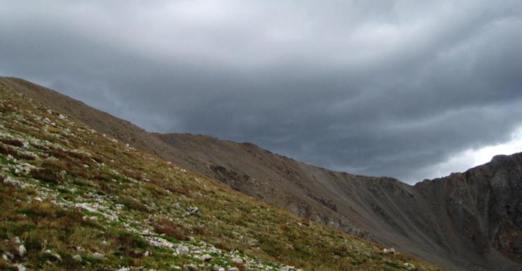
Heading down from the West ridge with rain clouds getting heavier and darker.
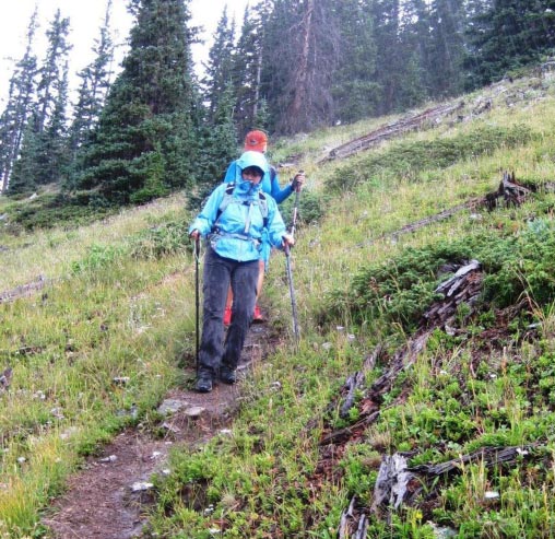
Out came the rain gear, and the ground started to get slippery.

Even Emme had her raincoat. Here we're well down from the summit, but still negotiating rocks,
and they were getting slippery...
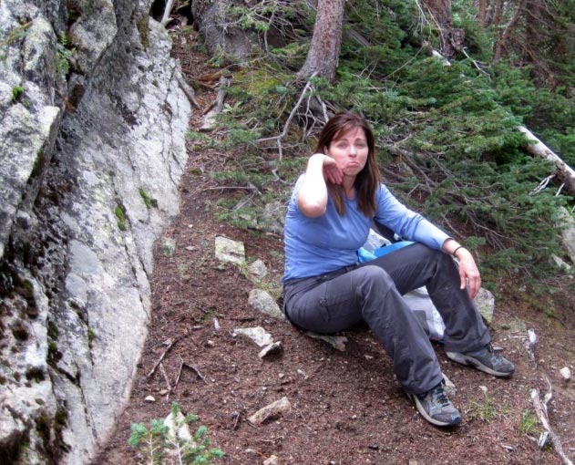
... slippery enough that Laura's feet went right out from under her and slipped down the steep rocks on the left - banged an elbow, raised an egg, but nothing broken.
Back at the car at 1:45 pm, great time down but the thunder was a motivator! Actually we were lucky - major rain didn't hit us until we were only a half hour from the car.
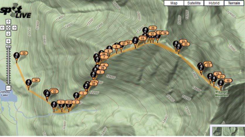
I have a new SPOT feature called Tracking - it traced our whole route - out and back with signals to satellite every 10 minutes. It's interesting to note the closeness of the markers as we were heading uphill, and how they stretched out when we were hiking the ridge - which had a few level stretches (e.g. between marker 15 and 16. Missouri summit was at marker 18, which would be 180 minutes or 3 hours - makes sense since we started sending tracking spots about 15 minutes into the climb.