
Difficulty: Class 3
Exposure: brief significant
Summit: 14,015 feet
Elevation Gain: 3,300 feet
Roundtrip: 7.00 miles
Trailhead: Matterhorn Creek at 10,800’
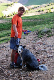
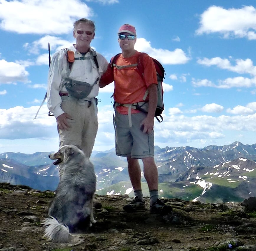
Climbers: Rick Crandall, Andy Mishmash and his dog Stormy July 22, 2011
A good friend and highly accomplished Class 5++ rock and ice climber, Andy Mishmash, has been offering to climb a Colorado fourteener with me, one that I wouldn’t have the skills to do myself. We finally committed to a date, despite the weeks of daily torrential rain and electrical storms. I picked Wetterhorn Peak, 3300 feet elevation gain to 14,015’, 7.5 miles round trip and a level of difficulty and route finding I haven’t done before.
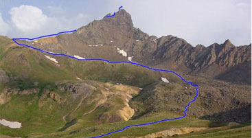
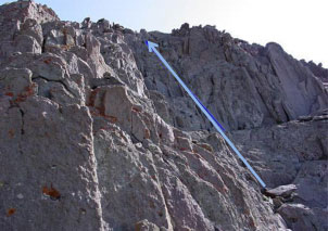
The full route – the real rock climbing started right after the yellow patch
A few days before the climb Andy called and asked if I was bringing my dog Emme. I said “are you kidding, this is hand-over-hand stuff, she can’t do that!” To which he said, “Well on the tough bits near the top we can put her in your pack!” Oh yeah, add another 22 lbs. of wriggling dog in my pack when I wasn’t even sure I could do this climb. Nah.
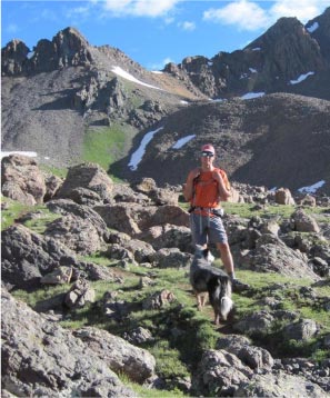
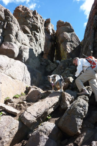
To my amazement Andy brought his incredible dog Stormy, an Australian Shepherd mix. Watching the two of them make it up was one of the wonders of this day. So the afternoon before the climb we drove out to Lake City – an old western town about 4 hours from Aspen, and overnighted in order to get an early start. At 5:30 am we were toasting bagels and eating oatmeal at the Matterhorn Hotel, and then headed to the trailhead for a 6:30 am start. The weather looked promising.
Andy and Stormy still waking up.
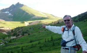
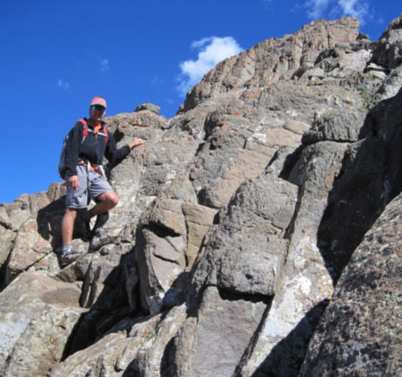
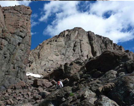
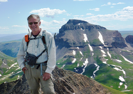
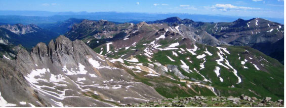
Above: Rick pointing to what we thought was Wetterhorn, but later we figured out it was Matterhorn, a nearby 13,600’ peak – we were going higher and steeper, more to the left.
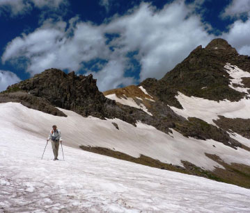
Off we went, we finally figured out there was Wetterhorn to the left, an ominous peak, but at least we had an easy start, a gorgeous day and stunning views with the rock climbing well ahead of us.
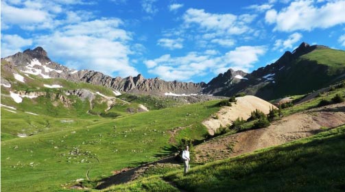
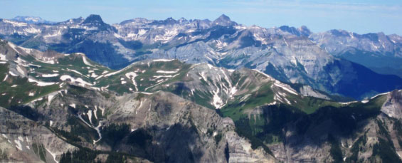
We eventually got into the boulder fields – not hard, but cool looking.
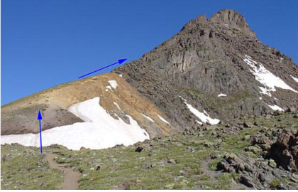
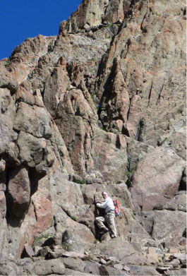
We finally got to the yellow patch after crossing a few snow fields (lots of fun on the way down later) where hiking got a bit steeper. Just beyond where the gray starts up is where the action really began.
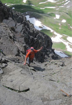
Almost immediately we got off the route I’d so carefully researched. I don’t think Andy ever really intended to pay any attention to that anyway. He scampered here and there, with low-ankle shoes, no sticks, no hands, dancing up and down pinnacles like they were level ground – and satisfied himself which way we were going to go.
“Let’s go this way”
“…and then this way.”
“Well OK,” says Rick – I guess if Stormy can do it, maybe I can – but how come she isn’t smiling?”
Rick: “This is getting interesting.”
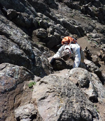
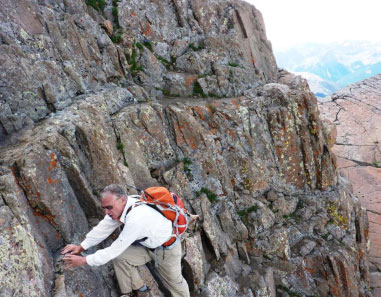
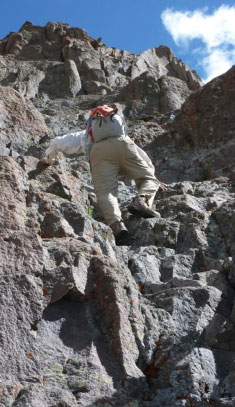
Rick’s hiking sticks no longer useful – strapped to his pack – definitely need your hands for Class 3 climbing.
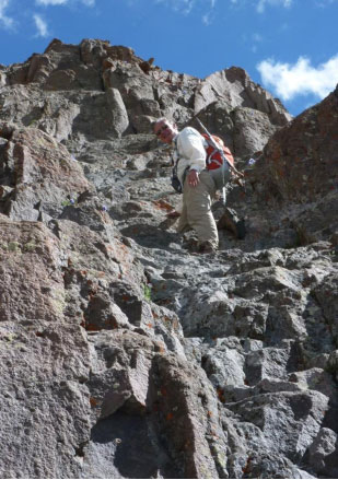
Rick approaching the final pitch to the peak. You can get perspective by seeing the few climbers part way up on the left of the pitch – to get a sense of scale – we’re not there yet!
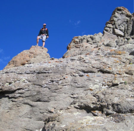
Andy decided to scamper up the cliffy thing to the left – just to spot the route and to make sure we weren’t running into climbers down-climbing at the same time we were going to go up – not a lot of room to pass each other. Watching him go up that rock was fun; it took him all of maybe 60 seconds.
Even if I could get up there, no way would I be standing where he is!
So, upon his signal, I headed up … straight up.
the final pitch to the summit.
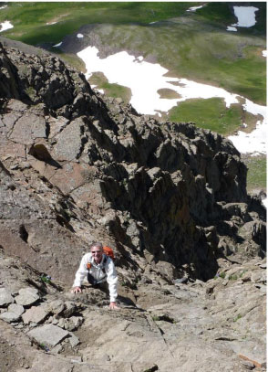
Thankful for solid rock and good hand-holds.
Rick: The summit is up there somewhere – because Andy says it is. I guess you keep going up until there’s no more up.
This is where they say “don’t look down!” But how can you not? – just look at that view!
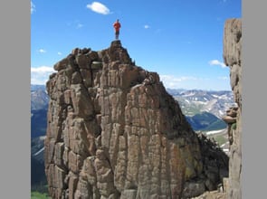
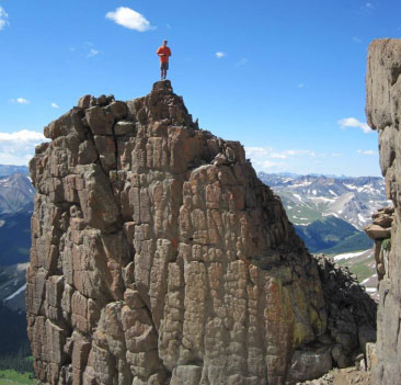
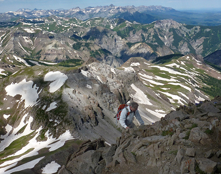
Summit! Wetterhorn Peak at 14,015’ at 10:45am, 4hrs and 15min – great time for Rick. See another 14er, Uncompahgre in the background – a peak I did a few years ago with son Brett and dog Emme.
I definitely couldn’t have done it without Andy – and that goes double for what is yet to come – gotta go down approximately the same way we came up. Stormy needed a few lifts here and there, but she was a real champ dog.
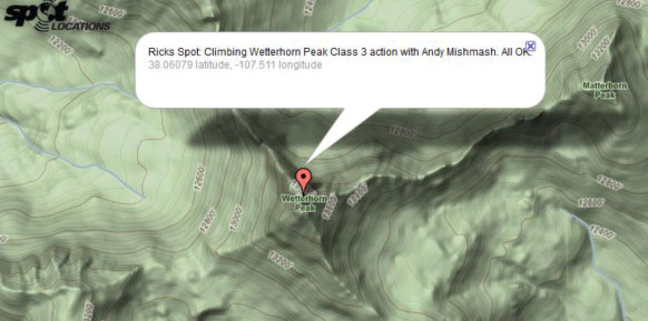
Spot emergency GPS locator that gets emailed via satellite evidencing our summit.
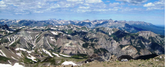
The views from the summit were incredible – 360 degrees with many of Colorado’s fourteeners in view. And the weather remained picture perfect.
So whatever goes up, must come down – one step, one hand at a time.
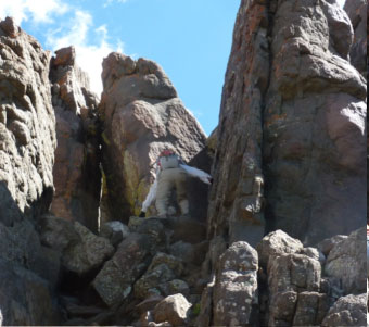
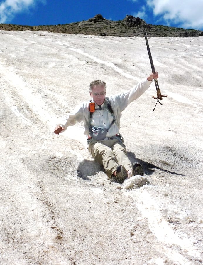
After down-climbing the peak pitch, past the yellow patch (some kind of mineral causing the bright yellow color) and on to the snow.
But enough of this walking and slipping …
Let’s Rock and Roll!
With a great end to an absolutely amazing day we got back to the trailhead at 1:20pm – 6 hours and 50 minutes round-trip including about ½ hour lunch on the summit.
Thank you Andy …
And thank you Anna for giving us amazing weather for the first time in 3 weeks for this celebration of the life we are given, in just the way you would have done it.