


Difficulty: Class 2 Difficult
Exposure: None
Summit: 12,953’
Elevation Gain:
4,860’ from Dinkle Lake parking lot
3,280’ from Thomas Lakes camping at 10,240’
Roundtrip:
14.2 miles from Dinkle Lake
5.2 miles from Thomas Lakes
Trailhead: Dinkle Lake at 8,640’
Climbers: Rick Crandall & Emme, Brett Crandall and his dog Amos, Rick & Diana Peckham September 25, 2011
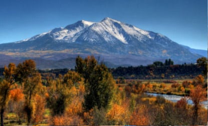
Mt. Sopris is one of the best known, most visible mountains in the Aspen – Carbondale corridor. It rises majestically with solo appearance displaying over 5500’ of elevation from the valley floor. While it is just under a “thirteener,” climbing it has all the characteristics of a fourteener in elevation gain, roundtrip mileage and impressive summit views. Named after Captain Richard Sopris who prospected in the Roaring Fork Valley in 1860 and later became the Mayor of Denver, Mount Sopris was first climbed by Hayden Survey party members in 1873.
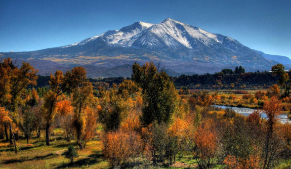
Sopris is at its breathtaking best in the mid-Fall, on a sunny day late in September with all the color change in full progress. We had just such Indian summer weather forecast and so we went for it.
Sopris can be done from the Dinkle Lake trailhead in one day, but it’s a very long day with almost 5000’ in elevation gain and 14 miles round trip. That grind can be converted to a joy by backpacking up to Thomas Lakes (4.5 miles and 1580’ elevation gain), camping and summiting the next morning. Even at that, Sopris is still a 3300’ climb with some challenging Class 2 rock, especially surrounding the so-called false peaks before the easier final summit approach-ridge.
My son Brett and I brought our dogs, both having fourteener experience, but turns out this is not the best mountain climb for dogs due to the large, sharp, steep and loose boulders on some of the pitches.
I’ve wanted to do Sopris for years as it is one of the mountains in clear view from my house. What better time than capping a great climbing season with super weather and with Brett within days of his 29th birthday?
There are little by way of route reports available on Sopris, so this report is a bit more detailed for those who are interested.
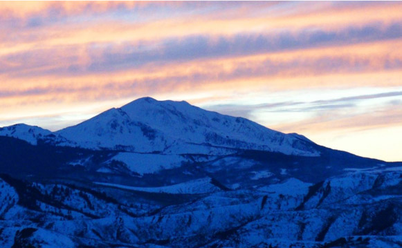
Mt. Sopris sunset seen from our house in Starwood
We left Aspen at noon on Saturday, parked at the Dinkle Lake trailhead parking lot (after driving a half mile too far to the actual Dinkle Lake) and began backpacking up the trail at 1:45pm. Brett took on the biggest weight with my tent, two bottles of wine, people food and dog food and other items. Rick P. fielded the steaks and utensils.
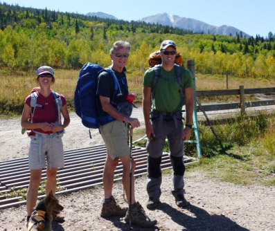
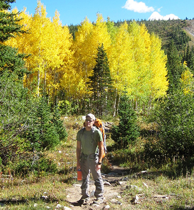
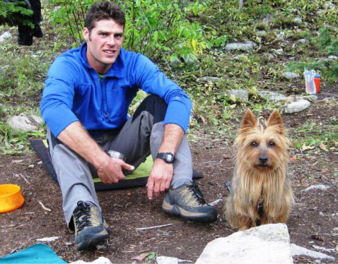
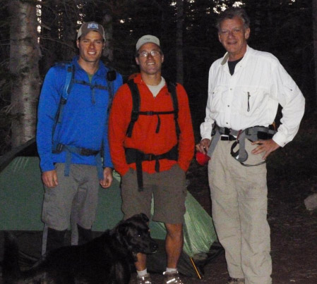
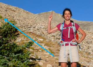
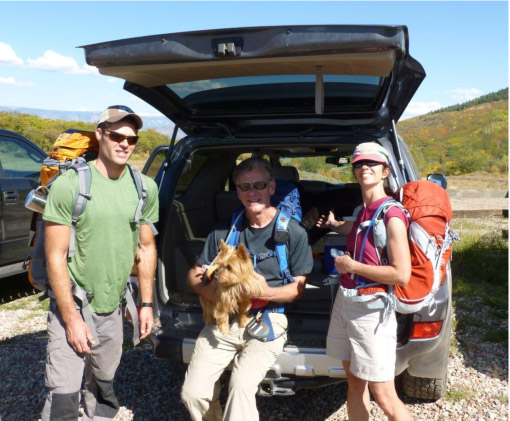
Dianna, me and Brett at the trailhead. Sopris can be seen in the background about 5 miles away.
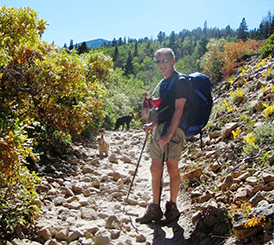
Brett (left) and me (right) hiking the old jeep road leading towards Thomas Lakes. Fall color change is evident.
We got to Thomas Lakes at 4:15pm, a 2 ½ hour hike on a good trail, and we selected our campsite for the night. The first orders of business were stringing the bear-proof lines for hanging the food, setting tent and finding and cutting firewood.
Me cutting firewood.
Setting lines from two trees to get the food hanging out of bear-reach away from either tree.
Emme’s first campout – trying to figure it out and listening for noises in the forest.
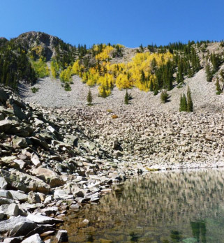
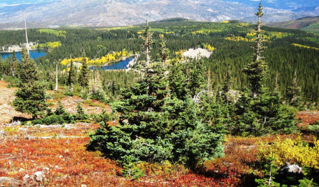
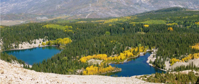
the lower Thomas Lake near our campsite.
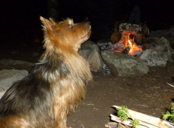
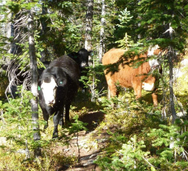
The trees rustled near our campsite – and then we spotted 6 or 7 cows descending upon us, not 20’ away. Emme and Amos kicked into action – barked and backed them off – which they had to do several times on into the darkness of night.
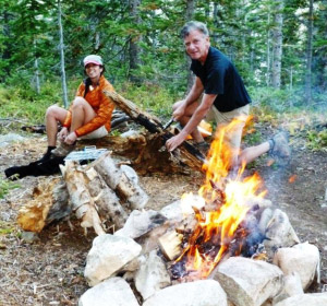
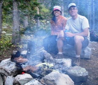
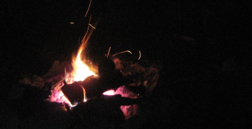
With the campfire ablaze, tents set, cows abound, we set about preparing for dinner.
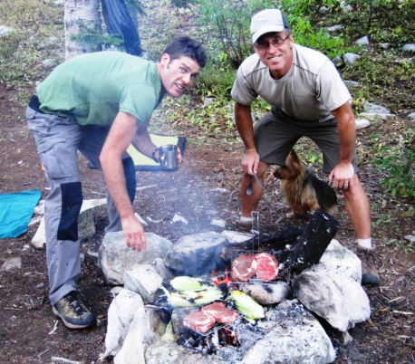
We had rib-eye steaks, corn in the husk; garlic mashed potato and dried and spiced kale accompanied by two bottles of Markham Petit Syrah which was selected for quality and minimal bruising while in Brett’s backpack.
Emme still trying to figure out what this was all about!
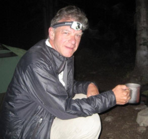
Dianna and Rick watching over the food and …me enjoying the wine, headlamp at the ready.
Life is good … we had a perfect evening, no wind, mild temps, no bugs and no bears – at least none that we saw, but every now and then the dogs went a-howling.
We retired to our tents early at 9:30 pm for an early start the next morning. It was cool out – nice but cool – enough to encourage Emme to climb into my sleeping bag creating warmth for both of us.
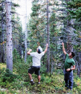
OK, enough camping fun, now for the climb. We were up at 5 am, re-lit morning fire, had oatmeal and coffee, loaded our day packs and set off towards the mountain at 6:50 am with just enough natural dawn light.
6:50 am, ready to start.
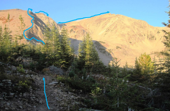
There is a good path around the lakes, then a steep uphill to an approach ridge towards two false summits on the upper left that were actually the crux of the climb due to large, sharp, steep and loose boulders.
From the upper lake, we hiked to the base of the steep slope to the southeast and ascended to a good trail on the ridge.
Gaining elevation from the lake heading towards the southern ridge.
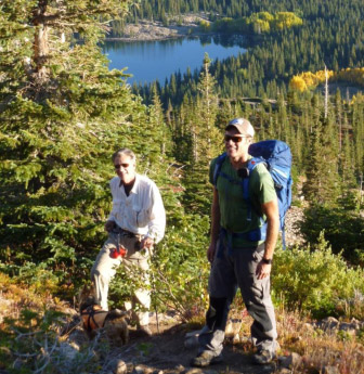
Further up towards the ridge we’re just about at tree-line. Dianna is pointing to the real objective still far away.
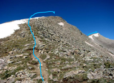
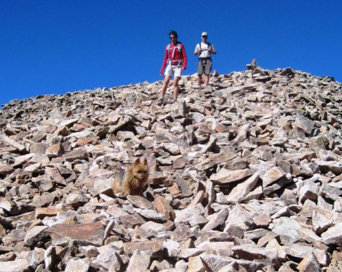
The first false summit is in the foreground with the true summit on the back right side.
The ridge narrowed as it approached the top of the first false summit, afterwhich there was some down-climb towards the 2nd false summit.
Past the first false summit and starting up towards the second false summit.
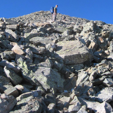
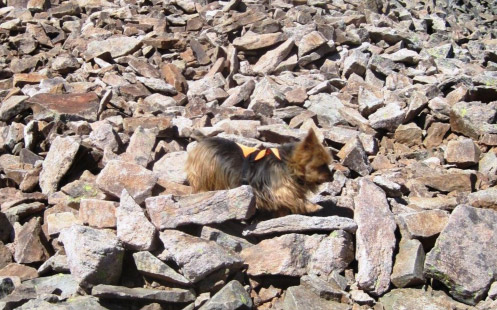
The footing got more serious with large, loose boulders and disappearing path. The dogs did well on this going uphill, but later, downclimbing presented a different story.
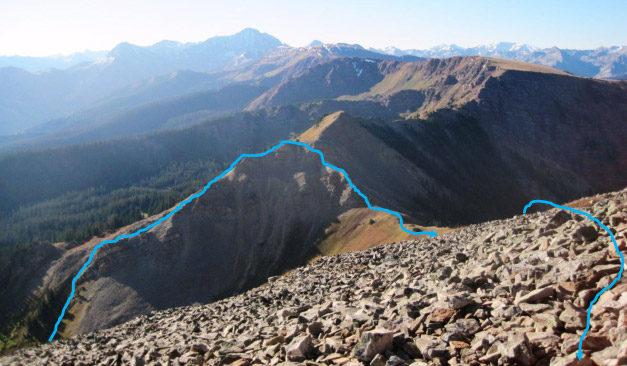
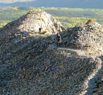
Looking back at the climb from the second false summit, you can see the approach to the southern ridge, then passing the first false summit and traversing the saddle to the rocky approach to the second false summit.
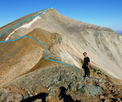
After downclimbing from the second false summit, the final approach to the real Sopris summit is in full view
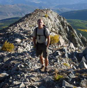
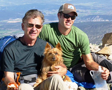
Rick on the approach ridge to the summit with Capitol Peak looming on the upper right in the background. Capitol is ranked by many as the most difficult of all the Colorado fourteeners.
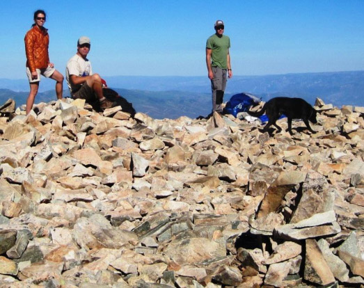
Summit Mt. Sopris at 10:08 am, 3hrs 19 minutes from campsite; cairn marker is in the right foreground. Happy Birthday Brett and thanks for coming back to Aspen to do Sopris with me celebrating a great climbing summer!
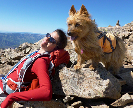
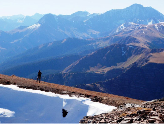
Dianna basking; Emme triumphant at the summit, her sixth this summer (but probably thinking the rocky down-climb will be no fun).
The weather continued perfect.
We basked and ate lunch for about 20 minutes at the summit, no other climbers in sight which was totally unusual for a weekend in late September, perhaps the optimal time to do Sopris. We did run into a few people on the way up when we headed down, but in total not more than about 10.
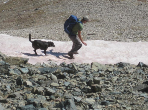
At about 10:20 am we started down. The sharp rocks were starting to bother the dogs, so Brett decided to try skating past some of the rocks on a snow cornice that was narrow and had a steep drop-off on the other side. None of the rest of us took him up on that … except Amos, but he’s got four legs and claws.
Emme leading the way down the rocky slope. Not recommended for dogs.
After a lot more of this ….
Emme hitched a ride on Brett …
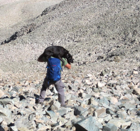
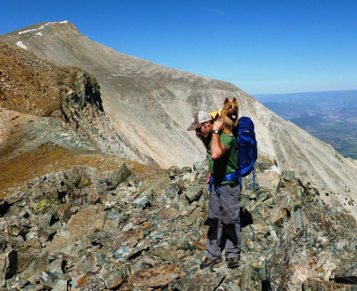
… but when Amos decided to call it quits, Brett heaved all 55 lbs. of him on his neck, on top of his 25 lb. pack – and hoofed down the entire rocky slope to the more docile saddle. That was a sight!
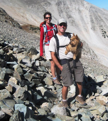
Emme got handed off to Rick …. the other Rick thankfully! This was the first time in 17 fourteeners she rode part of the way!
Finally, tree line at about 11,800’ and we could see the lakes once more.
Nearly back at campsite.
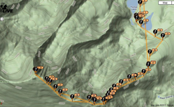
Spot Satellite tracking showing our whole route to the summit and back to campsite. Pin 11 is campsite and pin 31 or 32 are summit indicators.
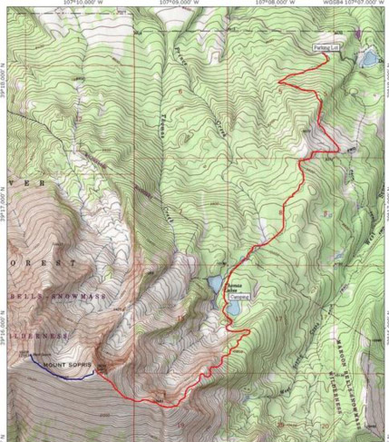
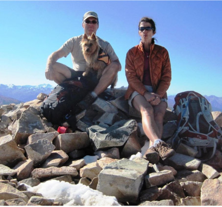
Here is the whole route, including the backpacking from the Dingle Lake parking lot 4.5 miles and 1600’ down from the campsite. The blue line traverse from the East peak goes down to a saddle and up to the second Sopris peak – which is exactly to the foot the same summit elevation as the East peak.
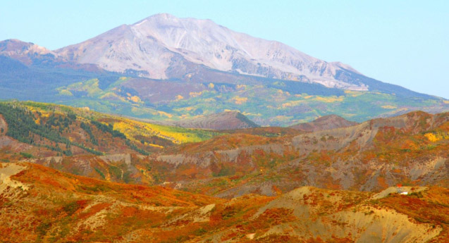
Mt. Sopris with full Fall colors: View from our deck on September 25, 2011.
We got back to camp at 1:22 pm, took down the tents and hauled back to the car by 2:37pm, only 1 hr.53 minutes to get from summit to camp and 1 hr.15 minutes to get from camp to parking lot – that was moving!
The dogs were motivated and made the whole rest of the trip on their own four feet.
At the Dingle Lake trailhead/parking lot after a long but great day.