


| Difficulty: | Class 2 |
| Exposure: | |
| Summit: | 14,421 feet |
| Elevation Gain: | 4,050 feet |
| Roundtrip: | 8.00 miles |
| Trailhead: | N. Halfmoon Creek at 10,500’ |
Climbers:
1st attempt August, 2010 Rick Crandall, Emme the Australian Terrier, Shan Stuart
2nd and success August, 2013 Rick Crandall, Rick Peckham
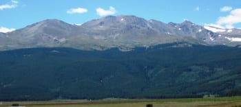
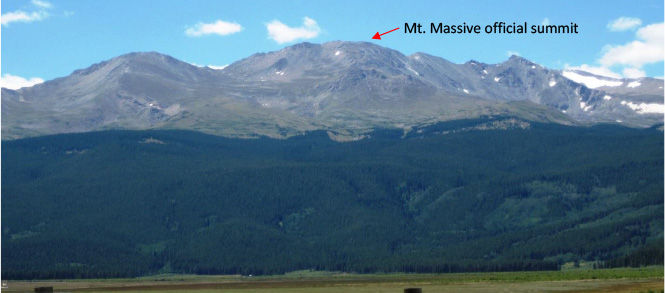
Mount Massive is a fourteener in the Sawatch Range. It is the second highest peak in the Rocky Mountains. Nearby Mt. Elbert edges it out by 12 feet and Mt. Whitney in California is 77’ higher. If any fourteener is a “massif,” this is it. The name comes from its elongated shape with five summits all above 14,000 feet. It has a summit ridge over 3 miles long with more area above 14,000’ than any other mountain in the lower 48 states. It is the show piece mountain and the visual backdrop for Leadville, CO. In the 1930’s advocates of Mount Massive piled rocks on the summit to elevate it higher than Mount Elbert (12 feet difference) only to be demolished by Mount Elbert proponents!
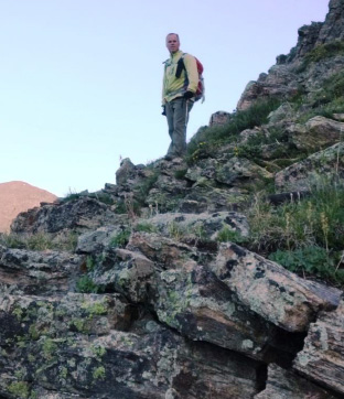
I attempted this mountain on August 10, 2010 with Shan Stuart and my dog Emme. It was the day after an unusual summer snowfall above 12,000’. That day we got to about 12,800’ when I thought I was feeling altitude sickness. We aborted the attempt. I later found out that I had a medical condition causing the discomfort. It was easily repaired with a common surgical procedure, which I’m happy to say returned me to skiing that winter and mountain climbing ever since.
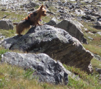
I’m including a few photos from then to give credit especially to Emme our amazing Australian Terrier who in her career summited 17 fourteeners even without Mt. Massive!
Both then and now we traveled from Aspen over Independence Pass to Leadville where we overnighted for an early morning start. Early August is in the middle of the monsoon weather pattern which brings electrical storms to Colorado almost daily. This pattern starts each morning when moisture from the Gulf of Mexico travels west to Arizona where it picks up heat, and then rotates north to Colorado where it must rise against the tall peaks in the Rockies. As the wet, hot air rises, condensation accelerates and friction is created causing electrical storms.
Leadville Boom Days.
This time in Leadville we happened into the locally well-known Boom Days held the first full weekend in every August and has been honored by the United States Congress as a Local Legacy Event. This 3-day celebration of the area’s mining heritage offers entertainment including mining competitions, a gun show, live music, a craft fair and a parade.

Cowboy shootouts with blanks Leadville Boom Days
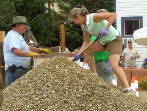
Women’s competition: who can shovel 1000 lbs. of rocks into a mining cart the fastest (this one did it in 2 min. 20 sec.)
 >
>
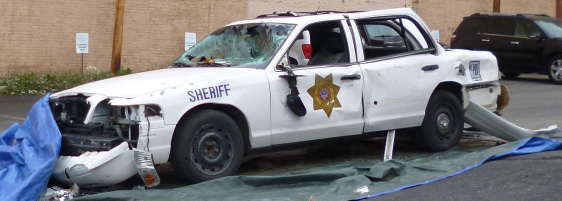
Get your jollies: Smash a cop car!
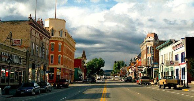
Leadville’s Main Street
Leadville takes its place among a collection of authentic Colorado towns. Others such as Lake City, Fairplay, Ouray and even Aspen have been covered in other of my climbing stories.
In the late 19th century, Leadville was a silver mining town. It was the second most populous city in Colorado, after Denver. At an elevation of 10,152 feet, it is the highest incorporated city in the United States. Leadville was founded near the new silver deposits in 1877 setting off the Colorado Silver Boom. By 1880, it was one of the world’s largest silver camps, with a population of over 40,000. The city’s fortunes declined with the repeal of the Sherman Silver Purchase Act in 1893. The 2010 census reported an official count of 2,602 inhabitants with a median household income of $36,714.
The Climb
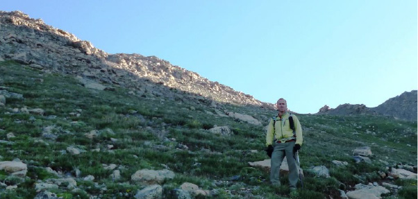
Our plan this time was to get started really early to get to the summit and then to get off the ridge of 14,000’ peaks well before noon to avoid lightening exposure. Rick Peckham and I left Leadville at 4 am and drove my trusty 4Runner off-road in the pitch dark (no moon in sight). We got to the trailhead at 5 am and started to hike the first 1000’ of elevation gain to tree line with headlamps. We chose the North Halfmoon Creek trailhead and Southwest Slope approach because it was steeper (more to our liking) and shorter (8 miles roundtrip instead of 13 miles for a shorter walkout to avoid afternoon storms). There are two route notes included at the end of this story for anyone starting from the North Halfmoon Creek trailhead.
The skies brightened by 6 am just as we were getting into the many rocky switchbacks ascending to the several ridges and false summits leading to the real summit. I noticed right away that the route was much improved this time as compared with three years ago. At that time the climb was a never-ending jumble of rocks covering the steep ascent. Since then the Colorado Fourteeners Initiative had done their work improving the route. Whereas I would have then called Mt. Massive a grind and a leg burner, now I’d say it’s a great climb – in fact I’d recommend it as a second or third mountain for anyone starting out with Colorado Fourteeners.
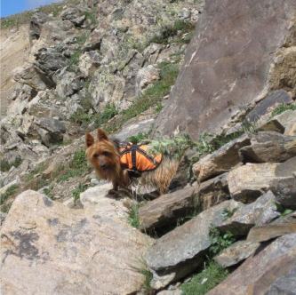
Emme in 2010 negotiating rock-strewn slopes;
See the natural “steps” now in 2013 as moved into place by the Colorado Fourteeners Initiative.
Thank you CFI!
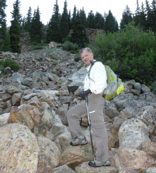
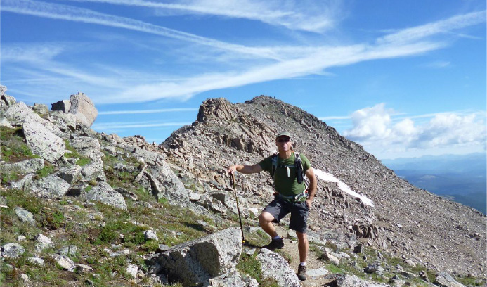
Rick C. heading up the improved trail.
Rick P. wondering when we’d reach the
distant sun line to warm up.
It wasn’t until we neared the first ridge at about 13,000’ that we got to that sun line.
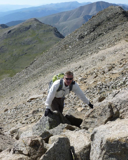
Approaching the first ridge – it wasn’t all a walk in the park,
but the climb was never more than Class 2 rock hopping.
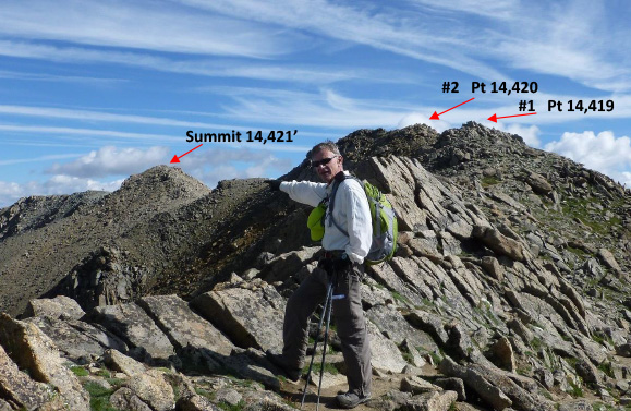
Finally on the ridge, but where’s the summit? Not #1 at 14,419 feet, nor #2 at 14,420 feet.
It is marked “Summit” at 14,421 feet, still a long but enjoyable ridge-walk away.
The weather was holding incredibly well – warm, little wind, gorgeous skies with some cloud accumulation that was not yet the wet monsoon kind, but we knew that was coming.
Rick C. trying to signal that this was his 40th Fourteener … in his enthusiasm, he didn’t get that he should have switched hands.
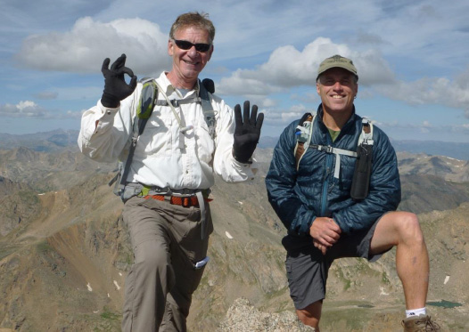
Summit Mt. Massive 14,421’ at 9:50 am Aug. 4, 2103, 4 hrs. 50 min. from trailhead.
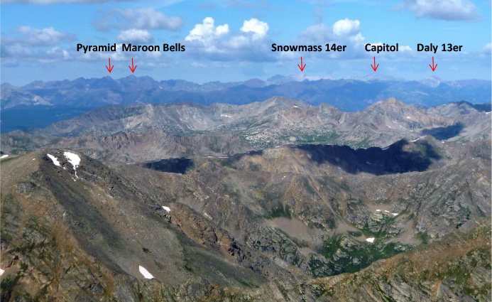
The views from the summit were terrific – everywhere you turned you saw famous 14ers. This shot shows the Elk Range surrounding Aspen.
At about 10:15 am we started down. We had a long way to go and I saw clouds amassing far away. I was sure they were an early warning the weather would not stay docile.

On descents, Rick P. often can’t help himself – he builds cairns.
Cairns are rock piles used to mark a route when there is no path.
As useful as cairns can be, they are rarely present for an entire route. They don’t substitute for pre-climb research and detailed route planning before attempting a fourteener.
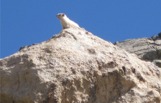
The rare white Marmot. One of the really cool things about Mt. Massive is that it houses a very rare Marmot – all white! Climbers have been commenting on the white Marmot ever since it was a juvenile. On our 2010 attempt at Massive, Shan spotted the white Marmot and we got a few great pictures. He was juvenile then. On this climb in 2013 we were treated to likely the same Marmot now as an adult – they’re very rare.
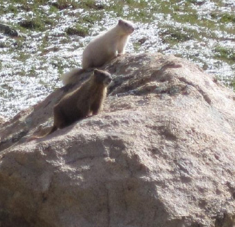
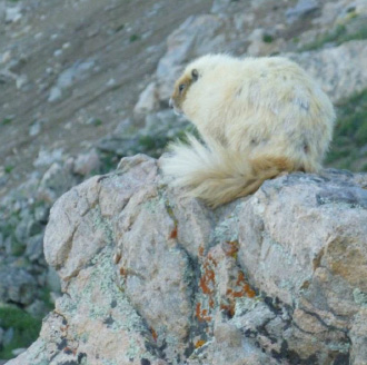
The Mt. Massive white Marmot in 2010 The white Marmot all grown up in 2013
I finally discovered that this condition is called Leucism which is different than albinism. With Leucism, all color in an animal is gone (hence white fur) not just the lack of melanin found in albinos which are actually yellowish, not entirely white. Also albinos have red eyes whereas with Leucism the eyes are normally colored.
Normal Colorado Marmots are brown and they are always present on rocky slopes all the way up to summits. They are thieves so don’t leave your pack or hiking sticks unattended. Marmots are large ground squirrels that live in burrows in rock piles. They hibernate in winter.
Most Marmots are highly social and use loud whistles to communicate with one another, especially when alarmed. They are 15 – 20” long not counting tails – and weigh about 7 lbs.
Emme spotting a Marmot
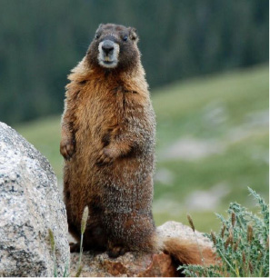
A standard brown Marmot checking me out
We had a great hike down the rest of the way with sun, blue sky and puffy clouds that were gathering but not yet threatening. As we got back below tree line we caught glimpses of worsening weather through the tree cover, but we made it back to the car right at the targeted 1:30 pm time. Our descent time was 3 ¼ hours for a total round trip of 8 ½ hours.
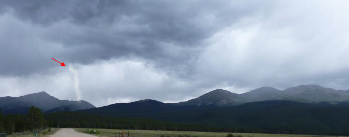
We off-roaded back to the paved US 24 where we were able to look back at Mt. Massive – and it wasn’t a pretty sight – especially for the climbers who had a late start and were still out there.
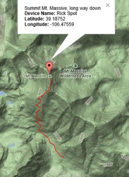
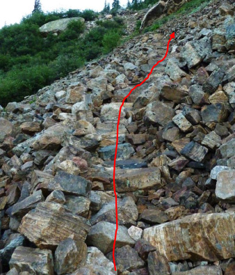
Some Climbing Notes for the North Halfmoon Creek Route
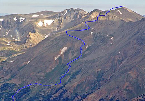
The total route is shown in blue, although there were many more switchbacks than indicated.
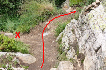
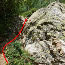
Note 1: about ¾ mile from the trailhead there is an unmarked junction. Don’t go left, go RIGHT up a short rocky “V” after which the path will soon re-appear.
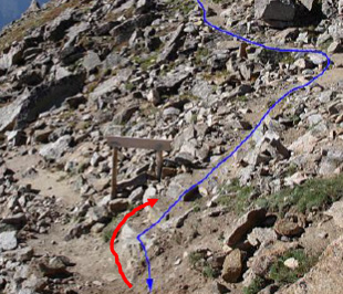
Note 2: On the ascent to the first 14,000’ ridge you’ll see the route drops slightly (blue line) to a signed junction where the longer East trail joins.
On descent, (red arrow) to get back to North Halfmoon trailhead. Otherwise you’re in for a 5 mile descent to a totally different trailhead.
[/eleven_col]