


Difficulty: Class 2 Difficult
Exposure: None
Summit: 14,005 feet
Elevation Gain: 5,600 feet
Roundtrip: 11.5 miles
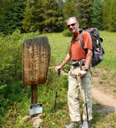
Trailhead: Half Moon (Tigiwon) at 10,320’
Climbers: Rick Crandall; Rick Peckham August 16, 2012
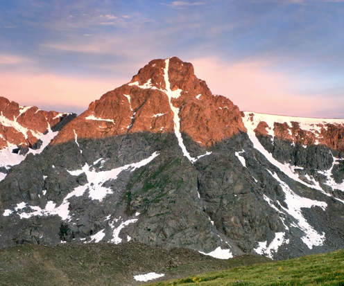
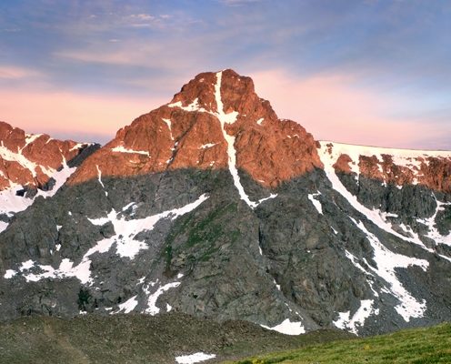
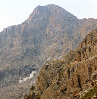
Mount of the Holy Cross is the northernmost 14,000-foot mountain in the Sawatch Range. It was named for the distinctive cross-shaped snowfield on the northeast face. The mountain was proclaimed “Holy Cross National Monument” by Herbert Hoover on May 11, 1929.
This mountain has been the subject of painters, photographers and even a poem by Henry Wadsworth Longfellow, (The Cross of Snow). The first publicly available photograph was published in National Geographic magazine. Thomas Moran depicted the mountain in an oil painting, which now is part of the collection of the Museum of the American West, part of the Autry National Center in Los Angeles, California.
The Cross is visible from the top of Vail Mountain, but was first spotted in 1869 from the top of Grays Peak (another fourteener). The Cross is 1400’ high and 750’ wide – it melts each year to fill the Bowl of Tears Lake directly under the east face of the peak.
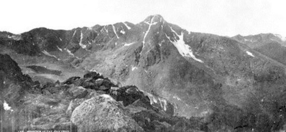
William Henry Jackson’s photo of Mount of the Holy Cross 1873.
Mount of the Holy Cross has a history of endangering the lives of many hikers. Unprepared hikers are frequently stranded or lost due to changing environmental conditions and confusion regarding the surrounding landscape.
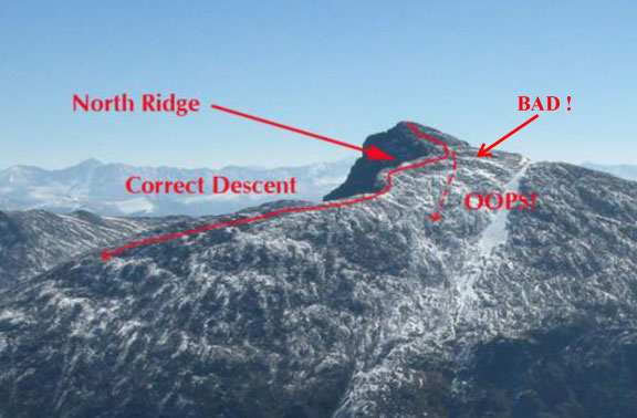
As you can see, the top of the mountain is descended to the west, and then you have to turn to your right and follow the north ridge back to get the trail and ultimately the proper descent route. What people do to get lost, is miss this right turn and just keep going down straight, somehow the shape of the mountain there when you are on it, encourages that. If they are lucky they get through to Search and Rescue, but some have died facing Class 5 cliffs.
To Trailhead:
Take CO 82 over the Pass, left on CO 24 through Leadville, and then about 26 more miles, and turn left onto Tigiwon (Ute word for “friends” ) Road. The Tigiwon road is 8 miles of dirt, closed last year while being improved.
This is a very big hike and climb to do in one day so most (including us) backpack in from trailhead and camp overnight. Even with this approach makes for a long day on the second day.
We arrived at trailhead (10,320’) at about noon on August 15, 2012, parked and backpacked up 1400’ in 1.5 miles to Half Moon Pass and then descended 1000’ to East Cross Creek where we camped. That’s what makes day two a long day – after climbing and descending 3200’ to summit Holy Cross, you then have to ascend this 1000’ (which causes everyone to grumble) and descend another 1400’ to the car.
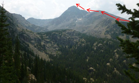
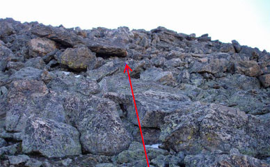
Just as we started descending from Half Moon Pass at about 11,200’ we got a full view of the objective for the next morning. The upper reaches of the route for the next day are shown with red arrows.
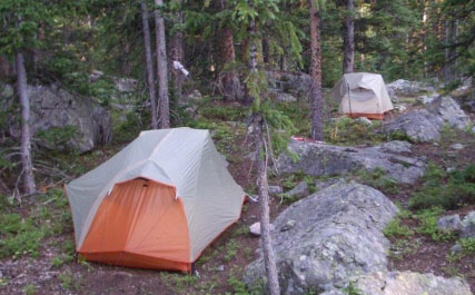
We reached the river, crossed and hiked up a few hundred feet to a good campsite at 10,800’.
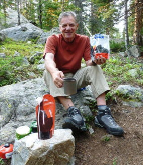
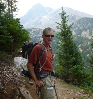
Rick C. enjoying a perfect weather evening with climbing buddy Rick Peckham, no mosquitos, feasting on Backcountry dehydrated beef stroganoff and noodles dinner brought back to life with 2 cups boiling water, and a special light weight collapsible wine bladder with a wonderful 2003 vintage Marquis Phillips Shiraz 9. That combined with a signature Colorado fourteener summit waiting on the morrow – makes for pure joy, wouldn’t you say?
Actually we had a bit of a worry about the weather for the next day – the monsoon season has been bringing rain and electrical storms up from Arizona almost daily, usually not arriving until 1 or 2 pm. We also had met a climber passing near our campsite who described the climb we faced as “exhausting and the upper parts involve Class 3 climbing over rocks as big as Volkswagen buses.”
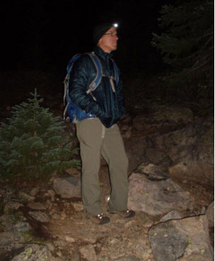
Not to be deterred, we started the next day early, awakening at 4:15am and leaving camp at 5am in the dark with headlights. We got to tree line (about 11,700’) by dawn, a little after 6am, which was perfectly timed since that’s where the rocks began. One of the great things about Mt. of the Holy Cross is that there has been a major effort last year and this year to improve (actually create) a stepped trail in the lower reaches of the rocky ridge by the Colorado Fourteeners Initiative, staffed with the Rocky Mountain Youth Corps.
We watched them use a crowbar to move huge flat rocks into place, one above the other creating natural steps. Amazing that they could move rocks that big and place them perfectly. On this particular mountain one might say they were creating a stairway to heaven 🙂
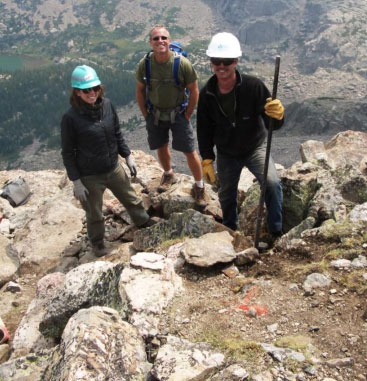
Why is Rick P. in this photo with two members of Rocky Mountain Youth Corps? Maybe thinking of a new career? Why not, you get to enjoy Colorado’s premier mountains and you get to quit work at 2pm each day before the thunderstorms arrive!
By the way, in case any reader is interested, when climbing a mountain where the Fourteener Initiative has been at work, the little plastic tassels you see here and there embedded along a trail are color coded – orange marks the trail and yellow marks a stone feature they didn’t want touched during their work.
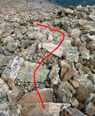
We joined the ridge at about 12,100’ where the trail disappears in the rocks but there are plenty of cairns to mark the way, some of them were big enough to see a long way off.
From tree line, the summit is approximately 1.6 miles away.
Climbing the ridge, suddenly the summit comes impressively into view – but looks a long way away with a quite steep approach.
As we worked our way through the rocks, mostly Class 2 to Class 2 difficult with some occasional Class 3 rock climbing, the summit finally begins to look closer.
At about 13,700’ the rocks did get bigger and some indeed were the size of Volkswagens, but climbing over or around them was more fun than difficult.
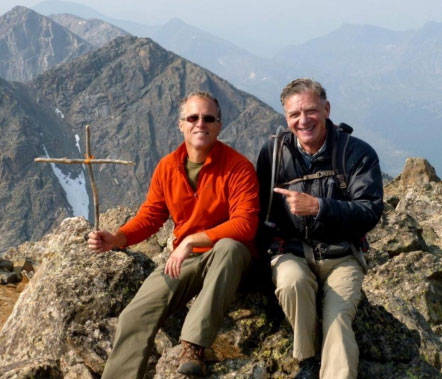
Summit: Mount of the Holy Cross 14,005’ 9:30 am, 4 ½ hours and 3205’ up from campsite
We were liking the climb so much that when we hoisted over the last rock to the summit we were surprised we were there already.
Rick P. brought up two perfect sticks and made a cross to leave at the summit.
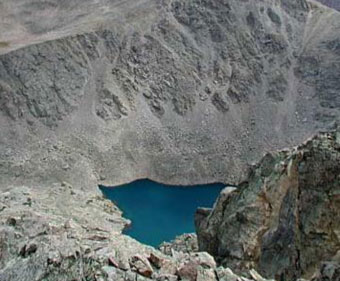
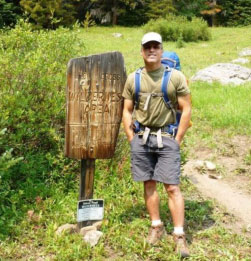
Looking down from the cross side of the summit is the Bowl of Tears – a lake created by the snowmelt from the Cross couloir. In times past there were many pilgrimages to the lake and the base of the Cross to drink from the snowmelt, thought to have healing properties. Pilgrimages dwindled when a rock fall ruined the right part of the horizontal on the Cross (compare the two images at the start of this article).
The weather was still great, no threats although the haze from West Coast forest fires impacted what would normally be our view of other Fourteeners such as Snowmass Mountain, Elbert and Massive. We basked at the summit chatting with a few others and then started the very long journey back to our car. This was to involve a 3200’ descent to campsite, loading up full packs, a 1000’ climb to Half Moon Pass and another 1400’ descent to the trailhead.
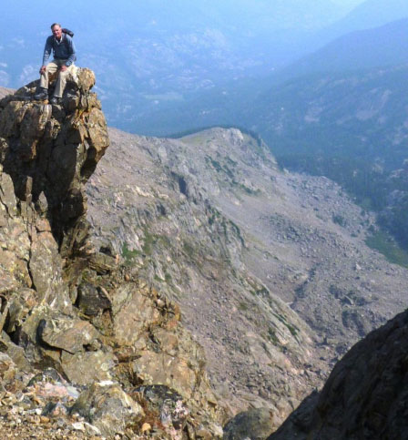
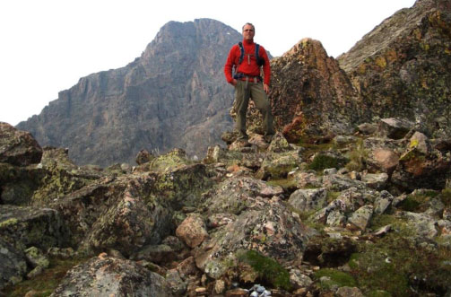
On the way down, Rick C. resting on a pinnacle at the top of the Angelica Couloir, a prominent gully curiously named from a Spanish and French word meaning Angel Gully.
We got to campsite at 1:30pm, broke camp, loaded up and headed out at 2:10pm and then started the 1000’ climb up to the Pass. All the reports I’d read talk about how “unpleasant” everyone regarded this climb after a summit descent of 3200’. I can say “unpleasant” is an understatement you often get in these reports – it seemed to be one of the longest 1000’ ascents I’d done. We got to the top of the Half Moon Pass at 3:20 pm.
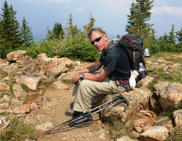
Rick C. feeling “unpleasant” at the top of Half Moon Pass. Rick P. called it the “Death March of Holy Cross!”
We then trudged down the remaining 1.5 miles and 1400’ of descent to our car and headed home. Aside from the last part of the hike-out, this is a fabulous and beautiful mountain to climb.
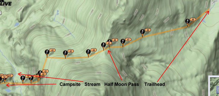
Spot track showing 3 mile segment from campsite to trailhead.
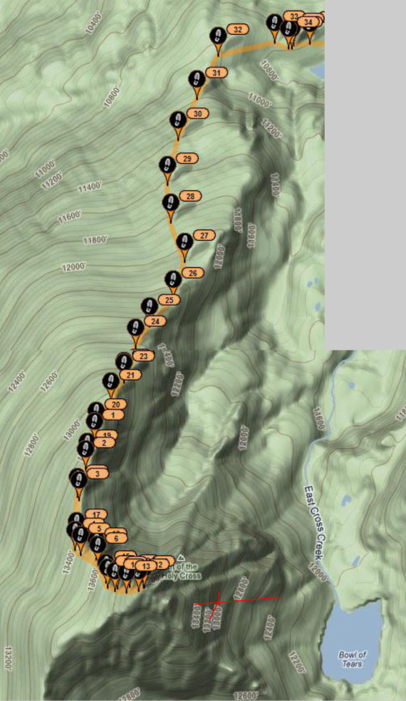
Our climb from campsite (Flag 34) to summit (Flag 11).
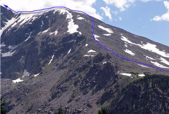
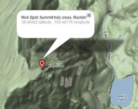
I think I marked where the Cross is in red.